82% of North Carolina voters support state action to reduce single-use plastics
RALEIGH, NC — In a new statewide poll of North Carolina voters, a significant majority expressed concern about the health impacts of plastics and said state lawmakers should take action to reduce single-use plastics.
Support for state government action to reduce single-use plastics was widespread and bipartisan: More than eight out of ten (82%) North Carolinians support enacting policies to protect human health and the environment. Nearly three-quarters (74%) of Republican and 91% of Democratic voters support reducing single-use plastics.
Recent studies and media reports have linked the presence of plastics in the human body to obesity, heart attack, stroke, falling sperm counts, infertility, premature births, birth defects, developmental disorders, and possibly Parkinson’s and dementia. Nearly nine out of ten (88%) North Carolinians said they were concerned about the health effects of plastic, with 50 percent of those saying they were very concerned.
Statement from Hartwell Carson, French Broad Riverkeeper with the Western North Carolina-based conservation organization MountainTrue:
“Ensuring that our food, water, and environment are safe and free of dangerous plastic pollution is widely supported by young and old, women and men, and Republicans and Democrats. With a resounding 82% of North Carolinians calling for action, it’s imperative that corporations quit forcing single-use plastics on us. We don’t want it. Sound policy can move us away from the detrimental impacts single-use plastics cause. In the meantime, businesses should be working to phase them out..”
These poll results mirror surveys conducted by the City of Asheville in 2023, which found that more than 80% of respondents supported a citywide plastic bag ban, and by the Outer Banks Chamber of Commerce (2017), in which all but two of 500 respondents opposed overturning a popular local bag ban.
Special Interests Blocked Popular Local Laws. Now, It’s Time for the State to Act
In 2023, Durham was on the cusp of passing a 10-cent fee on disposable plastic and paper bags. In Western North Carolina, Buncombe County, the City of Asheville, and the towns of Black Mountain, Weaverville, and Woodfin were moving toward enacting local ordinances that would ban single-use plastic shopping bags at the checkout aisle and styrofoam takeout containers.
As those local laws moved forward, Senate Leaders conspired with special interest lobbyists from the North Carolina Retail Merchants Association to insert language into the state budget blocking local governments from enacting any regulations on “the use, disposition, or sale of an auxiliary container (153A-145.11)”, including styrofoam containers and single-use plastic bags. The omnibus budget containing these new limits on local governments was released to the public and to the House and Senate for an up-or-down vote without opportunity for debate or amendment. Governor Roy Cooper later allowed it to become law without his signature.
Environmental and public health advocates around the state regrouped and are now focusing their efforts on building support for and passing a state-wide ban on single-use plastic bags and takeout containers.
Statement from Steve Wall, MD, a retired pediatrician and member of the Plastic-Free WNC Health Working Group:
“Our legislators have a constitutional duty to safeguard the health and well-being of the people of North Carolina. It’s time for North Carolina to join the more than 500 state and local governments across the United States that have already passed commonsense laws to reduce single-use plastics. This is not just an environmental imperative—it’s a public health necessity.”
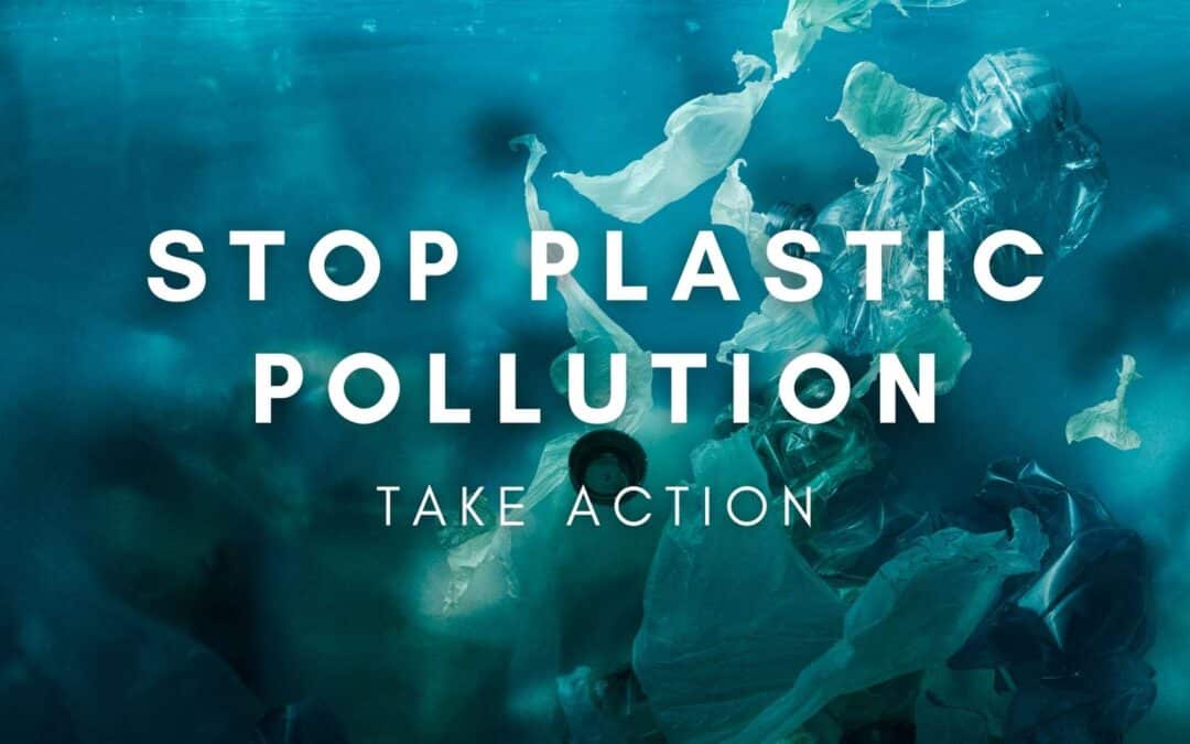
The Rise of the Plasticene Era: Plastics’ Significant Impact on Human Health
The theme of Earth Day 2024 is Plastic vs. Planet, and environmental and health advocates worldwide are calling for a 60% reduction in the production of plastics by 2040 for the sake of human and planetary health.
The production of plastics has seen an exponential increase since the 1950s, now accounting for 20% of global fossil fuel usage—surpassing its use in vehicles and electricity generation. This shift marks the dawn of what many scientists are calling the “Plasticene” era, characterized by significant environmental and health impacts due to pervasive plastic production and waste.
Despite the common practice of recycling, the reality remains stark; less than 6% of plastic waste in America is recycled. The lower cost of producing new plastics compared to recycling only exacerbates the issue, leading to increased plastic waste that often ends up in landfills and natural environments. Over time, these materials break down into microplastics that infiltrate the air, water, and even our food supply.
Research indicates that the average individual inhales approximately 22 million plastic particles each year. Studies have confirmed the presence of plastics in various human tissues and bodily fluids, including blood, brain, lungs, colon, liver, placenta, breast milk, and carotid arteries.
The impact of plastics on human health is becoming increasingly clear. Microplastics can penetrate cellular structures, disrupting energy production and promoting inflammation. They also interfere with hormonal functions, impacting brain communication, immune responses, and organ function. The consequences are severe, linking plastic pollution to a range of health issues including infertility, premature births, various cancers, and even neurodegenerative diseases. Research has shown that plastics in arterial plaques could increase the risk of severe cardiovascular events by up to 4.5 times within a three-year period.
The economic burden is also significant, with diseases related to plastic exposure costing approximately 1% of the US GDP annually. As the problem of plastic pollution grows, its pace is outstripping our ability to fully understand and mitigate its impacts on human health and the environment.
About the Poll
This poll was conducted by Mason-Dixon Polling & Research, Inc. of Jacksonville, Florida from April 9 through April 13, 2024. A total of 625 registered North Carolina voters were interviewed statewide by telephone.
Those interviewed were randomly selected from a phone-matched North Carolina voter registration list that included both land-line and cell phone numbers. Quotas were assigned to reflect voter registration by county.
The margin for error, according to standards customarily used by statisticians, is no more than ± 4 percentage points. This means that there is a 95 percent probability that the “true” figure would fall within that range if all voters were surveyed. The margin for error is higher for any subgroup, such as a gender or age grouping.
About Plastic-Free WNC
Plastic-Free WNC is a coalition of environmental organizations, advocates, and citizens dedicated to reducing plastic pollution in our environment. Members include MountainTrue, Sierra Club of WNC, Environmental Action Community of Western North Carolina, Riverlink, Creation Care Alliance of WNC, Beloved Asheville, Asheville En Espanol, NRDC, NCPIRG, and the North Carolina Plastics Coalition. Learn more at PlasticFreeWNC.com.
Media Contact:
Karim Olaechea, MountainTrue
Phone: 828-400-0768 E-mail: karim@mountaintrue.org
###


")