MountainTrue’s August 2024 E-Newsletter
MountainTrue’s
August 2024 E-Newsletter
August news from MountainTrue’s four regional offices:
Central Region News
Click here to read
High Country News
Click here to read
Southern Region News
Click here to read

Western Region News
Click here to read
Central Region News
A message from Executive Director Bob Wagner:
Growing up, my grandfather often spoke about folks in difficult positions being “between a rock and a hard place.” Because MountainTrue doesn’t shy away from difficult or controversial issues, we often find ourselves in this position. It’s a bellwether for me, that we’re focusing on the right issues.
Several recent examples come to mind: Asheville City Council’s controversial vote to approve a development project in Haw Creek, Henderson County’s proposal to build a new sewer treatment plant that would discharge into an already impaired Clear Creek, and several forest projects that seek to commercially log sensitive areas of Pisgah and Nantahala National Forests. In each of these instances, there are good people with valid perspectives on each side of the issue… Advocates who want to maximize our housing supply versus homeowners concerned about the quality of development in their neighborhoods; county officials who want to leverage federal dollars to meet future sewer demand versus planners concerned about supercharging suburban sprawl; forest planners focused on meeting agency timber targets and sustaining timber industry jobs versus advocates who want forest management to prioritize climate change mitigation and support WNC’s $5 billion recreation economy.
It’s a liminal space where there are no easy answers, and it’s often difficult to navigate. At MountainTrue, we weigh the short and long-term ecological, economic, and social impacts on our natural environment and the community. We do this knowing that even when we get it right, we’re likely to tick someone off. However, this work is critical to laying the groundwork and protecting our planet and our region for future generations.
Thank you for your willingness to engage in these challenging discussions, to learn, and for your unwavering support on this important journey. Your commitment is truly appreciated.

MountainTrue Annual Member Gathering: Saturday, September 14, in Asheville, NC
Join your fellow members, MountainTrue Board, and staff to celebrate another year of growing our reach and deepening our roots! Hear highlights from the year; help us recognize outstanding volunteers and partners; eat, drink, and be merry; and don’t forget to stick around for a fun night of trivia after the main program wraps! Register here.
Paddling Film Fest: August 22 in AVL, NC
Join us for the Paddling Film Festival World Tour at New Belgium Brewing in Asheville, NC, on August 22! Organized by Paddling Magazine and Rapid Media, sponsored by Headwaters Outfitters, and hosted by New Belgium Brewing, this event is a fundraiser for MountainTrue’s French Broad Riverkeeper program, which includes Swim Guide and the French Broad Paddle Trail. You’ll be inspired to explore rivers, lakes and oceans, push extremes, embrace the paddling lifestyle, and appreciate the wild places. Find out more and buy tickets!
Paddle + clean the French Broad River
Come out on Thursday, August 29, to help MountainTrue and The Hub clean up the French Broad in Transylvania County between Pisgah Forest River Access and Penrose Boating Access Area. This will be a boat-based cleanup on a 5.5-mile section of calm water with the option to clean access points if you don’t want to be on the water. Sign-up here.
Help eradicate invasive plants at Richmond Hill Park
Richmond Hill Park is Asheville’s largest forested park and hosts miles of trails. Despite its suburban location, Richmond Hill has a diversity of native plants that are being choked out by nonnative invasive plants. Participants will receive training in plant ID + invasive species control methods. Join MountainTrue Biologist Josh Kelly on Sunday, September 15, to remove nonnative invasive plants and help the native forest thrive!
Curious about solar energy?
Don’t miss a chance to hear from our friends at Sugar Hollow Solar at Brainy Brews in Asheville, NC, on Wednesday, September 18. We’ll discuss what solar energy is, how it benefits the environment (and you), financial incentives and tax rebates for 2024, and next steps for getting started. Sugar Hollow Solar will buy the first drink for any homeowner who brings a copy of their power bill!
Turning trash into a hellbender puppet
MountainTrue is teaming up with Street Creature Puppet Collective to create a hellbender puppet for community events, including the Asheville Holiday Parade (stay tuned for more parade deets). This will be crafted out of tan and gray plastic bags, and lightweight, colorful, clean(ish) items from the river — think bottles, flip flops, toys, etc. Keep your eye out for river items on your summer adventures! Contact amy@mountaintrue.org to drop off your plastic bags and salvaged river items before Saturday, August 31.
Join us on Tuesday, September 24, for a community craft night with Street Creature Puppet Collective! You don’t have to be crafty to come help out and have fun. Kids are welcome. RSVP here.
Help guide transportation funding for the next 25 years
Elevate 2050 is a plan that will help guide federal funding for things like bike and pedestrian infrastructure and intersection improvements for the next 25 years. Weigh in at a Public Input Session on Tuesday, August 6, or through an online survey (available in both English and Spanish). Details here.
Win a sweet paddle made by the Broad Riverkeeper!
Want to paddle in style? Grab a raffle ticket for a chance to win a paddle designed and crafted by Broad Riverkeeper David Caldwell! Proceeds support MountainTrue and the Broad Riverkeeper program. This paddle is made of walnut, basswood, oak, and mahogany; it’s 150 cm long and weighs 32 oz. Unlike most “production” paddles, which have a hard finish, Caldwell Carvings’ paddles have an oil finish that is warm to the touch and easily maintained. The raffle winner will be drawn on September 14. Click here for full guidelines or to purchase tickets.
Want to volunteer + help raise funds for MountainTrue?
If you’re looking for an easy volunteer activity, look no further! MountainTrue is the nonprofit beneficiary for the Wicked Spooky 5k in Asheville, NC, on Saturday, October 26. MountainTrue will receive $5 per runner for providing 20 volunteers. You choose your shift and role. Find out more or register!
Dam removal in WNC
Dam removal has become a major focus for MountainTrue’s Clean Waters team as another tool to mitigate the impacts of climate change, restore aquatic connectivity, and open safe public recreation corridors for paddlers across Western North Carolina. Working in partnership with groups like American Rivers, we were able to successfully advocate for a WNC Dam Removal Fund of $7.2 million housed by the North Carolina Wildlife Resource Commission. We now have active dam removal projects in the Watauga, New, Catawba, French Broad, and Tuckasegee, and Upper Tennessee River watersheds!
Neighbors for More Neighbors WNC supports controversial Haw Creek development
MountainTrue Housing and Transportation Director Susan Bean delivered public comment at Asheville’s City Council meeting on July 23 supporting the proposed residential development project at 767 New Haw Creek Rd. To learn more about why we support this project, read our blog post here.
New merch sneak peek: I Love Mountains
Pre-orders start September 1 for our new I Love Mountains merch, which was designed by Ellis Gibson (winner of MountainTrue’s Kid’s Design Contest) and refined by Calor Creative. Why not wear your heart on your sleeve? Stay tuned for more information, coming soon! About Ellis: Ellis is a rising 5th grader at North Windy Ridge Intermediate School in Weaverville, NC. He loves creating art and his dream is to become a comic book artist one day. Born and raised in Asheville, he loves hiking with his parents and younger brother.

High Country News
A message from High Country Regional Director & Watauga Riverkeeper Andy Hill:
It’s been an incredible summer in the High Country. With your support, we achieved a long-held dream to remove the Shull’s Mill Dam and reconnect the Watauga River and her tributaries from the Headwaters on Grandfather Mountain to the Tailwaters in Tennessee! Following the successful removal of the Wards Mill Dam in 2021, we’ve re-established more aquatic habitats and improved water quality across the watershed. These dam removals culminated in the relocation of hellbenders to a part of the river from which they had been long absent. Help us celebrate and imagine a better future for the Eastern hellbender and aquatic life at the unveiling of the Hellbender Mural in Downtown Boone on August 23! Wear your MountainTrue gear and raise a toast to all we’ve accomplished together. We’re so very grateful for your support.
MountainTrue Annual Member Gathering: Saturday, September 14, in Asheville, NC
Join your fellow members, MountainTrue Board, and staff to celebrate another year of growing our reach and deepening our roots! Hear highlights from the year; help us recognize outstanding volunteers and partners; eat, drink, and be merry; and don’t forget to stick around for a fun night of trivia after the main program wraps! Register here.
Snorkel the Watauga on August 16
Join us for a guided Watauga River snorkel from 2-4:30 p.m. on Friday, August 16, near Sugar Grove, NC. Get up close and personal with local aquatic wildlife, including many native fish species, and maybe catch a glimpse of the gorgeous tangerine darter! Learn more + register.
Boone hellbender mural coming this month
Join us for the Hellbender Mural Unveiling in downtown Boone, NC, from 4-6 p.m. on Friday, August 23! This hellbender mural is the last in the Center for Biological Diversity’s Endangered Species Mural Project. A collaboration between MountainTrue, Downtown Boone Development Association, Turchin Center for the Visual Arts, and the Watauga Arts Council made this beautiful piece possible. Enjoy a block party on South Depot Street and an evening filled with celebration, good food + drinks, and admiring beautiful artwork created to highlight the flora and fauna that make our region so spectacular! For more info, contact lane.moody@townofboone.net.
August Trash Trout cleanout
Want to get in the river and contribute to its health? Assist with cleanout and inventory of trash types and brands found within the Winkler’s Creek Trash Trout at the Boone Greenway on Saturday, August 24, at 11 a.m. Be sure to sign up through this link so our team can bring enough waders and boots. See y’all there!
Antlers & Acorns: Boone Songwriters Festival selects MountainTrue as In-Harmony Partner
Join us September 5-7 at the Appalachian Theater for the 2024 Antlers & Acorns festival. Famous songwriters like James McMurtry, Eric Erdman, and Rodney Crowell will be there bringing a unique sound and perspective to the stage. Come experience a “Nashville feel” to Downtown Boone, with the original songwriters behind popular hits from artists like Chris Stapleton, Johnny Cash, and The Red Clay Strays! Our team looks forward to talking about conservation, hellbenders, dam removal, and how storytelling and music play a crucial role in meshing our work with the community. Buy tickets and learn more here, and check the Antlers & Acorns Facebook page.
Dam removal in WNC
Dam removal has become a major focus for MountainTrue’s Clean Waters team as another tool to mitigate the impacts of climate change, restore aquatic connectivity, and open safe public recreation corridors for paddlers across Western North Carolina. Working in partnership with groups like American Rivers, we were able to successfully advocate for a WNC Dam Removal Fund of $7.2 million housed by the North Carolina Wildlife Resource Commission. We now have active dam removal projects in the Watauga, New, Catawba, French Broad, and Tuckasegee, and Upper Tennessee River watersheds!

Photo: Excavators get to work removing the Shulls Mill Dam in Boone, NC.
Shulls Mill Dam removal update
The Watauga is now flowing free at the site of the former Shulls Mill Dam! A huge shoutout to all of the incredible partners, volunteers, organizations, and agencies that have uplifted and supported our High Country team through this busy month of concerts, water sampling, and river restoration. We’re so proud of the work we’ve accomplished together, but there’s still much more to be done. Stay tuned for updates on future dam removal projects! See more dam removal photos + videos on the Watauga Riverkeeper Instagram.
Shulls Mill Dam Removal in the news:
- Shull’s Mill Dam removal to open up 78-mile corridor on Watauga River from the Watauga Democrat
- Environmental groups remove the last dam on the Watauga River from WHQR Public Media
- Finding new homes for hellbenders on the Watauga River from Carolina Public Press
- NC biologists mount ‘search-and-rescue operation’ for America’s largest salamander before dam removal from Blue Ridge Public Radio
- Scuba-diving scientists capture rare underwater footage of prehistoric-looking hellbenders in North Carolina from Discover Wildlife (via BBC Wildlife Magazine)
Eradicating Japanese knotweed at Valle Crucis Community Park
Our High Country Outreach Coordinator, Emma Crider, has been working to remove Japanese knotweed from Valle Crucis Community Park this summer. Former MountainTrue Ecologist Bob Gale created a special herbicide recipe that’s been working wonderfully at the park!* Almost all knotweed has been eradicated in the wetland area, and most patches along the main paved walking path are actively decomposing as we write this. After a year of trial sprays, next year will be even more successful. Big thanks to Bob Gale and VCCP for all they’ve done to make this season of invasive plant removal possible!
*Emma is trained in safe herbicide application and Bob Gale’s treatment method prioritizes no harmful impacts to water quality or wildlife.
Halfway mark: 2024 Swim Guide season
We’re officially halfway done with our Swim Guide season and wanted to give a big thanks to our incredible water sampling volunteers and sponsors who are the backbone of this program. We couldn’t do it without y’all! Check out our Instagram or Swim Guide page to see weekly results. If you or anyone in your network would like to know more about becoming a water sampler or sponsor, please contact emma@mountaintrue.org.
Join Harmony Lanes and MountainTrue in supporting pedestrian safety
Create a better way for pedestrians to cross River Street in front of John E. Thomas Hall. This safety concern has been affecting students, staff, and members of the community for years. The installation of a crosswalk, pedestrian refuge island, and high visibility signage with flashing beacons on River Street would dramatically improve pedestrian safety. Sign our petition here.
Big thanks to our friends at Beech Mountain!
July 2 Fundraiser Concert: Our awesome friends at Beech Mountain Resort hosted a family-friendly benefit concert for MountainTrue and the Colon Cancer Coalition. With Shadowgrass and Liam Purcell & Cane Mill Road providing the sweet jams, it was a bluegrass music lover’s dream! Our team enjoyed delicious food, a funky photo booth, and even better company. What a great way to spend a Tuesday night.
Party on the Mountain: July was a concert-filled month for our High Country team! The annual three-day concert series at Beech Mountain Resort was nothing short of awesome this year. NEEDTOBREATHE, Dispatch, and GreenSky Bluegrass brought fun crowds, cool jams, and the weather even held up for us! Thank you to Beech Mountain for hosting another great year of Party on the Mountain!
Special offer from Climate Karen
The last 13 months have been the hottest 13 months EVER. Why? Too much carbon dioxide in the atmosphere is becoming the fleece blanket Earth doesn’t need or want. But, did you know it’s now possible to remove some of that CO₂ for good? For the cost of your Netflix subscription, Climate Karen permanently removes CO₂ and rewards you as your impact grows.
The first 100 monthly subscribers to www.ClimateKaren.com get the “So Hot Right Now” tote. But that’s not all! For every new subscriber, Climate Karen will donate $20 to the Watauga Riverkeeper. That’s right, folks! You get to remove CO₂ every month, sport a cool tote, and support the clean waters — all in one go.
New merch sneak peek: I Love Mountains
Pre-orders start September 1 for our new I Love Mountains merch, which was designed by Ellis Gibson (winner of MountainTrue’s Kid’s Design Contest) and refined by Calor Creative. Why not wear your heart on your sleeve? Stay tuned for more information, coming soon!
Southern Region News
A message from Executive Director Bob Wagner:
Growing up, my grandfather often spoke about folks in difficult positions being “between a rock and a hard place.” Because MountainTrue doesn’t shy away from difficult or controversial issues, we often find ourselves in this position. It’s a bellwether for me, that we’re focusing on the right issues.
Several recent examples come to mind: Asheville City Council’s controversial vote to approve a development project in Haw Creek, Henderson County’s proposal to build a new sewer treatment plant that would discharge into an already impaired Clear Creek, and several forest projects that seek to commercially log sensitive areas of Pisgah and Nantahala National Forests. In each of these instances, there are good people with valid perspectives on each side of the issue… Advocates who want to maximize our housing supply versus homeowners concerned about the quality of development in their neighborhoods; county officials who want to leverage federal dollars to meet future sewer demand versus planners concerned about supercharging suburban sprawl; forest planners focused on meeting agency timber targets and sustaining timber industry jobs versus advocates who want forest management to prioritize climate change mitigation and support WNC’s $5 billion recreation economy.
It’s a liminal space where there are no easy answers, and it’s often difficult to navigate. At MountainTrue, we weigh the short and long-term ecological, economic, and social impacts on our natural environment and the community. We do this knowing that even when we get it right, we’re likely to tick someone off. However, this work is critical to laying the groundwork and protecting our planet and our region for future generations.
Thank you for your willingness to engage in these challenging discussions, to learn, and for your unwavering support on this important journey. Your commitment is truly appreciated.
MountainTrue Annual Member Gathering: Saturday, September 14, in Asheville, NC
Join your fellow members, MountainTrue Board, and staff to celebrate another year of growing our reach and deepening our roots! Hear highlights from the year; help us recognize outstanding volunteers and partners; eat, drink, and be merry; and don’t forget to stick around for a fun night of trivia after the main program wraps! Register here.
Upcoming river cleanups with your Broad Riverkeeper:
Join Broad Riverkeeper David Caldwell on Saturday, August 10, near Boiling Springs, NC, for the Broad River Summer Sweep AND on Saturday, September 7, near Lawndale, NC, for the 9th Annual Sarah Sweep.
Paddling Film Fest: August 22 in AVL, NC
Join us for the Paddling Film Festival World Tour at New Belgium Brewing in Asheville, NC, on August 22! Organized by Paddling Magazine and Rapid Media, sponsored by Headwaters Outfitters, and hosted by New Belgium Brewing, this event is a fundraiser for MountainTrue’s French Broad Riverkeeper program, which includes Swim Guide and the French Broad Paddle Trail. You’ll be inspired to explore rivers, lakes and oceans, push extremes, embrace the paddling lifestyle, and appreciate the wild places. Find out more and buy tickets!
Love to fish?
Don’t miss your chance to compete in the 5th Annual Virtual Broad River Fishing Tournament happening August 24 through September 2. The Broad Riverkeeper will award prizes for the Broad’s Best Angler and Biggest Bass. Check out the Broad Riverkeeper on Instagram to see previous winners.
Paddle + clean the French Broad River
Come out on Thursday, August 29, to help MountainTrue and The Hub clean up the French Broad in Transylvania County between Pisgah Forest River Access and Penrose Boating Access Area. This will be a boat-based cleanup on a 5.5-mile section of calm water with the option to clean access points if you don’t want to be on the water. Sign-up here.
Turning trash into a hellbender puppet
MountainTrue is teaming up with Street Creature Puppet Collective to create a hellbender puppet for community events, including the Asheville Holiday Parade (stay tuned for more parade deets). This will be crafted out of tan and gray plastic bags, and lightweight, colorful, clean(ish) items from the river — think bottles, flip flops, toys, etc. Keep your eye out for river items on your summer adventures! Contact amy@mountaintrue.org to drop off your plastic bags and salvaged river items before Saturday, August 31.
Join us on Tuesday, September 24, for a community craft night with Street Creature Puppet Collective! You don’t have to be crafty to come help out and have fun. Kids are welcome. RSVP here.
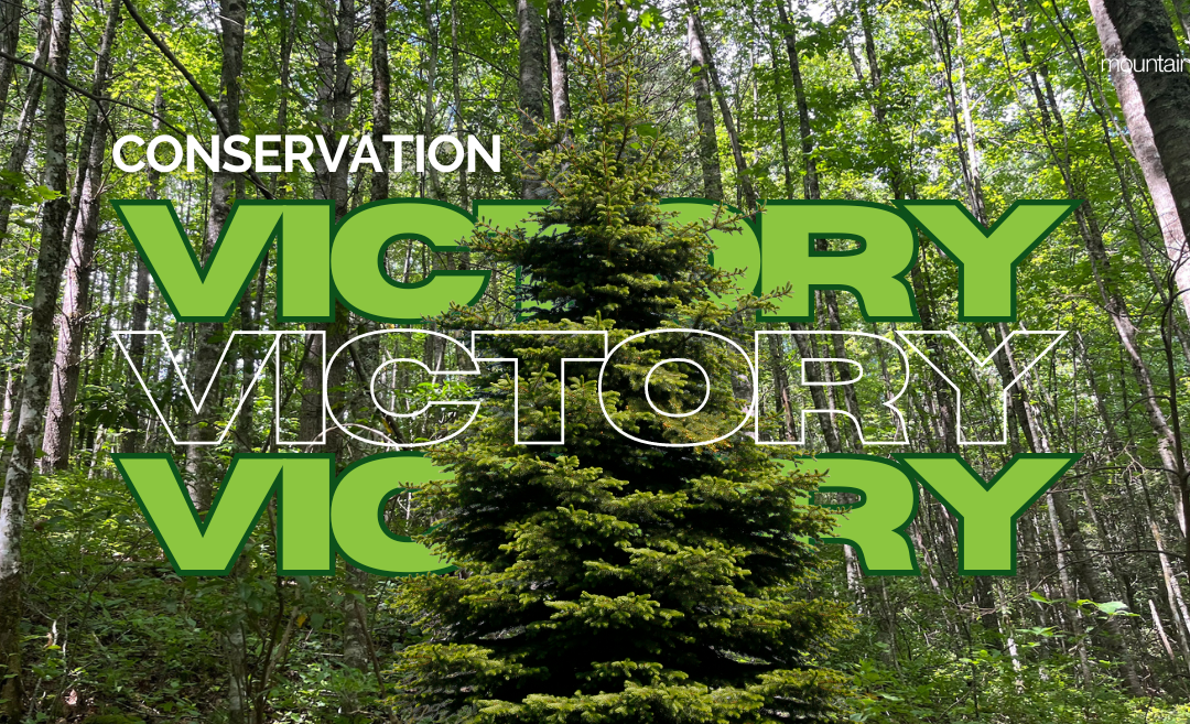
Clear Creek Sewer Project update: victory for clean water
Earlier this year, you joined us in speaking out for clean water and sustainable development by submitting comments and attending public meetings on Henderson County’s Clear Creek Sewer Project. With this project, County Commissioners proposed constructing a new sewer line extending to Edneyville and sought permits for a new wastewater treatment plant that would discharge into Clear Creek — a stream that has already been listed as impaired by the state due to ongoing pollution problems. In response to your public pressure and our advocacy, the NC Department of Environmental Quality revised its draft permit to severely limit pollution discharge levels and the overall capacity of a treatment plant in the final permit. That means that the County has had to come up with a better solution that doesn’t further pollute Clear Creek. This is a major victory for protecting water quality. Thank you for making your voice heard! Read more on the MountainTrue blog.
Shoutout to our Broad Riverkeeper summer ’24 intern, Caleb!
A huge thanks to our awesome intern, Caleb McCabe, for all the hard work he’s put in this summer. Caleb oversaw our Swim Guide program, which included collecting samples, running the lab, cataloging weekly data results, and updating the Swim Guide website and social media. He also spent a good bit of time in the water doing all things Riverkeeper: assisting in river sweeps and river access cleanups, cleaning out the Trash Trout (an in-stream passive litter collection device), removing log jams and strainers along the First Broad River paddle trail, scouting river sections for upcoming outings, and helping lead our guided river adventures! His internship was made possible by the Golden LEAF Foundation which “provides leadership development opportunities, exposes scholars to career experiences, and promises a lifetime connection to an extraordinary community of Golden LEAF Scholars across the state.”
There’s still time to win a sweet paddle made by the Broad Riverkeeper!
Want to paddle in style? Grab a raffle ticket for a chance to win a paddle designed and crafted by Broad Riverkeeper David Caldwell! Proceeds support MountainTrue and the Broad Riverkeeper program. This paddle is made of walnut, basswood, oak, and mahogany; it’s 150 cm long and weighs 32 oz. Unlike most “production” paddles, which have a hard finish, Caldwell Carvings’ paddles have an oil finish that is warm to the touch and easily maintained. The raffle winner will be drawn on September 14. Click here for full guidelines or to purchase tickets.

Photo: Will Sarcos (left) accepts the Race Day trophy, Betsy the wooden River Cooter from Broad Riverkeeper David Caldwell (right).
Broad River Race Day has a new champion
Congratulations to Will Sarcos! Will paddled the 4.5 miles in a solo kayak in 62 minutes. His first time in a kayak was back in June when he joined us for a Rotary Club river sweep. His second time in a kayak… he won the race; he’s definitely a natural-born paddler and a fighter. Will is a young asylum seeker from Ecuador who made his way to NC a few months ago. One of our members is helping him navigate the paperwork that will allow him to stay in the US. Welcome to our community, Will, we hope you’ll be here a long time!
Transylvania County residents: contribute to the County 2050 Comprehensive Plan
Transylvania County 2050 is an update of the county’s Comprehensive Plan and sets the vision and goals for what we hope the community will be for our children and those who come to live here in the coming years. Please take a few minutes to complete the survey and follow our efforts as we develop this plan for the future over the next year. Sign up for updates here.
Hendersonville residents: your input is needed
Join the City of Hendersonville’s Public Works Department for a community input session on the draft Parks and Greenspace Master Plan from 5-6:30 p.m. on Monday, August 12, at the Henderson County Public Library (301 N. Washington St). In addition to the meeting, the Public Works Department will be collecting virtual feedback through a survey that will be posted online in mid-August at hvlnc.gov/cohparks.
Opening on the Hendersonville Environmental Sustainability Board
A seat on the City of Hendersonville’s Environmental Sustainability Board (ESB), previously held by a long-time MountainTrue member, is now vacant after years of dedicated service. Thanks to all our members who serve on local boards and commissions; they do important work to advise local governments on key issues. If you’re interested in filling this open seat on the Hendersonville ESB, you can apply here. Meetings are currently held on the third Thursday of each month at 3:30 p.m. at the City’s Operations Center near downtown.
NCDEQ recognizes BRCC for energy reductions & progress on Executive Order 80 targets
The North Carolina Department of Environmental Quality’s (NCDEQ) State Energy Office has recognized 13 state agencies, universities, and community colleges for their significant energy reductions and progress towards Executive Order 80’s goal. Congratulations to Blue Ridge Community College (BRCC) for being the most improved community college in comparison to the previous year’s reduction (15% improvement)!
Want to volunteer + help raise funds for MountainTrue?
If you’re looking for an easy volunteer activity, look no further! MountainTrue is the nonprofit beneficiary for the Wicked Spooky 5k in Asheville, NC, on Saturday, October 26. MountainTrue will receive $5 per runner for providing 20 volunteers. You choose your shift and role. Find out more or register!
New merch sneak peek: I Love Mountains
Pre-orders start September 1 for our new I Love Mountains merch, which was designed by Ellis Gibson (winner of MountainTrue’s Kid’s Design Contest) and refined by Calor Creative. Why not wear your heart on your sleeve? Stay tuned for more information, coming soon!
Western Region News
A message from Western Regional Director Callie Moore:
Although the “back to school” sales and preparations make me feel like summer is ending, by the Earth calendar, we’ve still got at least six more weeks! There’s plenty of time to continue enjoying long days, garden-fresh tomatoes, corn, green beans, watermelon, and water sports. I hope y’all are making plans to attend our 2024 MountainTrue Annual Member Gathering, which is closer to the real end of summer on the afternoon of Saturday, September 14 — it’s always a fun time to celebrate our work. Read on for a few highlights of what we’ve been doing and what’s coming up in the Western Region. We couldn’t do any of it without your support!
Thank you for reading and for being MountainTrue
MountainTrue Annual Member Gathering: Saturday, September 14, in Asheville, NC
Join your fellow members, MountainTrue Board, and staff to celebrate another year of growing our reach and deepening our roots! Hear highlights from the year; help us recognize outstanding volunteers and partners; eat, drink, and be merry; and don’t forget to stick around for a fun night of trivia after the main program wraps! Register here. If you would like to carpool with other MountainTrue members from the Western Region, email Western Region Program Coordinator Tony Ward (tony@mountaintrue.org) by August 31.
Thanks to Eve Davis for service with MountainTrue
AmeriCorps program associate Eve Davis’ service term ended on July 31. During her time with us, Eve expanded our invasive plant control work along the Tuckasegee River and Jackson County Greenway, as well as the volunteer microplastics sampling program in Swain County. Eve recruited and trained volunteers to start sampling microplastics in Jackson County waterways. They also continued the Swim Guide E. coli monitoring program for the Little Tennessee River Basin in Macon County. But Eve’s enduring legacy lies in strengthening MountainTrue’s organizational partnerships, including WCU’s Center for Community Engagement & Service Learning, Friends of Panthertown, and Highlands-Cashiers Land Trust. Thank you for your service with MountainTrue, Eve! We wish you all the best in your future endeavors.
Macon County Commissioners table decisions on ordinance revisions
MountainTrue wishes to thank the Macon County Commissioners for tabling revisions to its Soil Erosion and Sedimentation Control, Watershed Protection, and Flood Damage Prevention ordinances to consider additional input. Proposed revisions to the Flood Damage Prevention Ordinance in particular would decrease safety and increase public and private losses due to flooding, including potential loss of life, over time. MountainTrue and many others opposed these changes through an online Action Alert and by speaking at the public hearings on July 9.


Photos: Lake Chatuge at the US Hwy 76 bridge near the Macedonia RideShare lot east of Hiawassee, GA, before (left) and after (right) parrot feather treatments.
Lake Chatuge parrot feather treatment update
MountainTrue is proud to report that no parrot feather is visible at the surface of Lake Chatuge this summer! While we’re still finding and treating small patches that are trying to establish themselves below the surface in a few locations, the parrot feather treatments conducted by Aqua Services have been successful in controlling the massive infestation we’ve had for two previous summers in the south end of Lake Chatuge.
Swim Guide update
As summer winds down, we have just five more weeks of our weekly Swim Guide E. coli monitoring program left. For the first 10 weeks, all of the sites on Lake Chatuge, Lake Nottely, Hiwassee and Fontana Lakes were very clean again this year! We didn’t get much rain in June, so most of the river access sites were also safe, at least for secondary recreation such as wading or paddling. However, with all the mid-July rainstorms, all of our Western Region river sites, including the Nantahala River at the Ferebee Memorial Launch Site, failed the Swim Guide guideline for the week of July 22. Swimming in our large rivers after rain events is not recommended, as too much pollution runs off the land from animal agriculture operations, leaking septic systems, sewer overflows, and other sources. Click here to see how your favorite locations in the Hiwassee and Little Tennessee River basins are doing. Or click here to visit the larger swim guide site for results from other rivers, including the Tuckasegee and Pigeon.
Hike outing, national forest policy update & social planned for October 5
Join MountainTrue Biologist & Resilient Forests Director Josh Kelly on Saturday, October 5, for a hike in the Whitewater Special Interest Area, which is renowned for its unique flora and wildlife. The Forest Service attempted to log 15 acres of the Special Interest Area as part of the Southside Project, but MountainTrue and our partners took legal action and won. We’ll meet at 9:45 a.m. in Cashiers, NC, to carpool to the trailhead. Register for the hike now!
After the hike from 4-6:00 p.m., we’ll be gathering nearby for a social event and update on national forest policy. You don’t have to participate in the hike to attend the social. More details coming soon!
Farm Weather Impact Survey
Calling all farmers in Haywood County! Click this link to fill out our Farm Weather Impact Survey and enter to win a $100 Tractor Supply Co. gift card!
As extreme weather events continue to pose challenges for farming operations, we must take steps to rally behind our farmers. This is why MountainTrue is launching a Farm Weather Impact Survey. The survey aims to better understand how extreme weather is affecting agricultural production in the Southern Blue Ridge and what resources are needed for resiliency. The information we receive will help guide MountainTrue in tailoring support initiatives, advocating for vital resources, and implementing strategies to support farms in Western North Carolina.
Any farmer cultivating, operating, or managing a farm for profit in the Buncombe, Haywood, Transylvania, Henderson, Polk, Rutherford, & Cleveland Counties is encouraged to participate. It should take less than 5 minutes to complete and will be open until September 1, 2024. Your responses will be anonymous unless you choose to share your contact information. If you have any comments, questions, or concerns, please reach out to climateaction@mountaintrue.org.
New merch sneak peek: I Love Mountains
Pre-orders start September 1 for our new I Love Mountains merch, which was designed by Ellis Gibson (winner of MountainTrue’s Kid’s Design Contest) and refined by Calor Creative. Why not wear your heart on your sleeve? Stay tuned for more information, coming soon!


")