
Stay Informed
Protect the Waters of Nantahala-Pisgah National Forest
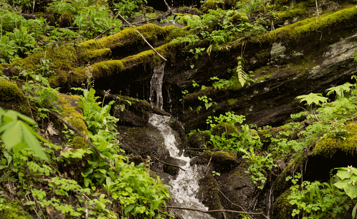
The Nantahala and Pisgah National Forests are the headwaters of seven major river systems, providing drinking water for millions of people in four southeastern states and wildlife habitat for a bewildering array of native species. Unfortunately, the current draft plan is inadequate in a few very important ways when it comes to water quality protections and we need you to speak up. The deadline for public comments is June 29 and this is our last significant chance to have our say. Please submit your comment today!

Check Out Our New Oriental Bittersweet Invasive Plant Coloring Sheet
Our COVID-19 Activities Guide is chock-full of resources to help you keep learning and protecting our public lands. A recent addition is a series of coloring sheets featuring non-native invasive plants that you can print and color at home. Each sheet will have a short history on how that plant was introduced to our region and tips in identification and eradication.
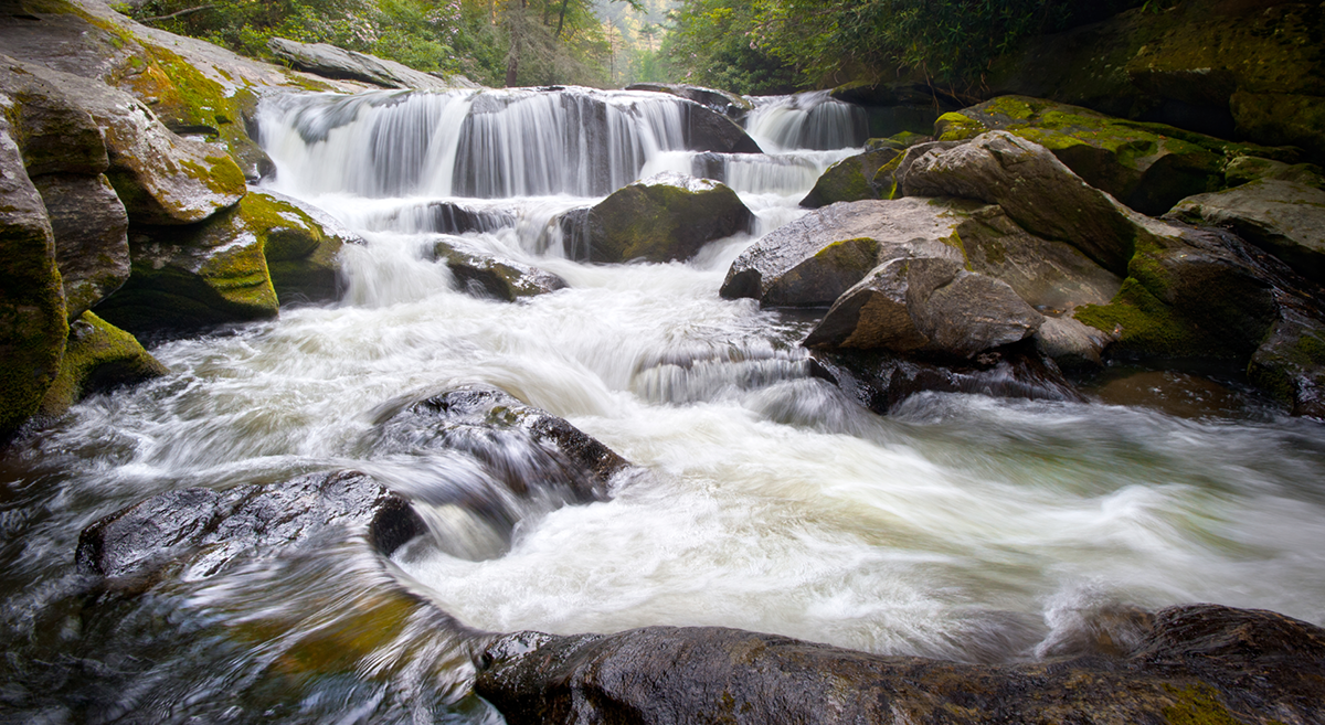
Water and the Draft Plan for Nantahala and Pisgah National Forests
On April 28, MountainTrue’s Western Regional Director Callie Moore hosted a live webinar to explore water quality issues in the draft management plan for Nantahala and Pisgah National Forests. From protecting our cleanest streams to the effects of delayed road maintenance on our waters, here’s a quick rundown of some of the topics Callie covered.
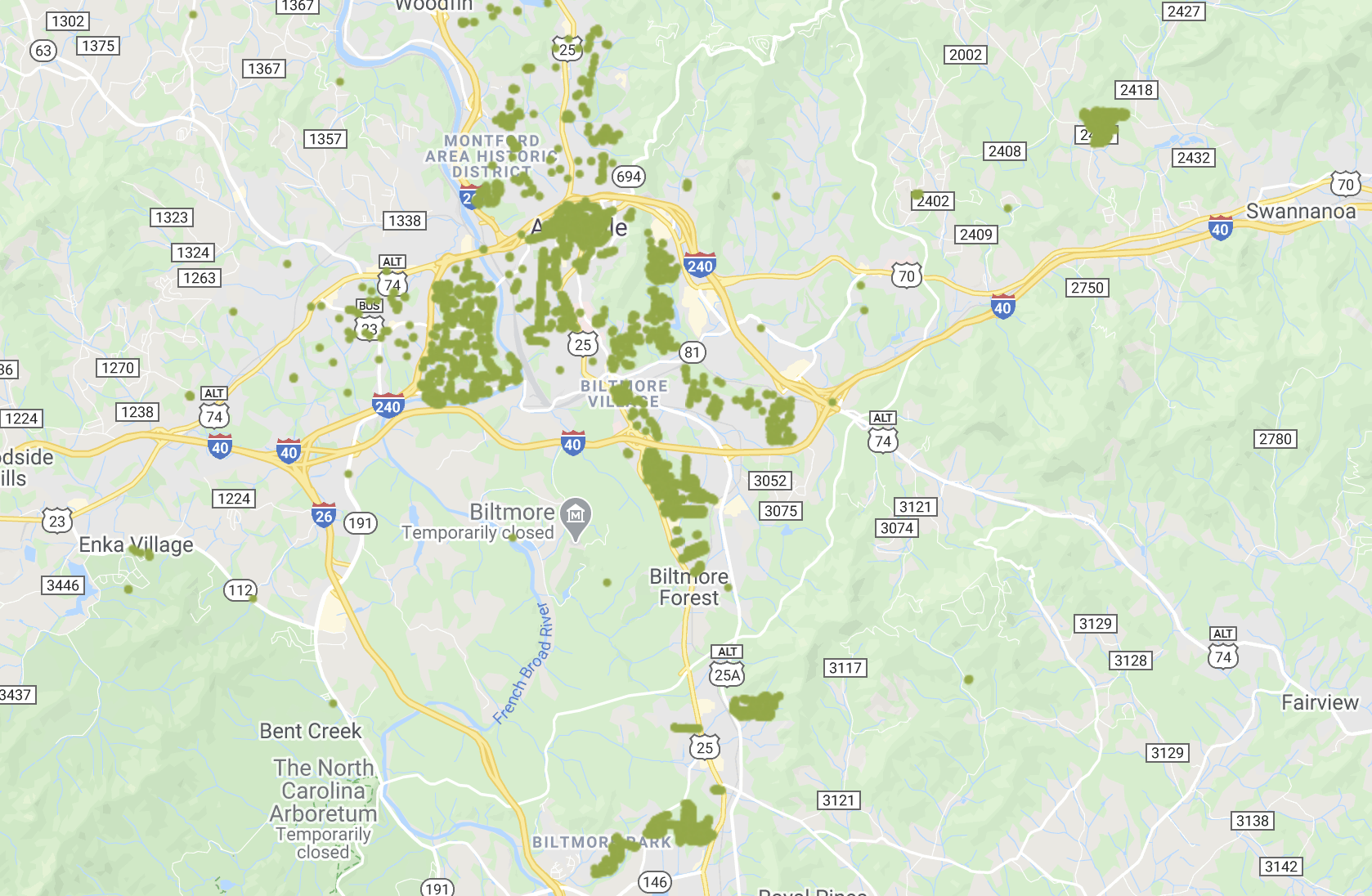
Get to Know Your (Other) Neighbors with the Asheville Tree Map
Western North Carolina is well known for our beautiful forests, but the city of Asheville has slowly been losing tree cover over the years. Thankfully, there are lots of projects underway to try to protect our precious urban trees! One such endeavor is the Asheville Tree Map, an app that allows folks to map the trees in their neighborhood and city, and monitor changes in urban tree density.

MT Raleigh Report, COVID-19 Edition: What To Expect From NC Lawmakers This Week
With the legislative session beginning tomorrow, here’s what you should know about where things stand in Raleigh and what MountainTrue’s priorities are for the session.

Introducing Topic-Specific Info Sessions on the Nantahala-Pisgah Forest Management Plan
MountainTrue will kick off our series of topic-specific info session on the Nantahala-Pisgah National Forest Management Plan on Tuesday, April 28 with a deep dive into water quality issues in the draft plan.