MountainStrong Hurricane Recovery Fund

In the wake of Hurricane Helene, MountainTrue is dedicated to addressing the urgent needs of our community.

 - 
Arabic
 - 
ar
Bengali
 - 
bn
German
 - 
de
English
 - 
en
French
 - 
fr
Hindi
 - 
hi
Indonesian
 - 
id
Portuguese
 - 
pt
Russian
 - 
ru
Spanish
 - 
es
Oppose the weakening of land-use regulations and save the Henderson County Comprehensive Plan.

Oppose the weakening of land-use regulations and save the Henderson County Comprehensive Plan.

Oppose the weakening of land-use regulations and save the Henderson County Comprehensive Plan.

Take action to oppose the weakening of land-use regulations and to save the Henderson County Comprehensive Plan.

The Henderson County Commission is backsliding on important land-use regulations, and that spells big trouble for the 2045 Comprehensive Plan and for our region’s ability to manage future growth and prevent sprawl.

Here’s what you can do:

  1. Join us at the September 6 County Commissioners’ meeting, and let’s remind our elected leaders of their responsibility to their constituents. Stand up for responsible development rules, good planning, and a better comprehensive plan.
    Henderson County Commission Meeting
    September 6, 2022, at 5:30 P.M. 
    1 Historic Courthouse Square, Hendersonville
  2. Email the Henderson County Commissioners and let them know that you oppose rolling back floodplain regulations and that you support a smart, comprehensive plan.

Poor Land-Use Decisions Undermine the County’s Future

In its July 20 meeting, Henderson County Commissioners went against the recommendations of their own planning board and voted to adopt extremely lax rules on residential storage units that would allow property owners to construct an unlimited number of storage units within five feet of neighboring properties.

More concerning is that Commissioner Michael Edney and Commission Chair Bill Lapsley have proposed a dangerous rollback to floodplain regulations. As reported by the Hendersonville Lightning, Edney has proposed allowing more industrial development in floodplains — an idea rejected in an 8-0 vote by its own appointed Planning Board. And Commission Chair Lapsley has suggested allowing for more residential and commercial development in floodplains as well. Building in floodplains increases the chances of flooding and puts homes, businesses, and people’s lives at risk. As climate change now causes 100-year floods much more frequently, Henderson County should be taking the opposite approach by increasing limits on floodplain construction.

MountainTrue has serious concerns about Commissioners’ willingness to circumvent and ignore the recommendations of the County’s Planning Board — an expert body appointed by the Commission to give input on these very issues. We are also concerned about Commissioner David Hill’s stated opposition to any countywide zoning (as quoted in the Hendersonville Lightning), especially as the County is preparing to release its draft Comprehensive Plan.

Done well, Henderson County’s 2045 Comprehensive plan will help our communities meet the challenges of climate change, a growing population, and increased development pressures on the natural environment. Done badly, it will have the opposite effect — leading to more sprawl, less preservation of farmland, and more of our forests being cut down to accommodate poorly-planned development.

County Residents Support Support Land-use Protections

As part of the Comprehensive Planning process, the county fielded a survey to gauge the priorities of Henderson County residents. They received more than 7,000 responses and found out that the public is overwhelmingly in favor of land-use protections, preservation and conservation.

Henderson County residents’ top 3 priorities for the 2045 Henderson County Comprehensive Plan:

  • protection of open spaces and forests (55.30%),
  • farmland preservation (45.16%), and
  • conservation (35.04%) of unique natural areas

But, these recent actions, coupled with the release of a poorly-designed draft Future Land Use Map, raise questions about whether Henderson County’s Commissioners care about the public’s priorities.

Learn More About the Henderson County Comprehensive Plan

Henderson County’s new Comprehensive Plan will serve as the blueprint for growth and development over the next twenty years. Learn about how this plan will help determine how our communities grow and develop to meet the challenges of climate change, a growing population, and increased pressures on our built environment.

Watch: How Henderson County can accommodate growth without sprawl.

Chris Joyell, MountainTrue’s Healthy Communities Director, discusses how Henderson County can welcome far more population growth than the state anticipates without causing sprawl. Watch.

MountainTrue offers to bid on reckless Southside Timber Sale to stop important old-growth forests from being cut

MountainTrue offers to bid on reckless Southside Timber Sale to stop important old-growth forests from being cut

MountainTrue offers to bid on reckless Southside Timber Sale to stop important old-growth forests from being cut

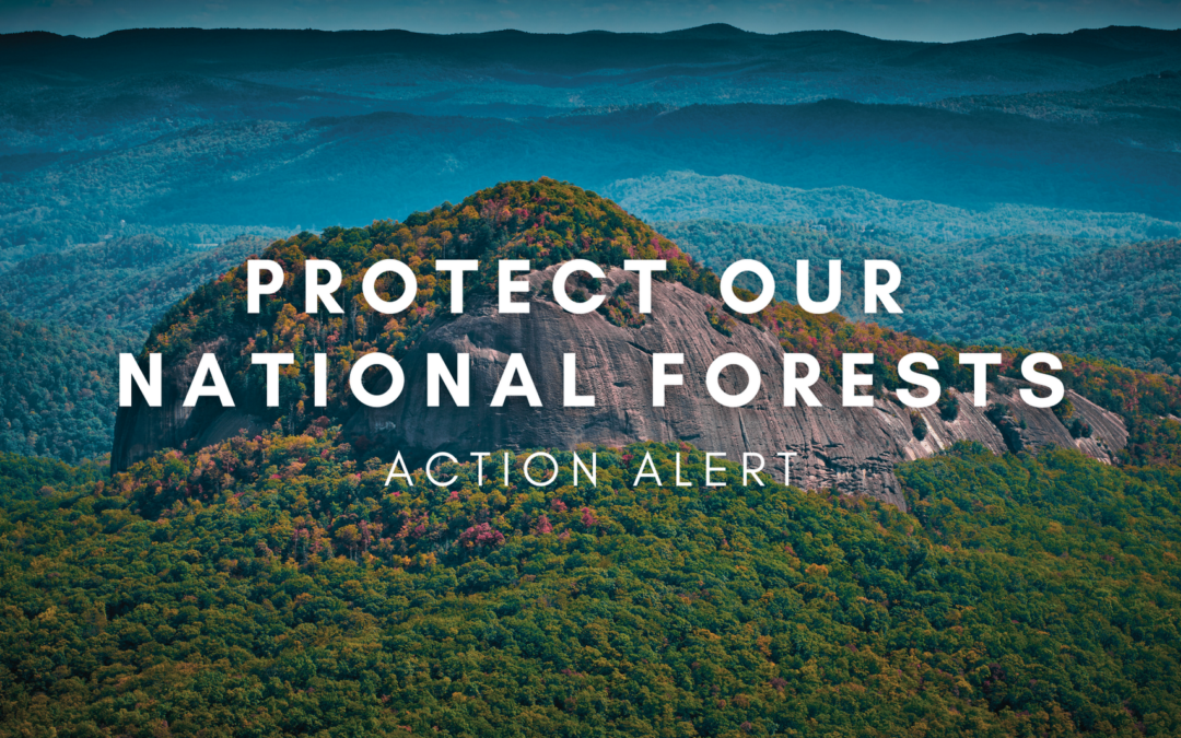
ASHEVILLE, NC — Today, the US Forest Service closed bidding on 98 acres of the Southside Timber Sale (pictured above), which aims to eventually log 300 acres of North Carolina’s Nantahala National Forest, including critical tracts of old-growth forests. To stop the logging of old-growth forest, MountainTrue is offering to pay the Forest Service to keep the 37 acres of trees in place and the Forest intact. 

This offer would protect exceptional old-growth forests from unnecessary logging and ensure the Forest Service recoups its investments in this sale. In fact, the Forest Service would make more money by accepting payment from MountainTrue, which is offering to match any offers for the value of the timber. Leaving the forest in place would free the Forest Service from the expense of administering the sale and overseeing roadbuilding and logging activities. 

While the Forest Service typically does not accept payment to keep forests intact, this extraordinary offer is an effort to stop an extraordinarily harmful sale. 

“We are willing to pay the Forest Service in order to save this old-growth forest and the critical habitat that it provides for native species,” explains Josh Kelly. “Our bid is both the most environmentally responsible and profitable option for the Forest Service.”

The 37 acres targeted by the Southside Timber Sale on Brushy Mountain are incredibly important ecosystems. Old-growth forests are made of trees that have been standing for centuries and hold tremendous amounts of carbon. Cutting these trees releases that carbon – tons of it – into the atmosphere, where it will worsen the impacts of climate change. Keeping these remarkable tracts of forest in the ground is a key step to fighting the climate crisis. 

These forests also provide habitat for what experts recently documented as one of the most important green salamander populations in the state. Cutting these forests threatens this already-imperiled species. In fact, Forest Service leaders have ignored concerns from the agency’s own scientists about the impact logging could have on this already-imperiled species.

The Forest Service acknowledges that 17 acres on Brushy Mountain are old-growth and knows about the presence of the critically imperiled Blue Ridge lineage of green salamanders at the site but still insists on cutting this forest. Logging these critical tracts of forest will threaten at-risk species, worsen the impacts of climate change, and do permanent damage to these important ecosystems. USFS leaders should instead preserve these forests for generations by allowing MountainTrue to purchase the carbon rights to the forests for sale at Brushy Mountain in Southside Timber Sale – or by scrapping this misguided project altogether.


Have questions? Email Josh at josh@mountaintrue.org.

MountainTrue Staff Spotlight: Forest Plan

MountainTrue Staff Spotlight: Forest Plan

Over the rivers and through the woods in

Pisgah and Nantahala National Forests

A brief chat with these amazing MountainTrue team members working hard to protect our region’s beloved national forests:

How long have you been involved in this process?

Bob: “I’ve been involved since the Forest Service’s planning process officially started in 2013. Prior to this, I also attended the first meetings held by The Wilderness Society (I think in 2011) when it first began to pull together a partnership of stakeholders in anticipation of the start of the planning process.”

Callie:I’ve been involved in this forest planning process almost since the beginning, first as Executive Director of the Hiwassee River Watershed Coalition and then in my current role as MountainTrue’s Western Regional Director. I helped organize the Nantahala Pisgah Forest Partnership in 2011. Our initial focus was on making the best Forest Plan ever, but what we’ve really created over the past decade is a ‘lasting voice for innovative management and public investment in the public forests of North Carolina’s mountains for the future.’

Josh:I’ve been involved with this Forest Plan revision for almost 10 years. MountainTrue was involved with the very first Forest Plan in 1987. We championed a petition to the Chief of the Forest Service that led to the 1987 Plan being remanded and the creation of the 1994 Amendment.”

Why is this an important part of your work and why is it important to you on a personal level?

Bob:It’s an important continuation of the forest protection work I did for what was then the Western North Carolina Alliance (now MountainTrue) during the decade before Josh came aboard. As a botanist/forest ecologist, I’ve always felt it’s important to work to keep our mountain ecosystems as healthy and secure as possible, given the continuing challenges from development, fragmentation, poor forest management, and climate change. On a personal level, my heart is in these mountains!”

Callie:Almost 20 years ago, I chose to make my home in Western North Carolina because of the amount of public land in these mountains. Nantahala National Forest is only eight miles from my house by car. It’s the view out my window — it’s my backyard!”

Josh:The new Forest Plan will set the management direction for over one million acres of Pisgah and Nantahala National Forests for the next 20 years. These forests are incomparable in their ecological and social value. They support thousands of species — many of them found nowhere else, they nourish the hearts and souls of millions of people, and they’re a huge part of important traditions.”

What’s one thing you want folks to know about the Revised Forest Plan?

Bob:Because the Forest Plan has not become finalized (due to the ongoing objection process), I’m not quite sure yet. But, there’s currently a strong focus on timbering that people should know about. I do think it’s encouraging that we have a diversity of partner organizations in place who have stated their commitment to helping the Forest Service implement the Plan over the next two decades. Their collaboration will be essential in shaping good management out of whatever becomes the Final Plan.”

Callie:While water quality and riparian protections are pretty strong, the Plan sets up the next 20 years to continue the tradition of making Nantahala the ‘working forest’ and Pisgah the ‘recreational forest.’ While timber harvest and recreation will of course continue to occur on both forests in a variety of locations, the emphasis for Nantahala is much more oriented toward timber harvest.”

Josh:The Revised Plan puts too much emphasis on logging cove forests. Southern Blue Ridge Cove Forests are some of the most diverse temperate forests on the planet. They grow the biggest trees in our region, support diverse understories of wildflowers and medicinal plants, protect water quality, and have historically been over-exploited. The new Forest Plan should instead put more emphasis on thinning and burning the fire-adapted forests that respond positively to timber harvest and are suffering from a lack of fire.”

What’s your favorite location in one or both of the forests?

Bob:My favorite conservation-related places are the old-growth forests in Nantahala’s Big Choga Creek area and Pisgah’s Daniel Ridge area. I’m also equally fond of the rare Southern Appalachian bogs in both national forests. My favorite recreation area is probably Pisgah’s Pilot Cove Loop (which is also a Natural Heritage Area), but it’s hard to pick out a single place!”

Callie:Fires Creek. Hands down. With its crystal clear, cold waters, unique biodiversity, trout fishing, hiking, camping, horseback riding, picnicking, swimming, and hunting, Fires Creek offers something for everyone!”

Josh:There are many great areas in Pisgah and Nantahala National Forests, but none are better to me than Santeetlah Creek in Graham County. It’s just an incredible landscape that inspires me every time I visit.”

Josh’s Forest Plan update:

We and our organizational partners had a great time at the Pisgah Party + Rally for the Forest, organized by I Heart Pisgah on August 1, 2022. Over 500 people attended and made clear that too much of Nantahala and Pisgah are being prioritized for logging. The Objection meetings hosted by the Forest Service from August 2-4 went well. The dialogue was high-quality and our team was well prepared — we made our case and the Forest Service should realize they need to make some changes to the new Forest Plan. We hope the Forest Service seriously reviews and implements the solutions included in the Nantahala-Pisgah Forest Partnership’s proposal. The Forest Service expects to respond to all objections and finalize the Forest Plan by late 2022. Click here to read our blog detailing our objections to the Draft Forest Plan.

More Forest News

No Results Found

The page you requested could not be found. Try refining your search, or use the navigation above to locate the post.

Sewage Spill in the Broad River? Check the Classifieds!

Sewage Spill in the Broad River? Check the Classifieds!

Check the Classifieds!

Disclaimer: this is not a sewage spill warning!

Thankfully, no recent sewage spills have been reported in the Broad River. Last week’s Broad Riverkeeper social media posts about high bacteria levels in the Broad got some folks wondering about bacteria levels and sewage spills. Heavy rainfall does cause E. coli levels in the Broad to rise, and sewage spills do occasionally occur after very heavy rain events. However, higher E. coli levels do not always signify a sewage spill.

In the event of a sewage spill, state law requires the wastewater treatment plant or municipality to inform the local public by placing a classified ad in a local printed newspaper.

Stay safe and informed on your river adventures.

This classified ad was printed in the Shelby Star on October 13, 2018, after nearly 45,000 gallons of untreated wastewater were discharged into the Second Broad River on October 11. The wastewater treatment plant was not required to directly notify your Broad Riverkeeper, the Broad River Greenway, or downstream neighbors. The treatment plant was also not required to place any signage downstream where folks might be accessing the river.

The protocol is an antiquated system for public notification of potentially dangerous pollution events. NC riverkeepers are urging the state to upgrade this system by utilizing more current communication methods like social media posts, email and text alerts, or a website. We’ll keep working to bring about a better system, but until then, make sure you know where to find potential future sewage spill notices in your local paper.

Halfway Through Swim Guide Season 2022 – Watauga Riverkeeper

Halfway Through Swim Guide Season 2022 – Watauga Riverkeeper

Watauga Riverkeeper Report:

Swim Guide Season 2022

We’re officially halfway through this year’s Swim Guide season!

Scroll on and check out these handy graphics to learn more about our High Country E. coli facts and figures and find out which Watauga Riverkeeper sampling sites have the lowest and highest E. coli averages. We’ll continue to post our weekly results on the Swim Guide platform until September. 

Follow us on social media!

ACTION ALERT: Protect Our Forests and Farms from Sprawl

ACTION ALERT: Protect Our Forests and Farms from Sprawl

ACTION ALERT: Protect Our Forests and Farms from Sprawl

We need you to email the Henderson County Board of Commissioners to ask them to take action to prevent sprawl and protect our forests, farmland, and rural communities.

Henderson County is drafting its new Comprehensive Plan — the blueprint that will guide growth and development here for the next twenty years. As part of that process, they have surveyed members of our community, and that survey shows broad support for conservation.

Henderson County residents identified:

  • protection of open spaces and forests (55.30%),
  • farmland preservation (45.16%), and
  • conservation (35.04%) of unique natural areas

as their top 3 priorities for the 2045 Henderson County Comprehensive Plan.

Unfortunately, MountainTrue has serious concerns that the comprehensive plan being created by the county’s consultants is out of step with the desires and needs of Henderson County residents. The County has circulated a draft Future Land Use Map that prioritizes sprawl — development that spreads too far into the countryside, unnecessarily destroying forests, farmland, and rural communities — at great expense to taxpayers and against the desires of county residents.

So we need you to act today. Email your Henderson County Commissioners, and ask that they adopt a smart, responsible and sustainable comprehensive plan.

Watch: How Henderson County can accommodate growth without sprawl.

Chris Joyell, MountainTrue’s Healthy Communities Director, discusses how Henderson County can welcome far more population growth than the state anticipates without causing sprawl. Watch.

Learn More About the Henderson County Comprehensive Plan

Henderson County’s new Comprehensive Plan will serve as the blueprint for growth and development over the next twenty years. Learn about how this plan will help determine how our communities grow and develop to meet the challenges of climate change, a growing population, and increased pressures on our built environment.