- 
Arabic
 - 
ar
Bengali
 - 
bn
German
 - 
de
English
 - 
en
French
 - 
fr
Hindi
 - 
hi
Indonesian
 - 
id
Portuguese
 - 
pt
Russian
 - 
ru
Spanish
 - 
es
2023 Western North Carolina Conservation Legislative Priorities

2023 Western North Carolina Conservation Legislative Priorities

2023 Western North Carolina Conservation Legislative Priorities

Protect Public Health – and the Jobs and Businesses that Rely on Clean Water

A recent report conducted by economists at Western Carolina University commissioned by the French Broad River Partnership found the total economic impact of the French Broad River and its tributaries is $3.8 billion annually, and river-reliant businesses create or maintain 38,554 jobs each year. In 2015, more than 55,000 people used a commercial outfitter to enjoy the French Broad, and thousands more used the river without an outfitter. 

Unfortunately, bacteria pollution threatens this economic engine by making the watershed unsafe for the thousands of people who play in it every year. Contaminated water poses health problems, including gastrointestinal, skin, ear, respiratory, eye, neurologic, and infections. 

Water quality testing in the heavily-used French Broad River watershed indicates the presence of E. coli and fecal coliform at levels that are unsafe for human exposure much of the time. One of the most popular areas for recreation, a 19-mile section of the French Broad River – from the Asheville Regional Airport,  through the Biltmore Estate and the River Arts District in downtown Asheville – was added to NC’s list of impaired waterways in 2022.

To protect public health and the jobs and businesses that rely on safe recreational waters, MountainTrue supports the following initiatives to reduce bacterial pollution:

  • Increase local WNC funding to help farmers improve water quality. Agricultural waste is a significant source of E. coli and other bacterial pollution in WNC rivers and streams, especially the French Broad River which, as mentioned above, was recently listed as impaired for fecal coliform. Unfortunately, demand for state funding to help WNC farmers afford improvements that would reduce this pollution far outstrips the current budget. Expanding state funding for local Soil and Water Conservation Districts (SWCDs) to meet this demand is critical to improving recreational water quality in WNC. We would like to request a $2 million nonrecurring allocation to SWCDs in the French Broad Watershed, allocated through the existing Agricultural Cost-Share Program, specifically for livestock operation improvement projects.  
  • Help property owners reduce stormwater pollution. The Community Conservation Assistance Program (CCAP) allows WNC’s SWCDs to help property owners reduce stormwater pollution in impaired waters.  Like the cost share program for farmers, funding for CCAP assistance is insufficient to meet demand. Providing WNC SWCD’s with an additional $500,000 for the CCAP program will significantly reduce stormwater pollution in rivers and streams already impacted by bacterial pollution. 


Other policy and funding initiatives that MountainTrue supports:

  • Abundant Housing Legislation – Opportunities for dense, energy-efficient housing located close to jobs reduce energy demand and transportation emissions. We support legislation to address housing availability and affordability.
  • Dam Removal Fund Implementation – The NCGA previously allocated $7.5 million to remove antiquated dams on waterways across WNC. MountainTrue is committed to advancing policies that give state agencies the support they need to advance dam removal projects efficiently.
  • Expand Transportation Funding – NC’s transportation funding relies on the gas tax, which is diminishing as people drive less and vehicles become more efficient. We support legislation that creates new sources of funding and expands the use to include stand-alone bike-ped projects.
  • Stormwater management reform for redevelopment projects – Recent amendments to G.S. 143‑214.7 deny local governments the option of requiring stormwater mitigation on redevelopment projects. We support legislation to repeal those changes.
  • Safe Passage Fund – As roadway construction creates new barriers to long-established wildlife corridors, inevitably, animals are increasingly encountering humans and their vehicles. We are joining a coalition of organizations seeking $10 million to support wildlife crossing projects.
  • Agency staffing needs and pay equity – State agencies across the board are struggling to hire and retain staff due to budget constraints and competition with the private sector. MountainTrue supports maximizing investments in state agency staff positions and salaries.

WNC Public Access and Recreation Investments:

  • Expand the Blue Ridge Snorkel Trail to include one publicly-accessible site in each WNC county, along with educational materials ($150,000 nonrecurring to Mainspring Conservation Trust).
  • Improve River Walk in downtown Murphy by building a boardwalk for Fisherman’s Loop, and extending the path to a housing development ($250,000 nonrecurring to the Town of Murphy).
  • Improve public access to the Watauga River Paddle Trail by purchasing an additional access point in Watauga County ($500,000 nonrecurring to Watauga County).
  • Expand access to the Green River and adjacent lands by developing a new access point at South Wilson Hill Road ($150,000 nonrecurring to Polk County Community Foundation).
  • Enhance Chestnut Mountain Nature Park by expanding paths and trails and improving the playground and creekside park ($450,000 nonrecurring to the Town of Canton).

Action Alert: Delivering on Goals Requires Stregthening Recommendations

Action Alert: Delivering on Goals Requires Stregthening Recommendations

Action Alert: Delivering on Goals Requires Stregthening Recommendations

MountainTrue has significant concerns about the latest draft of the 2045 Henderson County Comprehensive Plan. While much of the document and its goals reflect the priorities of our community, many plan recommendations are now undermined by weak or ambiguous language. 

MountainTrue staff and volunteers have analyzed the current draft and prepared the following open letter — which has been shared with County Commissioners by MountainTrue’s Southern Regional Director, Nancy Díaz. MountainTrue urges Henderson County residents to urge County Commissioners to adopt stronger recommendations, fix critical flaws with the suitability maps, and formulate an implementation plan. 


What you can do:

Write an email to the Commissioners about your concerns

  • David Hill – davidhill@hendersoncountync.gov
  • William Lapsley – wlapsley@hendersoncountync.gov
  • Rebecca McCall – rmccall@hendersoncountync.gov
  • Mike Edney – jmedney@hendersoncountync.gov
  • Daniel Andreotta – dandreotta@hendersoncountync.gov


Attend an upcoming County Commissioners meeting — click here to view the meeting calendar


Submit a letter to the editor (LTE) of the Times News about your concerns.

LTE guidelines:
A 200-word count maximum.
The deadline for letters each week is noon on Wednesday.
The best email to send letters to is tnletters@blueridgenow.com.
Please include your address and phone number with your signature.

Dear Henderson County Commissioners:

On December 1, the Planning Board approved, with no opportunity for public input, a catalog of edits undermining and further weakening the County’s ability to meet its own goals. In addition, the current Suitability Maps are in conflict with the expressed goals of the plan. MountainTrue urges Henderson County Commissioners to revise the December draft — which doesn’t fully address the priorities of County residents as reflected in the County’s own public survey — by reverting to the earlier language of the 2045 Comprehensive Plan. 

Through the County’s public survey, public input meetings, and hearings, Henderson County residents have made our priorities clear: protecting open spaces and forests, preserving farmland, and conserving unique natural areas. Residents also showed strong desires to expand access to broadband internet, improve water quality; reduce vulnerability to wildfires, flooding, and landslides; expand sidewalks, bike lanes, and greenways; and increase energy efficiency. 

While the County deserves praise for passing a resolution to start conversations with the City of Hendersonville toward establishing a joint water and sewer commission, the Comprehensive Planning process itself has been less than ideal. Overall, the goals of the current plan are good, and the November draft of the Comprehensive Plan laid out sensible recommendations. However, the latest edits proposed by the Planning Board will make meeting the plan’s goals more difficult. 

Weakening the Hand of the County
One of the most exciting ideas to come from the current planning process is the establishment of a preservation program to establish agricultural conservation easements. On page 62, under Goal 2 (Protect and Conserve Rural Character and Agriculture), the Planning Board revised a recommendation (Rec. 2.2.B) from “creating” to merely “consider the creation” of such a fund. The “consideration” of a farmland preservation fund was proposed in the last Comprehensive Plan. It’s time for the County to adopt more ambitious and committed wording. 

On page 67, under Goal 3 (Improve Resiliency of the Natural and Built Environment), the Planning Board ignores safety concerns when it comes to limiting development above and below hazardous steep slopes, demoting a recommendation (Rec 3.3.A) from “encourage the preservation of open space and conservation areas in and around areas with a high potential for landslides” to just “consider encouraging.” The County Commissioners should “encourage” at the very least and would do better by establishing a strong steep slopes construction code.  

On page 68, Rec. 3.4.D the Planning Board replaced “remove regulatory barriers […] for green infrastructure projects” with only the consideration of such regulatory barriers, which is too weak. Furthermore, a definition of Green Infrastructure is missing from the glossary. County Commissioners should adopt this definition: Green infrastructure is a network of natural and built green spaces that provide environmental, economic, and social benefits. It includes green spaces such as parks, trees, urban forests, streetscapes, green roofs and green walls, rain gardens, and more. These green spaces help to mitigate the effects of urbanization, protect ecosystems, reduce pollution, and improve public health.  

On page 68, the imperative (Rec. 3.3.G) to “adopt” best practice design standards for new construction within the Wildland Urban Interface” was downgraded to an “encouragement.” On page 72, in the second paragraph for the description of Goal 4 (Connectivity),  multimodal transportation funding is unnecessarily limited to the Utility Service Area. The County is promoting Greenways as alternative routes for transportation and to connect communities. This means building greenways not just within one Utility Service Area but also between them — such as Edneyville to Hendersonville. In each of these instances, County Commissioners should restore the more assertive language of the November draft and consider further strengthening the recommendations. 

Turning a Blind Eye Toward Real-World Challenges
At their December 1 meeting, the Planning Board excised from the Comprehensive Plan the sole mention of climate change. The region is experiencing more frequent, extreme rain events — what used to be classified as “100-year floods” are now happening every five or ten years. At the other extreme, when droughts do occur, they are expected to be hotter and longer, increasing the risks of a repeat of the destructive wildfires of 2016 — which forced the evacuation of 1,000 people in the areas of Bat Cave, Chimney Rock, and Lake Lure. 

Shifting climatic conditions put our farmers and their ability to grow food at risk, degrade our water quality, and negatively impact our tourism and outdoor recreation economy, yet, the Planning Board ignores these risks with the deletion of a sentence acknowledging these basic realities. The County should restore the language of the prior draft, which read, “As the frequency of extreme weather events increases, flooding, landslides, and drought-induced fires are likely to become a more regular occurrence.” Additionally, we suggest adding a sentence to this section clearly stating that “The County will develop policies and procedures that will improve the resiliency of the County to wildfires, flooding, and landslides.” (Coinciding with 29% of the respondents of the survey (p.144)

In some ways, the draft Comprehensive Plan is proactive when it comes to our changing climate realities. However, in critical areas, the changes made by the Planning Board unnecessarily limit the County’s ability to mitigate and adapt. For example, the Planning Board deleted a recommendation 2.2.D (page 62 in the November draft) that read, “Consider the introduction of Smart Solar programs throughout the County to encourage solar energy development and safeguard farmland” and recommendation 4.6.A-C (page 74 in the November draft) that read “Support the use of electric vehicles to reduce air pollution and dependency on fossil fuels.” Advancements to renewable energy, and more specifically solar panel and battery technology, have made green energy cheaper, cleaner, and more reliable than fossil fuels. To save on energy costs, the County should restore the recommendation to introduce Smart Solar programs, and in light of a recent projection (Bloomberg) that at least half of all passenger cars sold in the US will be electric vehicles by 2030, we would urge the Commissioners to restore the full text of these deleted sections.

Fixing Critical Flaws to the Suitability Maps
There are major flaws with the proposed Commercial and Industrial Suitability Maps found in the draft appendix of the Henderson Comprehensive Plan. These maps appear to conflict with the accompanying Plan Maps, as well as the Comp Plan’s stated goals and public input. Despite strong support for the preservation of open space and working farmlands, the designated suitable areas include sensitive natural areas, prime farmland, and key transition zones between protected lands and low-density residential areas. It appears that the map’s designers did not appropriately weigh for the following criteria: Biodiversity and Habitat Value, Agricultural Lands, Prime Farmland Soils, Wildfire Threat, Landslide Threat, or Flooding Threat.

While we understand that the Suitability Maps are not authoritative, they will certainly be cited by developers looking to build commercial or industrial projects within the areas highlighted as suitable. In addition, these maps will serve as guideposts for future Planning Board members and County Commissioners, which could influence land-use policy decisions. Therefore, it is important that these maps are accurate and reflect the goals and values stated within the Comprehensive Plan. The staff and their consultant should redraw the Industrial and Commercial Suitability maps and adjust the weighting to incorporate values expressed in the Comprehensive Plan’s own goals — namely, the preservation of farmlands and the protection of open space. 

Furthermore, these flawed maps are granted an unwarranted level of importance by the Planning Board in its December revisions to the first Outcome on page 35. The plan’s outcomes are “established based on stakeholder and citizen feedback” (page 54) and are the bedrock upon which goals, recommendations, and actions were subsequently developed. All three outcomes were included without change in every version of the plan since the September 9, 2022 draft — until the Planning Board rewrote Outcome 1 in December. 

The prior Outcome 1 reads, “Make intentional land use decisions that protect agriculture, rural character, and natural resources while strategically guiding development.” This was changed to “Make intentional land use decisions that preserve agriculture, rural character, and natural resources with the Future Land Use Map as a guide” (pages 35 and 56)  This elevated the Future Land Use Map above the important policies articulated in the Comprehensive Plan and is in direct contradiction to the intent expressed in every draft (including the current one) that “the map and associated policies are meant to guide growth and development as well as land use regulations in the County planning jurisdiction …” (page 40, emphasis added). Rather than altering a high-level outcome so late in the planning process, we suggest that the language in prior drafts be restored. 

Erasure & Exclusionary Language
In the “History of the County” section on page 12, the Planning Board has removed a reference to the Cherokee and Catawba and to the “forcible relocation” of Native Americans via the Trail of Tears. As a result, the Planning Board has taken an acknowledgment of a shameful chapter in our nation’s history and erased it completely. While intentions may not have been to hide, MountainTrue would not want the County to appear to be obscuring this part of our history. We encourage the County to reach out to the Eastern Band of the Cherokee Indians and other representatives of Native American peoples to adopt language that is accurate and respectful to our shared history.

Further down on page 12, the Planning Board suggests new language stating that “To plan for the future, the County must acknowledge its past and current strengths, in order to plan for the best possible future development of the County for its citizens.” There is no reason to circumscribe the beneficiaries of this plan to County citizens. There are many people who have a vested interest in the future of the County, including part-time residents, visitors, commuting workers, medical patients, and tax-paying lawful permanent residents.  MountainTrue recommends just ending the sentence with the word “County.”

Looking Ahead to Implementation
In summary, while many of these changes may seem minor, we believe that, in this case, the devil really is in the details. The 2045 Comprehensive Plan is meant to serve as a long-range vision for future growth and development for Henderson County. As such, it is the responsibility of the County Commissioners to ensure that the goals reflect the priorities and desires of the people who live and work in Henderson County and the voters who elected them to office.

Through extensive public outreach and the County’s own community survey, those priorities are clear and largely reflected in much of the narrative and goals laid down in the Comprehensive Plan. Unfortunately, the December edits proposed by the Planning Board seem specifically designed to remove any sense of urgency or accountability and make the plan harder to implement.  

The Comprehensive Plan still lacks an Implementation Section, which the Planning Board has assured the public can be adopted even after the Plan is voted on and approved by the County Commission. Clearly identifying what is to be done, by whom, and by what time is critical to turning the hopes and aspirations of the County residents into reality in a transparent and effective way. While MountainTrue continues to advocate for the inclusion of a well-thought-through implementation process, the lack of an Implementation Section underscores the importance of getting the details and recommendations right now. 

Sincerely, 


Nancy Díaz

Southern Regional Director, MountainTrue

MountainTrue’s Chris Joyell Writes About Housing, Open Space, and Climate Change in MTX

MountainTrue’s Chris Joyell Writes About Housing, Open Space, and Climate Change in MTX

MountainTrue’s Chris Joyell Writes About Housing, Open Space, and Climate Change in MTX

In this Mountain Xpress Contributor Piece, MountainTrue Healthy Communities Program Director Chris Joyell explains the undeniable connection between housing and the integrity of our natural environment. Joyell discusses how Buncombe County’s Open Space and Affordable Housing Bond Initiatives will help the county meet its goals of ensuring stable housing for children, homeownership for working families, and safe housing for seniors, while also protecting mountains, forests, productive farmlands, and clean water in our streams and rivers for future generations. 

MountainTrue and our organizational partners are proud to endorse both the Open Space and Housing Bond Initiatives, and we encourage you to vote yes on both bonds this election season. Learn more about the bonds and how they work, see what other community institutions endorse them, and read a helpful FAQ on the Better With Bonds website

“A colleague of mine recently closed on his first house. After years of anxiously scanning listings in Asheville and Buncombe County, he realized that if he were ever to become a homeowner, it would have to happen in another county — in this case, Haywood County.

Likewise, another colleague recently graduated college and began working at MountainTrue last year. She, too, has been frustrated by the housing market, having to settle for a substandard rental unit with a negligent landlord. As rent costs in Buncombe County soar, she has grown doubtful that she will find a better living situation soon. The prospect of owning her own home here is beyond imagination.

Both their struggles reflect our growing housing crisis, where people with stable jobs and decent pay are running out of housing options in Buncombe County. People like the teachers, artists, service industry workers, small-business owners, nurses and others who make Buncombe County such a vibrant place to live.

In response to this dilemma, the Buncombe County Board of Commissioners recently approved a ballot referendum that will direct $30 million toward the preservation of open space and $40 million toward the development of housing that is affordable for the county’s workforce. This November, county residents will get to vote on the bonds separately.

The open space and housing bonds can work in conjunction with one another. Buncombe County remains largely rural, and ample land is available to develop housing. The county will likely prioritize the more rural and remote areas for land conservation. On the other hand, housing that is affordable for the county’s workforce is best located in areas already developed and closer to transit services, jobs, schools and commercial centers.”

MountainTrue’s Analysis of Henderson County’s Draft Comprehensive Plan

MountainTrue’s Analysis of Henderson County’s Draft Comprehensive Plan

MountainTrue’s Analysis of Henderson County’s Draft Comprehensive Plan

Update: We have added detailed analysis and recommendations to improve the Comprehensive Plan further down on this page. We are providing these recommendations to the Planning Board and Henderson County Commissioners. Scroll down to view.

On September 9, 2022, Henderson County released the first draft of the 2045 Henderson County Comprehensive Plan. You can view a virtual presentation about the draft plan here. MountainTrue is conducting a full analysis of the draft plan and will provide a detailed set of recommendations to the Henderson County Planning Board and County Commissioners to ensure that the plan addresses the priorities of county residents as reflected in the county’s own survey*.

The draft plan will guide Henderson County’s growth and services for the next 20 years. Overall, the draft plan includes a strong set of goals that MountainTrue fully supports. Those goals, found on p.34 of the draft plan, include:

  •  Coordinate development near existing community centers.
  •  Protect and conserve rural character and agriculture.
  •  Improve resiliency of the natural and built environments.
  •  Prioritize multi-modal transportation options and connectivity.
  •  Create a reliable, connected utility and communication network.
  •  Stimulate innovative economic development initiatives, entrepreneurship, and local businesses.
  •  Diversify housing choices and availability.
  •  Promote healthy living, public safety, and access to education.

These goals provide a solid foundation for a 20-year plan. MountainTrue’s recommendations below offer targeted strategies to help the county achieve these goals. We start, however, with one glaring omission in the draft plan.

Primary Recommendations

Include a Detailed Implementation Plan
The County Commission’s adoption of the comprehensive plan is just the first step towards realizing the goals within. The real challenge comes in translating the plan’s strategies into the day-to-day operations and actions of the government, and in making the plan work in concert with the County’s other strategic actions and policy documents. To date, the draft plan and recently released draft appendix do not include any guidance for implementing the plan’s recommendations. 

The 2020 Comprehensive Plan, adopted in 2004, is widely considered a success, as the county has accomplished a majority of the plan’s goals. This was no accident. That plan contained a detailed implementation schedule that held our county leaders accountable while allowing the public to track our progress. Henderson County needs to draw on this past success to ensure that the 2045 plan accomplishes its goals rather than gathering dust on a shelf. 

We strongly recommend developing a process to implement the plan’s priority strategies and track plan progress. Various ways to ensure the implementation of the plan include:

  • Establish a single point of contact who will oversee the plan’s implementation. This will ensure accountability and continuity in the years that follow adoption.
  • Form a county team with representatives from key departments who will meet to track the plan’s progress, develop action items to implement strategies, educate staff about the plan’s goals, and help shape departmental work plans around the Comprehensive Plan.
  • Review plan progress with applicable boards and commissions and recommend new priorities to the County Commission.
  • Conduct an annual report on progress of the plan to the County Commission and set priorities.
  • Evaluate the viability of the plan every three to five years, and update the plan accordingly.

Don’t Expand the Utility Service Area
We encourage the City of Hendersonville and the County to share in decision-making around where sewer services will go. The county should have representation on the City’s water and sewer governing bodies, have a say in where the pipes extend throughout the county, and whether annexation follows those pipes. Therefore, the county must work closely with municipalities to direct new growth where infrastructure already exists.

Expanding the Utility Service Area (USA) to include Edneyville and Etowah will only encourage the development of new sewer that exceeds the current needs of these communities. This is a recipe for suburban sprawl all along the US 64 corridor. We do not support the current draft Future Land Use Map calling for commercial shopping centers and dense infill development in Edneyville or Etowah, as the existing infrastructure in these communities cannot support such development. We recommend maintaining the Central USA, as presented in the 2020 Henderson Comprehensive Plan.

We do not support the residential density described in Infill Area (formerly Medium Density Residential) designations in the more rural areas of the county outside the Central USA, including Etowah and Edneyville’s proposed USAs. The density allowed within Infill Areas (8-14 units/acre) would likely require new sewer service or package plants, spurring additional suburban sprawl to areas of the county lacking the infrastructure and road networks to absorb such volume.

We also do not support the amended density allowances in the new Transitional Area (formerly Low Density Residential) designation, as this will drive suburban sprawl into the Tuxedo, Dana, and Gerton communities — all found well outside the Central USA. Allowing for developments as dense as quarter-acre lots would tax our existing roads and alter the rural character of these communities.

Address Water Quality Concerns in Edneyville and Etowah
Wastewater seriously impacts water quality, and the county should invest wisely in wastewater infrastructure. We strongly encourage Henderson County to address water quality concerns in Edneyville and Etowah without inviting suburban sprawl into these communities. 

Edneyville: Adding another municipal sewage treatment plant in the Mud Creek watershed may contribute to water quality concerns. Edneyville’s existing uses (Edneyville Elementary, the Training Academy, Camp Judaea, etc.) should tie into the city’s existing sewage treatment system, and the city should refrain from annexing these rural areas, as they lie outside the Central USA.

Etowah: It is foreseeable that Etowah’s aging private sewer system may one day be acquired by the Metropolitan Sewer District, given its proximity to MSD’s existing network. By connecting Etowah to MSD’s system, Etowah’s capacity for development could significantly increase in the next 20 years. With the highly anticipated construction of the Ecusta Trail about to begin, we must take measures to preserve the trail’s rural character that makes it such an attractive destination. 

Additionally, any expansion of sewer infrastructure should be constructed with limited capacity to service only existing businesses and residences without facilitating future growth. The county should implement strong land use protections to prevent sprawling and high-density residential development, high-intensity and industrial uses, and other uses outside of the Central USA that compromise the rural character and agricultural heritage of the area. 

Provide More Housing Options in the Central Utility Service Area
When people think of housing choice, they usually default to single-family homes or large apartment complexes. But we are missing the opportunity to provide new homebuyers and renters a wide array of housing choices, many that are more affordable than what the current market provides. 

To offer more housing choice in the areas that can best support it – the Central Utility Service Area – we recommend broadening the types of housing that can be developed in traditional single-family neighborhoods. Remove restrictive zoning that stands in the way of modest infill development, like duplexes, triplexes, and townhouses. Within the Central USA, we recommend amending the Infill Area zoning designations to include ADUs, townhouses, duplexes, and triplexes. We also support the new density allowances for Transitional Areas within the Central USA, as this housing would be located closer to the services, jobs and infrastructure already concentrated in our municipalities.

Adopt a Voluntary Land Conservation Fund
We fully support the development of a fund that focuses on preserving working farmland and parcels key to greenway, park, and recreational opportunities, and sensitive natural areas. Consider a bond referendum to establish the fund. Focus on the Purchase of Development Rights to preserve working farms and make them more affordable to new farmers. Consider easements that would improve water quality protection.

Consolidate and Strengthen Steep Slope Controls
Current steep slope regulations are found scattered throughout the Land Development Code, making it difficult to assess their impact on ensuring public safety, protecting water quality, and preserving scenic mountain views. Residents and developers would be better served if the steep slope controls were consolidated, transparent, and more concise. We applaud the Planning Board’s recent efforts to address this, and we encourage the county to include such improvements in the draft plan.

*The county has published a second public input survey. Click here to take the new survey.

Additional Recommendations & Further Details

In addition to our primary recommendations, MountainTrue makes the following suggestions specific to various recommendations found in the draft plan:

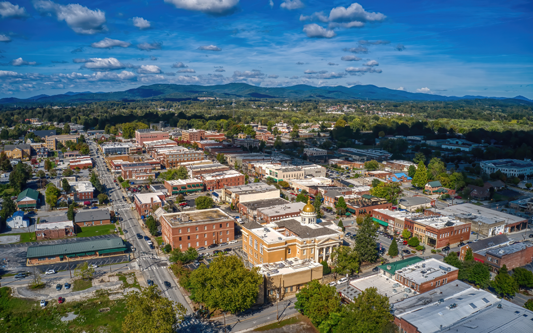
FUTURE LAND USE MAP (pp.38-44)

MountainTrue: We question whether the Dana community can support the recommended Industrial & Employment land use designation without sewer service. 

GOAL 2: PROTECT AND CONSERVE RURAL CHARACTER AND AGRICULTURE

R. 2.1.E. (p.57): Encouraging small businesses in rural areas can indirectly support agriculture by allowing non-farm income.
MountainTrue: To encourage appropriate small business development and maintain the rural and agricultural character of these areas, we recommend limiting the square footage of new structures and specifically defining what small-business activities are preferred in Agriculture / Rural Districts.

Rec 2.2.B. (p.58): Create a Voluntary Farmland Preservation Program to purchase farmland development rights and establish agricultural conservation easements.
MountainTrue: We recommend amending the Land Development Code to require that eligible applicants meet specific environmental standards or implement appropriate “best management practices” that protect water quality, such as undisturbed stream buffers.

Rec. 2.2.C. (p.58): Study potential mechanisms for private transfer of development rights program to allow for the transfer of density away from agricultural and natural resource areas to designated receiving areas.
MountainTrue: We strongly support the county in investigating a potential transfer of development rights program and would be willing to advocate for state authorization to provide Henderson County with this valuable conservation tool.

Rec. 2.3.C. (p.58) Consider zoning updates to reduce development pressure in agricultural areas.
MountainTrue: We recommend exploring new incentives to give farmers multiple options to preserve the working lands. We do not support the concept of downzoning Agricultural / Rural districts, such as requiring five-acre lot minimums, as this will only accelerate the development of undisturbed areas, while serving the few that can afford to purchase larger lots.

Rec. 2.4.A. (p.59): Provide incentives for revitalizing existing commercial and industrial sites.
MountainTrue: We strongly support this and encourage the Commission to prioritize commercial and industrial sites closest to main transportation corridors and in areas already serviced by existing water and sewer to disincentivize sprawl. 

Rec. 2.4.B. (p.59): Focus on higher-density housing closer to the city to reduce sprawl, provide affordable housing for the workforce, and relieve pressure on roads.
MountainTrue: We strongly support this designation, but we also recognize this requires coordination with municipalities, including participation in Hendersonville’s upcoming comp planning process. We encourage County staff and leadership to engage Hendersonville in developing plans that focus higher density development in appropriate areas already served by sewer and water, located closest to job and commercial centers, schools, and services.

Rec. 2.4.C. (p.59): Encourage industrial growth in areas away from large concentrations of farmland and agricultural operations.
MountainTrue: We question whether industrial uses and agricultural operations are mutually exclusive. Given the low residential density in such districts, there may be opportunities to cite appropriate industrial uses near working farmland, concentrating such activities away from established residential areas.

Rec. 2.4.D. (p.59): Carefully evaluate potential utility extensions that could impact large concentrations of productive farmland.
MountainTrue: See our Primary Recommendations above re: Edneyville and Etowah sewer expansion. 

GOAL 3: IMPROVE RESILIENCY OF THE NATURAL AND BUILT ENVIRONMENTS

GOAL 3 (p.60): Where risk reduction is not possible, careful planning and strengthening emergency response will help make recovery faster and more efficient when hazards do occur.
MountainTrue: We recommend: “Where risk reduction is not possible, careful planning could mitigate the impact of extreme events, thus reducing the costs of recovery for both private and public funds. Similarly, strengthening emergency response will save taxpayer dollars…”

Rec. 3.1.C. (p.60): Consider allowing for administrative approval for conservation subdivisions that meet certain criteria (i.e. are under a density threshold, have a minimum amount of open space, reserve priority open space types, and meet access standards).
MountainTrue: While we support this concept, we’ll note that administrative approval for conservation subdivisions works only if the thresholds are well defined. We recommend examining existing regulations and streamlining the project permitting and approval process so that development decisions are more timely, cost-effective, and predictable for the community and home builders.

Rec. 3.1.E. (p.61): Limit development on steep slopes and mountain ridges.
Rec. 3.3.C. (p.63): Discourage the amount of land disturbed in steep slope developments, including construction of roads, as well as decrease density.
MountainTrue: We strongly support these recommendations and would be willing to provide model ordinances from similar communities that have addressed steep slope development.

Rec. 3.3.D. (p.63): Continue to limit fill in floodplains unless additional standards are met.
MountainTrue: Under this recommendation, the County could further restrict the use of floodplains. Consider that multiple scientific studies now show that 100-year floods are increasing in frequency, including a Yale Environment study that predicts that Southeast counties like Henderson could experience such floods every one to 30 years.

Rec. 3.3.G. (p.64): Adopt best practice design standards for new construction within the wildland/urban interface.
MountainTrue: While we agree with this recommendation in concept, we seek clarification of the definition of “wildland/urban interface,” as the Future Land Use Map makes no reference to such designation. 

Rec. 3.4.E. (p.64): Educate the community and developers regarding green infrastructure projects, as well as state and federal rebates and tax incentives, which can lessen stress on natural systems.
MountainTrue: We strongly support this, and encourage the County to consider expanding streamside buffers to protect water quality. 

GOAL 4: PRIORITIZE MULTI-MODAL TRANSPORTATION OPTIONS AND CONNECTIVITY

Rec. 4.1.C.
Advocate for the French Broad River MPO (Metropolitan Planning Organization) to update the Comprehensive Transportation Plan, which was adopted in 2008, and focus improvements around active transportation options and transit.
MountainTrue: We strongly support this and ask the County to consider extending transit services to employment and commercial centers beyond the Central Utility Service Area. 

Rec. 4.2.B. (p.68): Consider reducing Henderson County’s Traffic Impact Study (TIS) threshold for developments located along specific road classifications.
MountainTrue: We support a reduction in traffic study thresholds in conservation/rural/ag-zoned areas, and recommend increasing the threshold for traffic studies in areas appropriate for denser development.

Rec. 4.2.D. (p.68): Consider amending the Land Development Code to allow for the integration of residential and commercial uses to allow for shorter travel time between destinations.
MountainTrue: Mixed-use developments are beneficial to combating sprawl, but the plan needs to specify where mixed-use would be deemed appropriate. Community centers and neighborhood anchors appear to be the most appropriate locations for mixed-use development. There will need to be adequate infrastructure already in place to support this level of development.

Rec. 4.3.A. (p.68): County staff should continue to seek grant funding (through the French Broad River MPO and other sources) for corridor studies along primary roadways throughout the county.
MountainTrue: We fully support commissioning a study of the Ecusta Trail corridor to inform appropriate land use designations along its path.

Rec. 4.3.B. (p.68): Establish a vision for significant roadway corridors and their surrounding land use, with input from the community they serve.
MountainTrue: This visioning process can be folded into an updated small-area planning process for Edneyville and Etowah. We would be willing to assist with gathering public input to inform these plans.

Rec. 4.3.D. (p.68): Support NCDOT with the ongoing corridor studies for US-64.
MountainTrue: This corridor study must consider future land-use recommendations for Edneyville and Etowah. We believe that an inappropriate expansion of sewer service in these communities will increase congestion along US 64 and contribute to suburban sprawl and loss of working farmlands.

Rec. 4.4.C. (p.69): Conduct studies of the transportation network surrounding County schools to identify deficiencies in safety and access.
MountainTrue: There is a critical need to address Etowah Elementary School and Etowah Park. We recommend investigating the Safe Routes to School program. We also recommend the County commission a bike/pedestrian connectivity study.

Rec. 4.5.C. (p.69): Initiate a study of Apple Country Public Transit to identify whether fare rates are a barrier to the use of the bus system and study the feasibility of a fare-free system.
MountainTrue: We support this and encourage the County to investigate the benefits of a fare-free system. 

Rec. 4.5.G. (p.70): Explore mechanisms to provide express routes to connect Hendersonville to Asheville and other destinations in Buncombe, Madison, and Haywood County, while focusing on regional mobility management, employee training, maintenance, and funding administration.
MountainTrue: We strongly support this and recommend advocating for transit connections to employment centers in Buncombe, Madison and Haywood counties to reduce traffic congestion along the primary north-south transportation corridors like I-26, US 25, and NC 191. We encourage the County to coordinate the comprehensive planning process with the ongoing planning process in Buncombe County.

Rec. 4.5.H. (p.70): Create connections between transit and greenways to help reduce traffic, vehicle miles traveled, and the county’s carbon footprint.
Rec 4.7.E. (p.71): Coordinate with the Rail Trail Advisory Committee, Transportation Advisory Committee (TAC), Planning Board, and Recreation Advisory Board on priority greenway implementation.
MountainTrue: We strongly support these recommendations and suggest hiring a sustainability coordinator to lead this important work.

Greenway and Sidewalks Map (p.73)
MountainTrue: Add language/graphics denoting the future regional Hellbender Trail and potential connections.

GOAL 5: CREATE A RELIABLE, CONNECTED UTILITY AND COMMUNICATION NETWORK.

Rec. 5.3.C. (p.75): Require conservation subdivision designs for all new major residential subdivisions residential growth in unincorporated areas tied to sewer infrastructure.
MountainTrue: We strongly support this and can provide Best Management Practices and precedent for sound conservation subdivision designs.

Rec. 5.4 (p.75): Take a leadership role in sewer and water planning by helping to foster intergovernmental cooperation.
MountainTrue: As stated in our Primary Recommendation, we fully support the County and Hendersonville to work together to address sewer expansion that does not promote suburban sprawl, while addressing current water quality concerns.

Rec. 5.4.B. (p.75): Conduct interchange studies with the City to evaluate and prioritize the development potential of key interchanges for future commercial and/ or industrial development.
MountainTrue: We strongly support collaborating with the City to coordinate development with existing sewer and water services.

Rec. 5.4.C. (p.75): Begin the development of a three, five, or ten-year capital improvement program and capital reserve fund to help implement planned investments in sewer infrastructure and other services.
MountainTrue: This requires coordination with MSD’s Capital Improvement Program and Hendersonville’s sewer & water services. We strongly encourage the County and City to work together on this.

Rec. 5.4.D. (p.75): The Environmental Health Department should identify areas of septic failure, areas where future septic systems may fail, and address these through existing remediation programs and by leveraging state and federal grants.
MountainTrue: We strongly support this and will work with our Legislative Team to advocate for adequate state funding.

GOAL 6: STIMULATE INNOVATIVE ECONOMIC DEVELOPMENT INITIATIVES, ENTREPRENEURSHIP, AND LOCAL BUSINESSES

MountainTrue: Add “conservation and outdoor recreation, bike/ped/transit” to initiatives, as they will bring in the kind of businesses the community desires.
Rec. 6.4 (p.79): Facilitate placemaking efforts to reinforce community character and attract businesses and investment.

MountainTrue: We strongly support this and would be willing to assist in community engagement around such placemaking efforts.

GOAL 7: DIVERSIFY HOUSING CHOICES AND AVAILABILITY

Rec. 7.1.B. (p.80): To avoid conflict with agricultural areas and natural resources, major subdivisions should be located near defined centers and within Medium and Low Density Residential areas as defined on the Future Land Use Map.
MountainTrue: Discourage rezonings for higher-density residential subdivisions outside the defined Utility Service Area and within the Agricultural/Rural districts identified on the Future Land Use Map.

Rec. 7.1.C. (p.80): Allow for a variety of housing types, including condos, townhomes, and multi-family complexes, in the defined Urban Service Area.
MountainTrue: We strongly support this and recommend that “missing middle” developments, including Accessory Dwelling Units, townhouses, duplexes, and triplexes, be allowed by right in Medium Density Residential districts. 

Rec. 7.2.E. (p.81): Continue to allow for manufactured homes in designated zoning districts in the county.
MountainTrue: Consider allowing manufactured homes by right in all residential districts. They represent the last option for truly affordable housing in the region.

Rec. 7.3 (p/82): Support the ability to “age in place.”
MountainTrue: Include language encouraging the implementation of Universal Design best practices that create homes that are accessible and habitable for all ages and abilities.

GOAL 8:PROMOTE HEALTHY LIVING, PUBLIC SAFETY, AND ACCESS TO EDUCATION

Rec. 8.1.B. (p.84): Address facilities and programming priorities, document ongoing maintenance needs, and provide benchmarking related to facilities and staffing within a master plan.
Rec. 8.1.E. (p.84): Develop a master plan for Jackson Park. The master plan should address connectivity, parking issues, and facility enhancements, and involve a variety of user groups.
MountainTrue: Jackson Park is already at capacity for hosting recreational events. We recommend expanding master planning efforts to encompass all county park facilities.

Rec. 8.1.L. (p.85): Require major subdivisions to provide pedestrian connections or provide easements to immediately adjacent greenway facilities.
MountainTrue: We support establishing concurrent sewer/trail easements where sewer expansion is permitted.

Rec. 8.3.  (p.86): Expand healthy food access.
MountainTrue: Add “F. Continue support for a food waste program.”

Oppose the weakening of land-use regulations and save the Henderson County Comprehensive Plan.

Oppose the weakening of land-use regulations and save the Henderson County Comprehensive Plan.

Oppose the weakening of land-use regulations and save the Henderson County Comprehensive Plan.

Take action to oppose the weakening of land-use regulations and to save the Henderson County Comprehensive Plan.

The Henderson County Commission is backsliding on important land-use regulations, and that spells big trouble for the 2045 Comprehensive Plan and for our region’s ability to manage future growth and prevent sprawl.

Here’s what you can do:

  1. Join us at the September 6 County Commissioners’ meeting, and let’s remind our elected leaders of their responsibility to their constituents. Stand up for responsible development rules, good planning, and a better comprehensive plan.
    Henderson County Commission Meeting
    September 6, 2022, at 5:30 P.M. 
    1 Historic Courthouse Square, Hendersonville
  2. Email the Henderson County Commissioners and let them know that you oppose rolling back floodplain regulations and that you support a smart, comprehensive plan.

Poor Land-Use Decisions Undermine the County’s Future

In its July 20 meeting, Henderson County Commissioners went against the recommendations of their own planning board and voted to adopt extremely lax rules on residential storage units that would allow property owners to construct an unlimited number of storage units within five feet of neighboring properties.

More concerning is that Commissioner Michael Edney and Commission Chair Bill Lapsley have proposed a dangerous rollback to floodplain regulations. As reported by the Hendersonville Lightning, Edney has proposed allowing more industrial development in floodplains — an idea rejected in an 8-0 vote by its own appointed Planning Board. And Commission Chair Lapsley has suggested allowing for more residential and commercial development in floodplains as well. Building in floodplains increases the chances of flooding and puts homes, businesses, and people’s lives at risk. As climate change now causes 100-year floods much more frequently, Henderson County should be taking the opposite approach by increasing limits on floodplain construction.

MountainTrue has serious concerns about Commissioners’ willingness to circumvent and ignore the recommendations of the County’s Planning Board — an expert body appointed by the Commission to give input on these very issues. We are also concerned about Commissioner David Hill’s stated opposition to any countywide zoning (as quoted in the Hendersonville Lightning), especially as the County is preparing to release its draft Comprehensive Plan.

Done well, Henderson County’s 2045 Comprehensive plan will help our communities meet the challenges of climate change, a growing population, and increased development pressures on the natural environment. Done badly, it will have the opposite effect — leading to more sprawl, less preservation of farmland, and more of our forests being cut down to accommodate poorly-planned development.

County Residents Support Support Land-use Protections

As part of the Comprehensive Planning process, the county fielded a survey to gauge the priorities of Henderson County residents. They received more than 7,000 responses and found out that the public is overwhelmingly in favor of land-use protections, preservation and conservation.

Henderson County residents’ top 3 priorities for the 2045 Henderson County Comprehensive Plan:

  • protection of open spaces and forests (55.30%),
  • farmland preservation (45.16%), and
  • conservation (35.04%) of unique natural areas

But, these recent actions, coupled with the release of a poorly-designed draft Future Land Use Map, raise questions about whether Henderson County’s Commissioners care about the public’s priorities.

Learn More About the Henderson County Comprehensive Plan

Henderson County’s new Comprehensive Plan will serve as the blueprint for growth and development over the next twenty years. Learn about how this plan will help determine how our communities grow and develop to meet the challenges of climate change, a growing population, and increased pressures on our built environment.

Watch: How Henderson County can accommodate growth without sprawl.

Chris Joyell, MountainTrue’s Healthy Communities Director, discusses how Henderson County can welcome far more population growth than the state anticipates without causing sprawl. Watch.

Henderson County Can Accommodate Growth without Sprawl

Henderson County Can Accommodate Growth without Sprawl

The Henderson County Planning Department is circulating a draft Future Land Use Map that contradicts our community’s priorities as reflected in the County’s own survey results. The draft map prioritizes sprawl — development that spreads too far into the countryside, unnecessarily destroying forests, farmland, and rural communities — at great expense to taxpayers and against the desires of county residents.

Fortunately, Henderson County has plenty of space to accommodate new residents in areas where development and infrastructure already exist.

This is the Future Land Use Map released by Henderson County. Source: https://www.hendersoncountync.gov/planning/page/planning-board-workshop
It looks very green, but let’s take a closer look.

Here is Henderson County. Permanently protected lands like Pisgah National Forest and DuPont State Forest are shaded green. Greenways appear as dotted green lines, with the Ecusta Trail running east-west and the Oklawaha Greenway running north-south.
Here we’ve shaded the municipalities in gray –Hendersonville, Fletcher, Laurel Park, Flat Rock, and Mills River. The County’s plan does not include these towns. County land that is served by water & sewer is shaded in dark yellow. Taken together, these areas have the existing infrastructure to support new development.

The state estimates that Henderson County should expect about 32,000 new residents over the next 20 years. If vacant land in the towns and the shaded county land were built out according to existing zoning, they could absorb three times as many people–nearly 95,000 new residents.

Here’s our version of the County’s Future Land Use Map. We’ve changed the color of areas open to development and sprawl from green to a more neutral light yellow.

If this land were built out, the County could accommodate an additional 75,000 people. If you add the 95,000 people that can already fit on vacant land served by sewer and water, you get a plan that accommodates 170,000 new residents when we need less than 1/5th of that.

In short, this is a recipe for sprawl, and it comes at the expense of taxpayers and our agricultural and natural heritage.

So to repeat, Henderson County can protect more forested lands and farms, save tax dollars and still accommodate new residents.

Let our commissioners know there are smarter ways to grow. Click here to take action.

Take Action to Support Good Comprehensive Planning

Henderson County is drafting its new Comprehensive Plan — the blueprint that will guide growth and development here for the next twenty years. This is a critical opportunity to have a voice in how our communities grow and develop to meet the challenges of climate change, a growing population, and increased pressures on our built environment.