

No Results Found
The page you requested could not be found. Try refining your search, or use the navigation above to locate the post.


Geese, ducks, and swans may seem like a beautiful and natural part of a lakeside environment. You may enjoy them so much that you spend time feeding them or otherwise encouraging them to spend time on your property or in local parks. But overly large waterfowl populations can actually cause several problems for humans, water quality, and the birds themselves.
The Canada goose (Branta canadensis) has been present in North Carolina and Georgia historically in both migratory and residential populations. During the 1970s, the number of migratory geese coming to these states declined drastically. In response, in the early 1980s, state wildlife agencies introduced populations of a goose sub-species with weak migrating skills that quickly adapted to the suburban lakes and rivers of Georgia and North Carolina. This new population of resident geese exploded into 45,000 birds in Georgia and 100,000 birds in North Carolina, but generations later, they now have next to no migrating skills.
These large waterfowl populations leave a lot of droppings behind. According to Clear Choices Clean Water Indiana, a single Canada goose eats three to four pounds of grass and can create as much as two to three pounds of waste per day. These droppings are unsightly and odorous and can also make people sick. Goose feces carries similar bacterial strains to those present in mammal waste. Research has shown that goose poop contains a wide variety of pathogens capable of infecting humans. Parasites that cause gastrointestinal problems (particularly Cryptosporidium and Giardia) have also been found in waterfowl feces. And feces from geese, ducks, and swans commonly act as hosts for the parasite that causes swimmer’s itch.
A large population of migratory birds staying in Georgia and North Carolina during the winter does not drastically raise the bacterial count of a waterbody, thanks to the low seasonal temperatures. Intestinal strains of bacteria do not reproduce in cold or freezing temperatures. However, with a large geese population now residing in our lakes during the summer months, warmer water temperatures promote the growth of potentially harmful pathogens. Additionally, bird waste is high in phosphorus, a nutrient that increases algae growth in mountain lakes.
As a general rule, try to stay away from areas that are heavily contaminated with waterfowl droppings. If you come into contact with poo, wash your hands thoroughly before touching your face or other people. Thoroughly wash any shoes, feet, or clothes that come into contact with droppings as well. It is especially important that parents be vigilant about keeping children away from areas heavily covered in droppings.
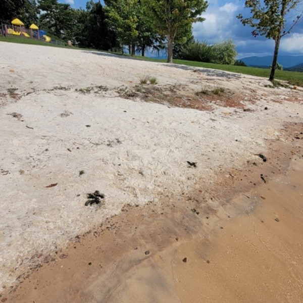

Pictured above: Goose droppings on a public swimming beach in the Southern Blue Ridge Mountains.
How can you help?
Do not feed geese. Handouts of bread or other human food items have little nutritional value to geese, artificially satisfy their hunger, and make them reliant on nesting in parks and residential communities. Geese are herbivores, and green plants, including sedges and grasses, make up the bulk of their diet.
Make it difficult for geese to find an ideal nesting location. Lush green turf grass planted right up to the edges of our lakes, ponds, and rivers has created the perfect habitat for goose populations to explode. If you typically keep your grass cut short, try letting it grow tall around the edges of the shoreline or plant some native moisture-tolerant shrubs such as buttonbush, arrowwood viburnum, and others — this makes it more difficult for geese to walk from the water to the land and back, making your property less inhabitable. You can also identify places where you’ve seen geese nest previously and place an object there to prevent geese from nesting there in the future — this object must be large and heavy enough that the goose can’t move it.
Get (or adopt!) and train a dog to chase geese away from your property. Border collies and similar herding breeds are exceptionally capable of chasing unwanted waterfowl away. Training your pup(s) to chase away the geese in the mornings and evenings is one of the most effective methods to deter the birds from spending time on your property. The geese perceive the dogs to be predators and decide to find somewhere else to live.
Hunt residential goose communities. The Canada goose is not an endangered species and hunting is permitted. All of Western North Carolina is classified as a residential population hunting zone with three seasons in the fall and winter. Georgia has four seasons beginning in September. Visit wncwildlife.org or georgiawildlife.org to learn more.
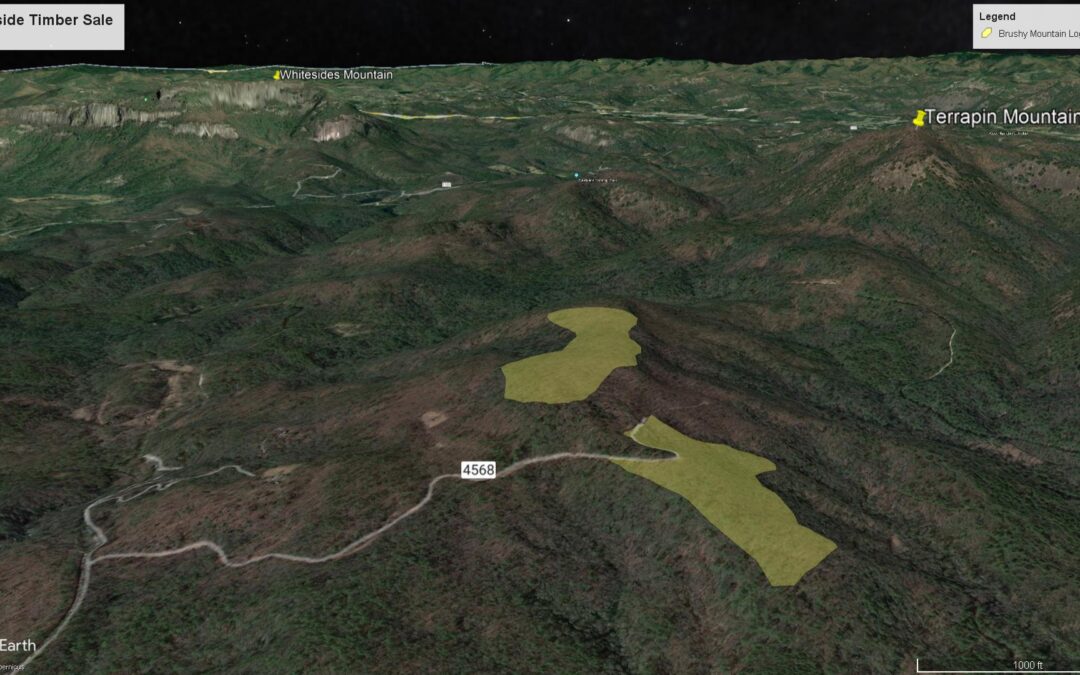
ASHEVILLE, NC — Today, the US Forest Service closed bidding on 98 acres of the Southside Timber Sale (pictured above), which aims to eventually log 300 acres of North Carolina’s Nantahala National Forest, including critical tracts of old-growth forests. To stop the logging of old-growth forest, MountainTrue is offering to pay the Forest Service to keep the 37 acres of trees in place and the Forest intact.
This offer would protect exceptional old-growth forests from unnecessary logging and ensure the Forest Service recoups its investments in this sale. In fact, the Forest Service would make more money by accepting payment from MountainTrue, which is offering to match any offers for the value of the timber. Leaving the forest in place would free the Forest Service from the expense of administering the sale and overseeing roadbuilding and logging activities.
While the Forest Service typically does not accept payment to keep forests intact, this extraordinary offer is an effort to stop an extraordinarily harmful sale.
“We are willing to pay the Forest Service in order to save this old-growth forest and the critical habitat that it provides for native species,” explains Josh Kelly. “Our bid is both the most environmentally responsible and profitable option for the Forest Service.”
The 37 acres targeted by the Southside Timber Sale on Brushy Mountain are incredibly important ecosystems. Old-growth forests are made of trees that have been standing for centuries and hold tremendous amounts of carbon. Cutting these trees releases that carbon – tons of it – into the atmosphere, where it will worsen the impacts of climate change. Keeping these remarkable tracts of forest in the ground is a key step to fighting the climate crisis.
These forests also provide habitat for what experts recently documented as one of the most important green salamander populations in the state. Cutting these forests threatens this already-imperiled species. In fact, Forest Service leaders have ignored concerns from the agency’s own scientists about the impact logging could have on this already-imperiled species.
The Forest Service acknowledges that 17 acres on Brushy Mountain are old-growth and knows about the presence of the critically imperiled Blue Ridge lineage of green salamanders at the site but still insists on cutting this forest. Logging these critical tracts of forest will threaten at-risk species, worsen the impacts of climate change, and do permanent damage to these important ecosystems. USFS leaders should instead preserve these forests for generations by allowing MountainTrue to purchase the carbon rights to the forests for sale at Brushy Mountain in Southside Timber Sale – or by scrapping this misguided project altogether.
Have questions? Email Josh at josh@mountaintrue.org.
Bob: “I’ve been involved since the Forest Service’s planning process officially started in 2013. Prior to this, I also attended the first meetings held by The Wilderness Society (I think in 2011) when it first began to pull together a partnership of stakeholders in anticipation of the start of the planning process.”
Callie: “I’ve been involved in this forest planning process almost since the beginning, first as Executive Director of the Hiwassee River Watershed Coalition and then in my current role as MountainTrue’s Western Regional Director. I helped organize the Nantahala Pisgah Forest Partnership in 2011. Our initial focus was on making the best Forest Plan ever, but what we’ve really created over the past decade is a ‘lasting voice for innovative management and public investment in the public forests of North Carolina’s mountains for the future.’“
Josh: “I’ve been involved with this Forest Plan revision for almost 10 years. MountainTrue was involved with the very first Forest Plan in 1987. We championed a petition to the Chief of the Forest Service that led to the 1987 Plan being remanded and the creation of the 1994 Amendment.”
Bob: “It’s an important continuation of the forest protection work I did for what was then the Western North Carolina Alliance (now MountainTrue) during the decade before Josh came aboard. As a botanist/forest ecologist, I’ve always felt it’s important to work to keep our mountain ecosystems as healthy and secure as possible, given the continuing challenges from development, fragmentation, poor forest management, and climate change. On a personal level, my heart is in these mountains!”
Callie: “Almost 20 years ago, I chose to make my home in Western North Carolina because of the amount of public land in these mountains. Nantahala National Forest is only eight miles from my house by car. It’s the view out my window — it’s my backyard!”
Josh: “The new Forest Plan will set the management direction for over one million acres of Pisgah and Nantahala National Forests for the next 20 years. These forests are incomparable in their ecological and social value. They support thousands of species — many of them found nowhere else, they nourish the hearts and souls of millions of people, and they’re a huge part of important traditions.”
Bob: “Because the Forest Plan has not become finalized (due to the ongoing objection process), I’m not quite sure yet. But, there’s currently a strong focus on timbering that people should know about. I do think it’s encouraging that we have a diversity of partner organizations in place who have stated their commitment to helping the Forest Service implement the Plan over the next two decades. Their collaboration will be essential in shaping good management out of whatever becomes the Final Plan.”
Callie: “While water quality and riparian protections are pretty strong, the Plan sets up the next 20 years to continue the tradition of making Nantahala the ‘working forest’ and Pisgah the ‘recreational forest.’ While timber harvest and recreation will of course continue to occur on both forests in a variety of locations, the emphasis for Nantahala is much more oriented toward timber harvest.”
Josh: “The Revised Plan puts too much emphasis on logging cove forests. Southern Blue Ridge Cove Forests are some of the most diverse temperate forests on the planet. They grow the biggest trees in our region, support diverse understories of wildflowers and medicinal plants, protect water quality, and have historically been over-exploited. The new Forest Plan should instead put more emphasis on thinning and burning the fire-adapted forests that respond positively to timber harvest and are suffering from a lack of fire.”
Bob: “My favorite conservation-related places are the old-growth forests in Nantahala’s Big Choga Creek area and Pisgah’s Daniel Ridge area. I’m also equally fond of the rare Southern Appalachian bogs in both national forests. My favorite recreation area is probably Pisgah’s Pilot Cove Loop (which is also a Natural Heritage Area), but it’s hard to pick out a single place!”
Callie: “Fires Creek. Hands down. With its crystal clear, cold waters, unique biodiversity, trout fishing, hiking, camping, horseback riding, picnicking, swimming, and hunting, Fires Creek offers something for everyone!”
Josh: “There are many great areas in Pisgah and Nantahala National Forests, but none are better to me than Santeetlah Creek in Graham County. It’s just an incredible landscape that inspires me every time I visit.”
We and our organizational partners had a great time at the Pisgah Party + Rally for the Forest, organized by I Heart Pisgah on August 1, 2022. Over 500 people attended and made clear that too much of Nantahala and Pisgah are being prioritized for logging. The Objection meetings hosted by the Forest Service from August 2-4 went well. The dialogue was high-quality and our team was well prepared — we made our case and the Forest Service should realize they need to make some changes to the new Forest Plan. We hope the Forest Service seriously reviews and implements the solutions included in the Nantahala-Pisgah Forest Partnership’s proposal. The Forest Service expects to respond to all objections and finalize the Forest Plan by late 2022. Click here to read our blog detailing our objections to the Draft Forest Plan.
The page you requested could not be found. Try refining your search, or use the navigation above to locate the post.
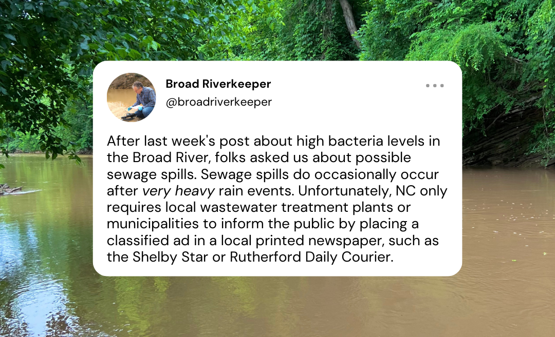
Disclaimer: this is not a sewage spill warning!
Thankfully, no recent sewage spills have been reported in the Broad River. Last week’s Broad Riverkeeper social media posts about high bacteria levels in the Broad got some folks wondering about bacteria levels and sewage spills. Heavy rainfall does cause E. coli levels in the Broad to rise, and sewage spills do occasionally occur after very heavy rain events. However, higher E. coli levels do not always signify a sewage spill.
In the event of a sewage spill, state law requires the wastewater treatment plant or municipality to inform the local public by placing a classified ad in a local printed newspaper.


This classified ad was printed in the Shelby Star on October 13, 2018, after nearly 45,000 gallons of untreated wastewater were discharged into the Second Broad River on October 11. The wastewater treatment plant was not required to directly notify your Broad Riverkeeper, the Broad River Greenway, or downstream neighbors. The treatment plant was also not required to place any signage downstream where folks might be accessing the river.
The protocol is an antiquated system for public notification of potentially dangerous pollution events. NC riverkeepers are urging the state to upgrade this system by utilizing more current communication methods like social media posts, email and text alerts, or a website. We’ll keep working to bring about a better system, but until then, make sure you know where to find potential future sewage spill notices in your local paper.

Scroll on and check out these handy graphics to learn more about our High Country E. coli facts and figures and find out which Watauga Riverkeeper sampling sites have the lowest and highest E. coli averages. We’ll continue to post our weekly results on the Swim Guide platform until September.


This is a full-time paid position based in MountainTrue’s Central Region. This position is focused on stewarding and expanding the French Broad River State Paddle Trail and supporting MountainTrue’s outdoor recreation projects and programming in Western North Carolina. The paddle trail work will consume most of this person’s time for the first 18-24 months. The recreation portion of the position will grow over time as the paddle trail improvements are completed.
French Broad Paddle Trail Administration
French Broad Paddle Trail Stewardship
French Broad River Paddle Trail Expansion
Regional Recreation Support
Add technical support and project management capacity to MountainTrue’s regional directors, healthy communities program, and partnering organizations for outdoor recreation endeavors.
The following are preferred:
Mid-40s. Benefits package includes 20-25 vacation days per year, 12 holidays, sick leave, sabbatical after five years, health insurance, simple IRA with employer contribution of up to 3%.
Email cover letter, resume, and three references to French Broad Riverkeeper Hartwell Carson at hartwell@mountaintrue.org. The subject line should read “French Broad Paddle Trail and Recreation Manager”. The cover letter should include answers to the following questions in 600 words or less:
Application deadline: September 30, 2022
By Bob Gale, MountainTrue Ecologist and Public Lands Director
While much hard work was accomplished in getting the horrendous 1987 Forest Plan substantially amended in 1994, this did not alleviate all concerns over the U.S. Forest Service’s (USFS) management activities. Concerns repeatedly arose when timber sales were planned by various Ranger Districts within the two national forests. A few of these have been notable, and MountainTrue members and staff were often successful in getting the most controversial parts of these projects removed. The following are some examples:
Roaring Hole
The Roaring Hole Timber Sale was significant in that it was the first time USFS meaningfully responded to a Western North Carolina Alliance (WNCA) appeal of a timber project. WNCA volunteer and retired Silviculturist, Walton Smith (see Cut The Clearcutting), wanted to appeal the sale after an earlier appeal of the similar Little Laurel timber project had been denied. Smith wanted to strengthen this appeal by documenting on-the-ground information in the Roaring Hole project to show USFS the errors he saw in their project management. After consulting with Smith, WNCA Director Mary Kelly and her husband, Rob (who was an experienced professional forester), decided to hike into the timber sale stands to conduct the survey. In Mary’s words:
“We met Clarence Hall, a bear hunter from the Greens Creek Community of Jackson County who was concerned about the sale, at the beginning of a long, gated USFS road on an extremely frozen, shiny winter day — I about froze my ass off! We needed Clarence to guide us to the timber stands and also help us identify those tricky winter trees, since Rob and I were greenhorns in the WNC mountains. But before we could start our survey, Clarence informed us that we first had to rescue a couple of his neighbor’s lost bear dogs — one of which had been dragging a chain and was found stuck on a stump! With that unexpected task completed, Rob took forester’s prism plots to document stand characteristics for Walton’s premise that USFS was doing ‘cookie cutter’ clearcuts on very diverse kinds of stands and never considering alternative methods despite huge public concern. The information we gathered resulted in the first-ever remand of a USFS individual timber sale… it turned out NC National Forest Supervisor Bjorn Dahl, who was a silviculturist, agreed with Rob and Walton’s plot data showing stand diversity and the ‘cookie cutter’ problem. It was a momentous victory!”
Their success went beyond this timber sale. Supervisor Dahl had ordered a resurvey of the stands during the growing season (when plant diversity is most evident) and wanted research on alternate, non-clearcutting logging methods. Mary jumped at the chance to accompany the eminent USFS Southern Research Station scientist, David Loftis, on another visit to Roaring Hole. Loftis had been focusing on oak silviculture study because clearcuts were not resulting in the desired oak tree regeneration following such logging. He was also advising a Ph.D. candidate, Don McLeod — a Professor of Botany at Mars Hill College who, late in life was pursuing another degree, “Plant Communities of the Black Mountains” — documenting cove forest plant diversity. Their survey turned up an important plant ecosystem.
“Dave Loftis and I started wading through classic and significant cove vegetation up to our butts. We looked at each other and realized it simultaneously,” Mary remembers. “I called Dan Pittillo (Western Carolina University’s well-known Professor of Botany) and he informed me the proposed clearcut units were right on top of some sites he had forwarded to NC Natural Heritage Program as rare plant sites!”
By educating USFS about the diversity Mary and others had found at Roaring Fork and pushing for better project analysis, WNCA was successful in moving the agency toward change. Mary and WNCA’s legal advisor, Ron Wilson (who had also authored WNCA’s successful Appeal of the 1987 Forest Plan), used the field data in their next appeal — the Bee Tree Timber Sale in Transylvania County. USFS responded positively by improving its environmental impact assessments of proposed projects from what had been typically four-paged “no info-no problem” documents to those which included botanical surveys for the first time. The agency also hired its first staff botanist. These changes activated a new agency focus on the importance of rare plant species within WNC’s forest ecosystems — rare plants were previously largely ignored by USFS, and Mary recalls how one silviculturist referred to them as step-overs.

Bluff Mountain
On the heels of the 1994 Nantahala-Pisgah Forest Management Plan Amendment victory (see Cut The Clearcutting), a backlash of dissatisfaction from some in the timber industry put pressure on USFS. Said pressure was the likely catalyst of the momentum behind the Bluff Mountain Timber Sale proposal.
The project called for 200 acres of logging and six miles of new roads carved over the biologically significant forests of Bluff Mountain and over the border into Tennessee’s Cherokee National Forest. Incredibly, it would also cross through the 400+ acre Fowler Tract, recently acquired by USFS for the specific purpose of protecting the Appalachian Trail. This was the biggest timber sale that USFS had ever proposed and the road mileage outraged the local Bluff community, including Hot Springs residents, bear hunters, tourism businesses, and raft companies. Many of these folks were also WNCA members.
WNCA didn’t initiate the Bluff Mountain campaign – it had recently lost some key forest staff and was also consumed with the highly controversial issue of extending I-26 through Madison County into Tennessee. However, many of its experienced members joined with others to fight the project using tactics they learned working within the Alliance. Elmer Hall, owner of the historic Sunnybank Inn and a Hot Springs WNCA member, notes that WNCA’s Director, Ron Lambe, “gave us all kinds of support, including widespread publicity about the negative aspects of the project through his close contacts in the news media.”
Ultimately, the campaign succeeded — the roads were not built and only about 20 acres of logging occurred. In addition, the coalition was able to get USFS to establish the Betty Place Trail in the former homestead site of that departed and much admired local resident.
Big Choga
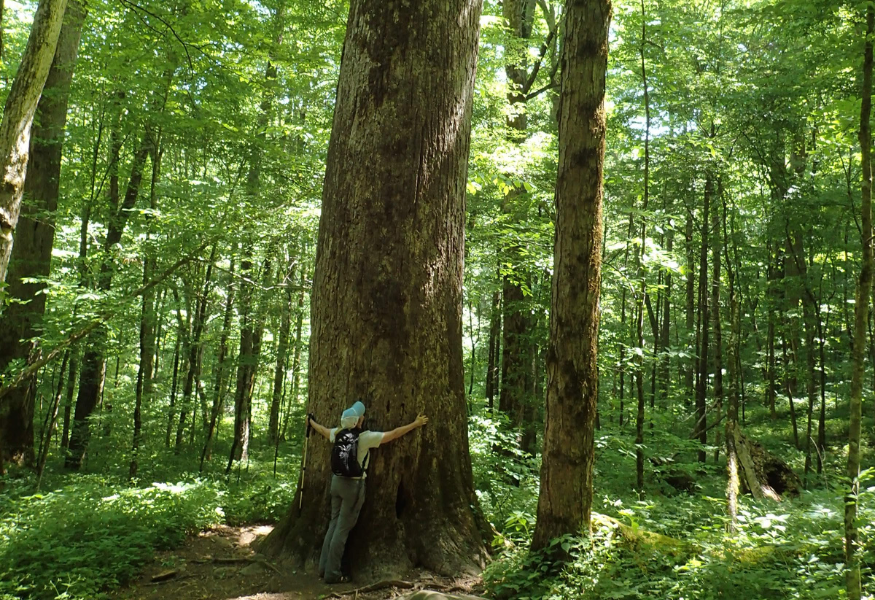
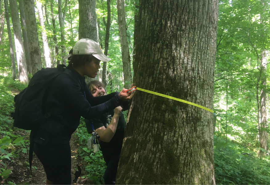
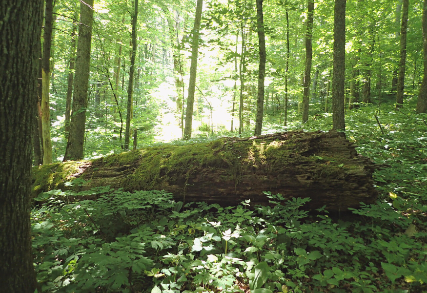
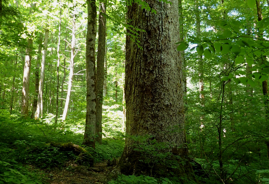
In 1997, the Wayah Ranger District proposed a timber sale in the Valley River Mountains not far from Hayesville, which included the Big Choga Creek drainage. The sale attracted the attention of WNCA staff, its local members, and bear hunters for a singular reason. Big Choga was home to intact and documented old-growth forest communities (see Seeking Older Forests: WNCA’s Search For Treasure Trees), and WNCA was adamant about protecting WNC’s national forests. The bear hunting community was equally upset because old-growth trees — which are often hollow but nevertheless live on for many decades — were an important winter habitat for hibernating black bears.
WNCA’s Old-Growth Committee member and researcher, Rob Messick, had already made site visits to Big Choga and was in the later stages of data collection for the upcoming old-growth report. Messick continued to make site visits throughout the sale process. Because he and his assistants had identified numerous old-growth trees and mostly undisturbed habitat, WNCA determinedly appealed the project’s Final Decision, which called for logging in these communities.
While this was going on, an amazing story had been unfolding that grabbed national attention. During the Atlanta 1996 summer Olympics, a backpack bomb had been found in Centennial Olympic Park by a police officer. He managed to evacuate much of the crowd before the bomb exploded, but two people ultimately died and 111 were injured. The bomb was traced to one Eric Rudolph, who had been active in the pro-life movement and who happened to have grown up in the WNC mountains. After the Atlanta attack, Rudolph went on the run and was a most-wanted fugitive.
It was highly publicized that Rudolf had excellent wilderness survival skills. Media reports claimed he could live off the land indefinitely, intimately knew the WNC mountain topography, and had many hiding spots there. Rudolf’s truck was found abandoned at a campground very near the Big Choga area. Local police and the FBI began a manhunt, searching the area’s forests and coincidentally encountering Messick’s old-growth researchers during their site visits. They were allowed to continue collecting old-growth data, but the encounters and news stories added a surreal experience to their research. The myth of Rudolph’s wilderness survival capabilities was eventually dispelled when the fugitive was found raiding a dumpster in Murphy, NC.
WNCA Executive Coordinator Brownie Newman requested a Big Choga timber sale site visit with the Wayah District, which was granted, and then worked with WNCA’s local Tusquittee Chapter Chair, Aurelia Stone, to turn out members for the visit. A long line of cars was given access through the gated road to the Big Choga sale and throughout the day, these volunteers and staff made their case to the District Ranger and his resource staff. During a break within a contested timber stand, a major discussion ensued and at one notable point, the Ranger asked his Botanist, “Do you think this is an old-growth forest?” His Botanist replied, “Well — Yes, I do.” After the visit, Newman gathered with the WNCA group and they collectively agreed to a bottom line of which points could be retained and dropped in order to settle the Appeal. It was unanimous that the old-growth stands must be dropped.
In the subsequent Informal Disposition meeting in Franklin, NC, Brownie could not convince the District Ranger to leave out the old-growth, so he stated that WNCA would not drop its Appeal. As he turned to walk out, the Ranger suddenly called him back. He started adjusting lines on the sale proposal map with his pen, removing nearly all of the old-growth areas. In the end, a consensus was reached and the Appeal was dropped. It was the first time this Ranger had ever agreed to WNCA terms on a project.
Big Choga had a lasting impact in establishing a precedent. Citing this milestone agreement in his written comments and negotiations with other ranger districts, WNCA Ecologist Bob Gale and members of the WNCA Forest Task Force were able to convince USFS to avoid old-growth in later timber projects. Soon after Big Choga, Rob Messick’s landmark report, Old Growth Communities in the Nantahala-Pisgah National Forest (Messick, May 2000), was published by WNCA, giving the organization even more leverage in championing old-growth protection in Nantahala and Pisgah National Forests.

Marley Kelly, the recipient of this year’s top Carson Conservation Scholarship award.
This year’s top Glenn F. Carson, II Memorial Conservation Scholarship award winner is Clay County resident and 2022 Tri-County Early College graduate, Marlena (Marley) Kelly. Marley is interested in a career in ecology and has been getting a jump start by volunteering with MountainTrue this past winter and spring to remove nonnative invasive plants on the Murphy River Walk & Canoe Trail. Marley is heading to NC State University this fall, where she plans to pursue a Biological Sciences degree with Ecology, Evolution, and Conservation Intent. Her scholarship is $2,000 and is renewable at $1,000 per year for up to three additional years, based on continued eligibility.
In her scholarship application, Marley wrote, “I hope to build sustainable relationships between people and nature so that we can learn to live together and thrive from the benefits of working with the earth. I am not sure yet what my specific career path will look like but I am very passionate about helping the environment and protecting the earth’s fascinating animals.”
Additional $500 scholarships were awarded to Baylee Parham from Robbinsville High School in Graham County and Lauren Cheeks from Hayesville High School in Clay County. Baylee is planning to attend the University of North Carolina at Charlotte where she will major in Science Education. Lauren will major in Environmental Science at Young Harris College in Young Harris, Georgia.
Originally established in 2014 by the Hiwassee River Watershed Coalition (now MountainTrue’s Western Regional Office), the Carson Conservation Scholarship is a memorial to the late Glenn F. Carson, II. At the time of his death, Glenn was the District Conservationist for Cherokee, Clay and Graham counties with the USDA Natural Resources Conservation Service, and was an important leader in the WNC conservation community. He was a graduate of Western Carolina University.
The Carson Conservation Scholarship assists young people from Cherokee, Clay, and Graham counties who want to pursue higher education in natural resource conservation fields such as agriculture, forestry, environmental science, health or engineering, and wildlife management. To date, $20,500 in scholarship funds have been awarded to 14 students.


To support more students through the Carson Conservation Scholarship fund, make a donation at mountaintrue.org/join and mark your donation as “In Memory of Glenn F. Carson, II.”


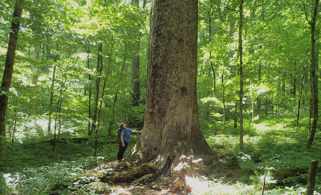
Pictured above: MountainTrue’s AmeriCorps Forest Keeper, Ellianna McLaughlin, stands at the base of a large ash tree in Pisgah National Forest.
From April to June 2022, MountainTrue’s Public Lands team re-treated hundreds of ash trees in Pisgah and Nantahala National Forests to continue protecting them against the emerald ash borer. We’ve treated approximately 1,200 ash trees since 2017 with help from our trusted partners at the Appalachian Trail Conservancy (ATC). Many thanks to our stellar MountainTrue volunteers and interns, the wonderful folks at Appalachian Arborists, and our ATC partners for making 2022’s successful treatment season a true “teamwork makes the dream work” scenario.
Click here to read more about this year’s treatment season and our partnership with ATC in more detail.
Quick facts:
What is the emerald ash borer?
The emerald ash borer is a nonnative invasive insect that was first identified in Michigan in 2002. This invasive beetle has spread to 35 states since then, including North Carolina.
What does the emerald ash borer do?
Emerald ash borer larvae bore into the bark of ash trees to feed on the cambium — a cell layer that transports nutrients throughout the tree. The beetles girdle the trees as they feed on the cambium, causing them to die. The devastating effects of the emerald ash borer were seen throughout our treatment areas as the giant ash trees we left untreated began to fall. However, with a highly effective treatment method, MountainTrue has been able to save thousands of ash trees over the last several years.
Where can I see treated ash trees?
Hike along the Moffett Laurel section of the Appalachian Trail or make a pit stop off the Blue Ridge Parkway and hike the section between the Mills River Valley Overlook and Stony Bald View to see the thriving, treated ash trees! Pro tip: you can also use this as an opportunity to support MountainTrue by taking part in the 40th-anniversary Hike-a-Thon!