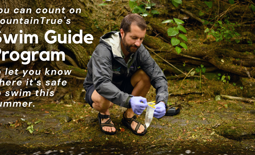
MountainTrue, a leading local environmental group, is encouraging the public to use the Swim Guide app before heading out onto the water to ensure a healthy and happy Independence Day weekend. MountainTrue is the home of the Broad Riverkeeper, French Broad Riverkeeper, Green Riverkeeper, Watauga Riverkeeper, and a Western Clean Water Team based in Murphy, North Carolina, that are dedicated to protecting the waters of the Southern Blue Ridge Mountains.
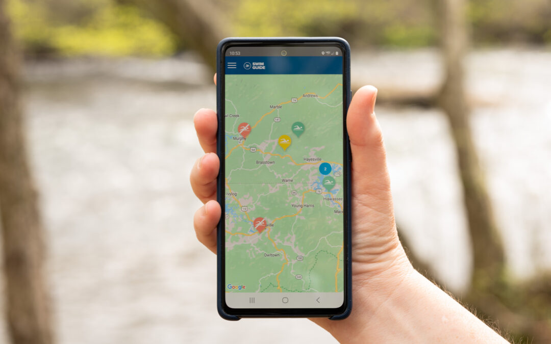
Each week between Memorial and Labor Day weekends, MountainTrue’s staff and volunteers collect and analyze water samples from 96 popular recreation spots across western North Carolina and Towns and Union Counties in northern Georgia. These samples are processed and analyzed, and the results are posted on the Swim Guide website (theswimguide.org) and the smartphone app in time for the weekend. This resource-intensive program is made possible by donations from MountainTrue’s members and the generosity of local businesses and organizations that sponsor one or more Swim Guide recreation sites.
Our Swim Guide Sponsors include Animal Hospital of Boone. Appalachian Veterinary Ultrasound, Asheville Fly Fishing Company, Birdies Coffee & Treats on the Fly, Blue Ridge Tourist Court, Boone Cocoon, Boone’s Fly Shop, City of Hiwassee, Fabbit Customs, Green River Cove Tubing, Joy Pharr Realty, Lake Adger Property Association, Mellow Mushroom Boone, Pink Mercury, The Purple Onion, Rivergirl Fishing Company, Rutherford Outdoor Coalition, Shelby Women for Progress, The SPOT, Trophy Water Guide Service, The Speckled Trout Outfitters, Tennessee Valley Authority, Watauga Tourism Development Authority/Explore Boone, Towns County (GA), Union County (GA), Watauga River Lodge, and Zach Hobbs.
E. coli bacteria makes its way into our rivers and streams from sewer and septic leaks and in stormwater runoff — especially runoff from poorly managed animal agricultural operations. E. coli is an indicator of the presence of more harmful microbes, such as Cryptosporidium, Giardia, Shigella, and Norovirus. Contact or consumption of contaminated water can lead to gastrointestinal illness, skin infections, respiratory issues, and other health problems.
MountainTrue tests mid-week, analyzes the samples, and posts the results in time for the weekend. These tests are a snapshot in time. If tests are conducted on a Wednesday after a dry spell, the results usually look pretty good, but conditions can change rapidly following heavy rains when stormwater runoff brings pollution into our waterways. MountainTrue encourages river recreators to take extra precautions after hard rains and not to ingest or expose any open cuts or abrasions to water.
The Swim Guide lists each testing site as either passing or failing based on the U.S. Environmental Protection Agency’s 2012 Recreational Water Quality Criteria for primary contact of 126 CFU/100 mL. Waterways located in remote areas or near protected public lands with minimal agricultural and industrial pollution sources tend to be the cleanest and less impacted by stormwater runoff. Areas closer to development and polluting agricultural practices face greater risks, especially after heavy rainstorms that result in increased water runoff.
While the primary purpose of the Swim Guide is to inform the public about where it’s safe to swim, MountainTrue also uses the data collected to solve water quality problems, inform our advocacy, and push for science-based policy solutions aimed at protecting the health of our communities and supporting our river recreation economy.
The rivers of the Southern Blue Rigde are an important cultural, recreational, and economic resource for our region. In order to clean up the dirtiest rivers and protect the cleanest ones, Mountaintrue encourages policymakers to increase riparian buffers, encourage better building and farming practices and invest in upgrading aging sewer infrastructure to meet current and future needs.
To find the latest bacteria testing sites for your favorite swim area or to download the Swim Guide app, visit theswimguide.org.