MountainStrong Hurricane Recovery Fund

In the wake of Hurricane Helene, MountainTrue is dedicated to addressing the urgent needs of our community.

 - 
Arabic
 - 
ar
Bengali
 - 
bn
German
 - 
de
English
 - 
en
French
 - 
fr
Hindi
 - 
hi
Indonesian
 - 
id
Portuguese
 - 
pt
Russian
 - 
ru
Spanish
 - 
es
2021 State of the River Reports

2021 State of the River Reports

2021 State of the River Reports

The 2021 State of the River Reports are finally here! In this blog, we’ll discuss the cleanliness and water quality of the French Broad, Broad and Green, and Watauga River watersheds. 

There are four sets of data that MountainTrue uses to formulate our water quality rankings for each stream, including:

  • E. coli data taken by MountainTrue’s riverkeepers and water quality monitoring volunteers.
  • Aquatic insect (a.k.a., benthic macroinvertebrate) data — part of the Stream Monitoring Information Exchange program (SMIE) — from the Environmental Quality Institute. Learn more about SMIE here
  • Chemical data — part of the Volunteer Water Information Network (VWIN) — from the Environmental Quality Institute.
  • Chemical, aquatic insect, fish, and bacteria data from the North Carolina Department of Environmental Quality (NC DEQ).

The data from testing sites in streams across each watershed are weighed, and each stream is given a letter grade. The grading scale is as follows: 

A (90-100): These streams have excellent water quality, low pollution levels, and healthy aquatic insect and fish populations.

B (80-89): These streams have good water quality but some impacts from pollution or development. The aquatic life and fish populations are relatively healthy.

C (70-79): These streams have average water quality. There are some concerns about pollution inputs and development impacts. Generally, aquatic life and fish populations are healthy but could become negatively impacted

D (60-69): These streams have below-average water quality. Pollution is a concern, and aquatic life and fish populations are not as healthy as they should be.

F (<60): These streams have poor water quality. Pollution levels are often high, and aquatic life and fish populations are impacted.

When comparing this year’s report to 2018’s report, it’s important to note that the way we process our water samples for E.coli at MountainTrue has changed. Up until 2018, we used an Environmental Protection Agency (EPA)-approved method using Coliscan Easygel. The results from this method were sometimes subjective and thus could be less accurate. In 2019, we switched to another EPA-approved protocol, using the Idexx system. Those results are quicker, more objective, and more accurate. This 2021 report includes E.coli data from both analysis methods (2018 Swim Guide data using Coliscan Easygel and 2019-2021 Swim Guide data using the Idexx system).

 Now, let’s review the findings from each of the three reports.

The state of the French Broad River Watershed:

 Of the 62 testing sites across the French Broad River Watershed, 16% received an A grade, 20.9% received a B grade, 29% received a C grade, 25.8% received a D grade, and 6% received an F grade. 

Overall, we observe a general decline in water quality. We attribute this to two primary factors — climate change and increasing construction and development throughout the watershed. Asheville and the surrounding region have experienced more frequent heavy rains in the last several years. Climate change in the Southern Blue Ridge region is expected to present random “boom and bust” patterns in precipitation, seen as floods and droughts in our region. This causes increased stormwater runoff from urban areas and agriculture operations, along with more sewer overflows and saturated septic fields surrounding failing septic systems. It also brings extra sediment into our waterways from construction sites and weak riverbanks, which can smother aquatic habitats, increase water temperature, and transport toxins into our rivers. All of this is happening during a period of unprecedented recreational growth on the French Broad. 

We documented the most dramatic change in Transylvania County, as the quality of the Upper French Broad decreased significantly. We attribute part of this decrease in quality to our transition to new, more accurate E.coli sampling protocols. However, that doesn’t explain the whole picture since water quality in other parts of the watershed didn’t drop as steeply. Notoriously the wettest county in the state, this drop in water quality is indicative of the effects that a changing climate coupled with increasing development is having on our region. 

On a positive note, the Nolichucky Watershed saw increased water quality with high grades in benthic and fish samples. Such pristine waters cannot be taken for granted, which is why we’re advocating for the Nolichucky River between Poplar, NC, and Erwin, TN, to be permanently protected with a Wild and Scenic Rivers designation.

Four Cleanest Streams:

  • Cataloochee Creek (A)
  • Cathey’s Creek (A)
  • Bent Creek (A)
  • South Toe (A)

Four Dirtiest Streams:

  • French Broad River – Pisgah Forest (F)
  • French Broad River – Etowah (F)
  • French Broad River – Hominy Creek (F)
  • French Broad River – Westfeldt (F)

 Learn more about the state of the French Broad River Watershed by reviewing last year’s Swim Guide results.

The state of the Broad and Green River watersheds: 

Of the 18 testing sites across the Broad and Green River watersheds, 27% received an A grade, 61% received a B grade, none received a C grade, 5.5% received a D grade (1 site), and 5.5% received an F grade (1 site). 

The Green River is the largest tributary of the Broad River in North Carolina, and its headwaters are largely protected. From its source in Henderson County to Lake Summit, the Upper Green is significantly impacted by agriculture, poor stream management practices, and lack of appropriate riparian buffers. 

The Green River flows into the Broad River near the Polk and Rutherford County Line. Major tributaries in the lower Green River Watershed include Walnut Creek from the north and White Oak Creek from the south. In a tale of two tributaries, the former touts excellent water quality and benefits from a large nature preserve while the latter suffers from degraded water quality as a result of development, land clearing, agriculture, and other intensive land use. 

By the time the First Broad reaches Shelby, it fails to meet EPA bacteria standards nearly 50% of the time. First Broad tributary Buffalo Creek has a history of high bacteria levels and feeds Moss Lake — Cleveland County’s only public reservoir and the water supply for Kings Mountain. In June 2020, NC DEQ documented Moss Lake’s first-ever harmful algal bloom (HAB) — this is a big concern for nearby residents, recreationists, and all who depend on Moss Lake for their drinking water supply. 

Overall, water quality in the most popular recreational area on the main stem of the Broad River is pretty good. The river is so large that contaminants of concern in the tributaries are diluted, and bacteria levels at the Broad River Greenway in Cleveland County almost always meet EPA standards for safe recreation.

Four Cleanest Streams:

  • First Broad River – North Fork (A)
  • Moss Lake (A)
  • North Pacolet River – Near Tryon (A)
  • Big Hungry River (A)

Four Dirtiest Streams:

  • Buffalo Creek – Above Moss Lake (F)
  • Sandy Run Creek (D)
  • Lower Broad River (B)
  • Upper Broad River (B)

Learn more about the state of the Broad and Green River watersheds by reviewing last year’s Swim Guide results.

The state of the Watauga River Watershed:

Of the 27 testing sites in the Watauga River Watershed, 37% received an A grade, 33% received a B grade, 11% received a C grade, 3.7% received a D grade (1 site), and 14.8% received an F grade. 

Overall, water quality is pretty good across the Watauga River Watershed, which originates at an elevation of 5,964 feet on the northern slopes of North Carolina’s Grandfather Mountain. The 78-mile-long Watauga River Basin includes the headwaters and tributaries of the Elk and Watauga Rivers, flowing northwest from North Carolina into Tennessee’s Holston and Tennessee Rivers before joining the Mississippi River and draining into the Gulf of Mexico. 

The Watauga River Watershed includes mountain bog wetlands that sit at the head of the basin and serve as an important water purification system and habitat for native wildlife. Nearly 90% of mountain bogs in North Carolina and throughout the Southeastern United States have been destroyed. The rapid elimination of mountain bogs poses a challenge for water quality and environmental conservation in the Watauga River Basin. 

Increases in development, plastic pollution, soil erosion, sedimentation, and excess nutrients are stressors on aquatic health and habitats. When combined, these stressors can significantly damage aquatic habitats and ecosystems. Much of the land disturbance in the basin takes place on steep mountain slopes, which are naturally vulnerable to soil erosion. As land is cleared due to urbanization and agriculture, rain and melting snow carry eroded sediments, pesticides, fertilizers, and road salt into the Watauga River. 

Fortunately, North Carolina has designated 18 miles along Boone’s Fork Creek for conservation to receive extra protection. More than half of the basin’s streams are classified as trout waters and thus require additional treatment at local wastewater treatment plants. In addition, 25-foot buffers of shrubs and trees must be maintained between trout streams and graded construction sites to filter runoff and prevent erosion.

Four Cleanest Streams: 

  • Watauga River @ Adam’s Apple Dr Bridge (A)
  • Watauga River @ Wilbur Dam Rd Bridge (A)
  • Watauga River @ Smalling Rd Bridge (A)
  • Elk River @ Lees-McRae Mill Pond (A)

Four Dirtiest Streams:

  • Watauga River @ Lover’s Lane (F)
  • Watauga River @ Hunter Bridge (F)
  • Watauga River @ Blevins Boat Ramp (F)
  • Watauga River @ Calloway Rd. Bridge (F)

 Learn more about the state of the Watauga River Watershed by reviewing last year’s Swim Guide results.

Microplastic pollution is widespread throughout the waters of Western North Carolina

Microplastic pollution is widespread throughout the waters of Western North Carolina

Microplastic pollution is widespread throughout the waters of Western North Carolina

Testing by MountainTrue shows that microplastics are present throughout the Broad, French Broad, Green, Hiwassee, Little Tennessee, New River and Watauga River Basins.

Western North Carolina — Regional conservation organization MountainTrue has documented the high levels of microplastics in surface water samples collected from waterways throughout western North Carolina. Microplastics are pieces of plastic smaller than 5 millimeters that are the result of the breakdown of larger plastic litter and debris into smaller and smaller pieces. They are harmful to aquatic life and are considered a potential threat to human health. 

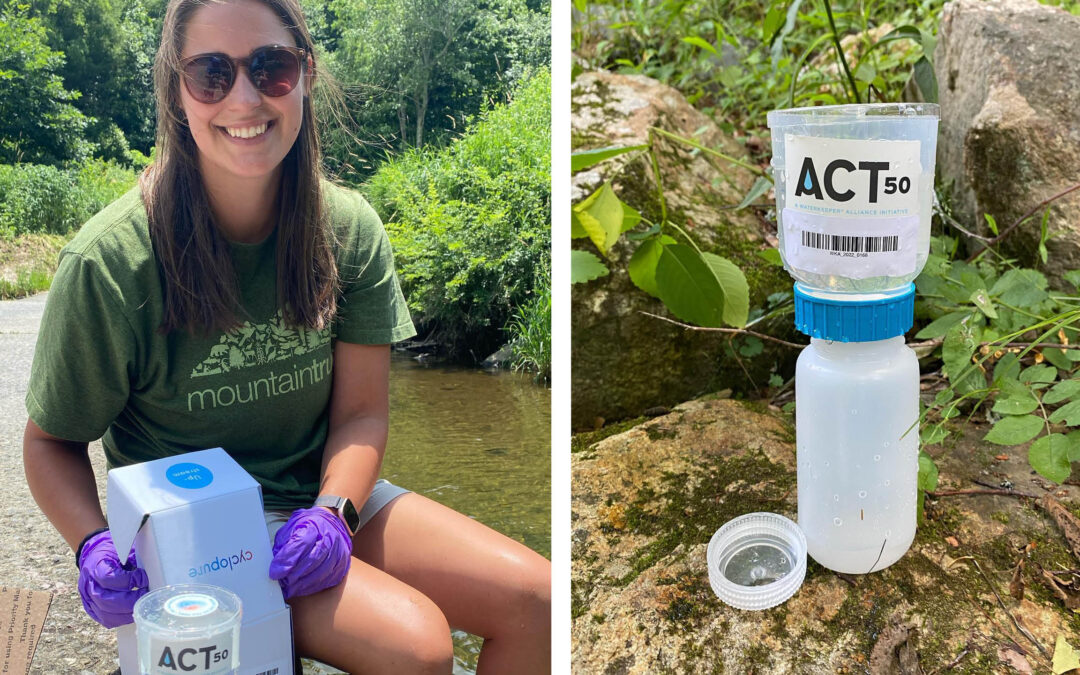
MountainTrue collected and analyzed water samples from the Broad, French Broad, Green, Hiwassee, Little Tennessee, New River and Watauga River Basins. We found microplastics in every sample from every region, even in otherwise pristine areas and protected watersheds. We documented an average of 19 particles of microplastic per liter of water across all tested watersheds. The highest particle counts of microplastics were found in the Little Tennessee (37 particles/liter) and Hiwassee (30 particles/liter) watersheds. Even in watersheds with lower levels of microplastic contamination, there were testing sites with concentrations in the high twenties and thirties. 

Watershed

Avg no. of microfibers per liter

Avg no of microbeads per liter

Avg. no of microfragments per liters

Avg. no. of microfilms per liter

Avg no. of all microplastics per liter

Broad River

12

1

5

6

24

French Broad River

7

0

4

5

16

Green River

20

0

5

2

27

Hiwassee River

18

0

2

10

30

Little Tennessee River

29

1

3

5

37

New River

20

0

3

6

29

Watauga River

14

0

0

3

17

All Watersheds

12

0

2

5

19

Microfibers, which come from synthetic clothing and fishing line, was the most common form of microplastic that we observed. Microfilms, which degrade from plastic bags and food wrappers, accounted for more than a quarter of microplastics recorded. 

There have been significant amounts of microplastics research in marine systems, but microplastics in freshwater systems have been less studied overall. MountainTrue’s study is one of the first to look at levels across western North Carolina in order to gain a general understanding of the amount of microplastics in our water. MountainTrue is partnering with the Waterkeeper Alliance on a state-wide study for all of North Carolina.

Microplastics can enter the environment as plastic litter degrades, in runoff from landfills, and through discharges from wastewater treatment plants. Once in the environment, they can travel for thousands of miles suspended in water or carried by the wind. 

MountainTrue is partnering with businesses in Hendersonville to help them shift their operations away from single-use plastics toward reusable bags and compostable utensils and packaging through the Working to be Plastic Free partnership. In Buncombe County and the Town of Boone, MountainTrue is advocating for local ordinances that would encourage the use of reusable shopping bags by replacing single-use plastic bags with paper bags and charging a 10 cent fee that would be waived for shoppers enrolled in the SNAP or WIC programs. To learn how you can support these efforts visit plasticfreewnc.com

“The first step to stop the contamination of our environment and our bodies is to reduce the amount of plastic that enters and escapes the waste stream,” explains Anna Alsobrook, MountainTrue’s French Broad Watershed Outreach Coordinator. “And that starts by breaking our dependence on single-use plastics like plastic grocery bags and fast food utensils and packaging.” 

Microplastics are inadvertently ingested by fish and other aquatic organisms causing microplastics to be transferred throughout the food web. Researchers have found that microplastic ingestion can negatively affect freshwater fish through physical complications of passing plastic through the gut or false satiation. Microplastics can also leach harmful chemicals like plasticizers and additives into the organs of fish. The chemicals have varying effects on fish changing feeding rates, development and survival. Much of the research is focused on centrarchids. Centrarchids are the family of sunfish, and they are a sentinel species, so they are often used to detect risks to humans by providing advance warning of danger.

People consume microplastics in contaminated food and water, and by breathing them in. Microplastics have been found in seafood, salt, tap water and even in bottled water. It is estimated that, globally, people ingest an average of five grams, or the equivalent of a credit card, worth of plastic every week. 

The effects of plastic pollution on human health is the subject of a growing body of research. A study has found microplastics small enough to be carried in the bloodstream in the placentas of pregnant mothers. Other research has shown that microplastics cause damage to human cells, including cell death and allergic reactions, at levels known to be consumed in food. 

Other research has shown that it’s not just the plastics, but also the additives used to make them can have a harmful effect on human health. Phthalates, which are a family of chemicals used in food packaging, are known endocrine disruptors that harm the reproductive and nervous systems and have been linked to higher rates of childhood asthma and other respiratory conditions. Styrene, which is used to make styrofoam cups, food containers, and disposable coolers, leaches into the food and drinks they hold and from landfills into drinking water. The World Health Organization has classified styrene as a probable human carcinogen

“These plastics can persist in our environment for hundreds if not thousands of years,” says Anna Alsobrook. “The more we learn about what plastics and the chemicals used to make them are doing to our environment and to our bodies, the clearer it becomes that we need to take action now.”

MountainTrue FAQ: Live Staking

MountainTrue FAQ: Live Staking

MountainTrue FAQ: Live Staking

We love live staking here at MountainTrue, as it’s one of the easiest and most effective ways to support native biodiversity and stream bank restoration! This blog hopes to answer many of the frequently asked questions we get about live staking. Most of this information is general, but some is specific to the Watauga Basin and Riverkeeper Program. 

Q: What’s live staking?

Live staking is a method of stream bank repair using native tree cuttings to revegetate the riparian buffer. The riparian buffer consists of trees, shrubs, and grasses alongside stream banks — it plays a crucial role in protecting stream health. The resiliency of riparian buffers is frequently impacted by land use. Activities like mowing to the edge of a stream, cutting down trees to see the water, or new development can negatively impact water quality. By live staking, we can positively and directly impact the overall health of our waterways! 

Q: Where do you get the stakes from?

We get our live stakes from Foggy Mountain Nursery in Lansing, NC — their team harvests the stakes from native tree species, cutting stakes two to three feet long and one-half to two inches thick. While it’s possible to cut the stakes ourselves, we choose to support a fantastic local business and ensure that we’re planting the correct species. We’ve also harvested stakes from our previous live staking sites, where planted stakes have become well established. 

Q: How do you choose where you’ll be planting?

We prioritize local public parks and river accesses because they’re easy to access and directly benefit the public. We’ve frequented Valle Crucis Community Park in Banner Elk, Cove Creek, and other public riverside locations around Watauga County. We also partnered with the City of Hendersonville to host two live staking workdays in Henderson County this February! 

Q: What species do you plant?

We only plant tree species native to our region — primarily silky willow, silky dogwood, elderberry, and ninebark stakes. We’ve also planted other species, like buttonbush, black willow, and red stem dogwood. Recommended for stream bank repair by the NC State Cooperative Extension, these native tree species prefer moist soil and thrive in riparian habitats. These species support native wildlife, especially local pollinators. They can also establish extensive root systems to successfully hold soil in place along riparian buffers, ultimately preventing erosion. 

Q: Why do you plant during the winter?

Live stakes are living cuttings of dormant trees that can propagate or sprout a new plant from the cutting of the parent plant. During winter, trees enter a state of dormancy to conserve their energy and weather the colder temperatures. Our live staking season lasts from November to March. We plant hearty hardwood stakes that use their energy to establish roots, waiting until spring to grow their branches and leaves. These resilient roots serve as a stream bank’s first line of defense against erosion, especially during high-flow events. Planting live stakes while tree species are in their natural pattern of energy conservation allows for a higher likelihood of survival along riparian buffers. 

Q: How successful are the stakes?

Live stakes have a survival rate of 30-80%. However, survival varies from species to species and depends on environmental conditions. For example, we’d likely have very low survivability if a drought occurred after planting. But, if we plant under ideal conditions using correct planting techniques and have favorable weather post-planting, our stakes can do remarkably well! We can also remove invasive plant species and water the freshly planted live stakes to give them a better chance of success. 

Stakes are most successful when planted along naturally sloped stream banks. They can still be planted on extremely incised banks, though they’re more likely to be less impactful in those locations. In our experience, silky willow and silky dogwood stakes tend to fare better than other native tree species we plant. 

Q: How long does it take for the stakes to grow?

Roots, leaves, and branches can be well established after one growing season. From there, they continue to grow in length from the tips of their roots and branches year after year. 

Q: How do live stakes benefit our waterways?

Live stakes grow root systems that hold soil in place and prevent erosion in local waterways. Sediment pollution remains a significant threat to the Watauga River Basin. This type of pollution clogs aquatic habitats and transports toxic substances through local waterways, increasing water temperatures and negatively impacting native biodiversity.

Once planted, small live stakes will grow into larger trees that stabilize and support riparian buffer health. Healthy riparian buffers benefit stream health in a multitude of ways — they also absorb nutrients, create wildlife habitat, and reduce the intensity of flooding from rain events. Unvegetated streams are often incised and can lose several feet of bank in a single rain event — this can be detrimental to nearby homes and other structures. 

Q: What’s a typical day of planting?

We prep the stakes by cutting the live ends at a 45-degree angle. The NC State Cooperative Extension states that such cutting is enough to catalyze root growth at the nodes. The folks at Foggy Mountain Nursery kindly mark the planting ends of our stakes, so we know which ends to cut (pictured right). Once prepped and ready, we take the stakes in buckets down to the stream. We plant along the bank from the water’s edge to the bank’s top — not in the actual stream bed. Stakes are planted at an angle and submerged into the soil about two-thirds of the way. From there, the rest of the work is up to the stakes!

Want to learn more about live staking? Check out our Events page to sign up for one of our upcoming volunteer workdays, or contact our resident live staking experts listed below:

Swim Guide Watershed Report: Upper French Broad, Green & Broad River Watersheds

Swim Guide Watershed Report: Upper French Broad, Green & Broad River Watersheds

Swim Guide Watershed Report: Upper French Broad, Green & Broad River Watersheds

While the past year has been unkind to the French Broad River, the Green River Watershed — a headwater tributary of the Broad River — had a great year. Alternatively, the larger Broad River Watershed’s 2020-2021 highlight reel is less glamorous, but we’re happy to report commendable water quality improvement across this important watershed. 

We’ll split this blog post into three sections, starting with a summary of our upper French Broad River Watershed data. Then, we’ll discuss the data we collected across the Green River and greater Broad River Watershed, summarize the good and bad news for each, and spotlight the water testing sites with the lowest and highest bacteria counts. We’ll conclude with achievable solutions for the future and a call to action so you can continue to help us protect the places we share.

Before we dive into our water quality summary, let’s review important terminology to help us better understand the data our Riverkeepers, volunteers, and Clean Waters teams worked so hard to collect, analyze, and report. Cfu, or colony forming unit, is a data metric scientists use to estimate the number of microbes present per 100 milliliters of a singular water sample. Microbes (also known as microorganisms) include bacteria, algae, and fungi. Like most things, some microbes are good for human health and some aren’t. We test for E. coli bacteria because it’s the best indicator for the presence of microbes that pose threats to human health.

According to the US Environmental Protection Agency (EPA), 235 cfu/100mL is the safe standard for primary recreational waters, where people are most likely to engage in recreational activities involving underwater immersion and potential water ingestion.

First, let’s talk about the Upper French Broad River

About Our Swim Guide Program

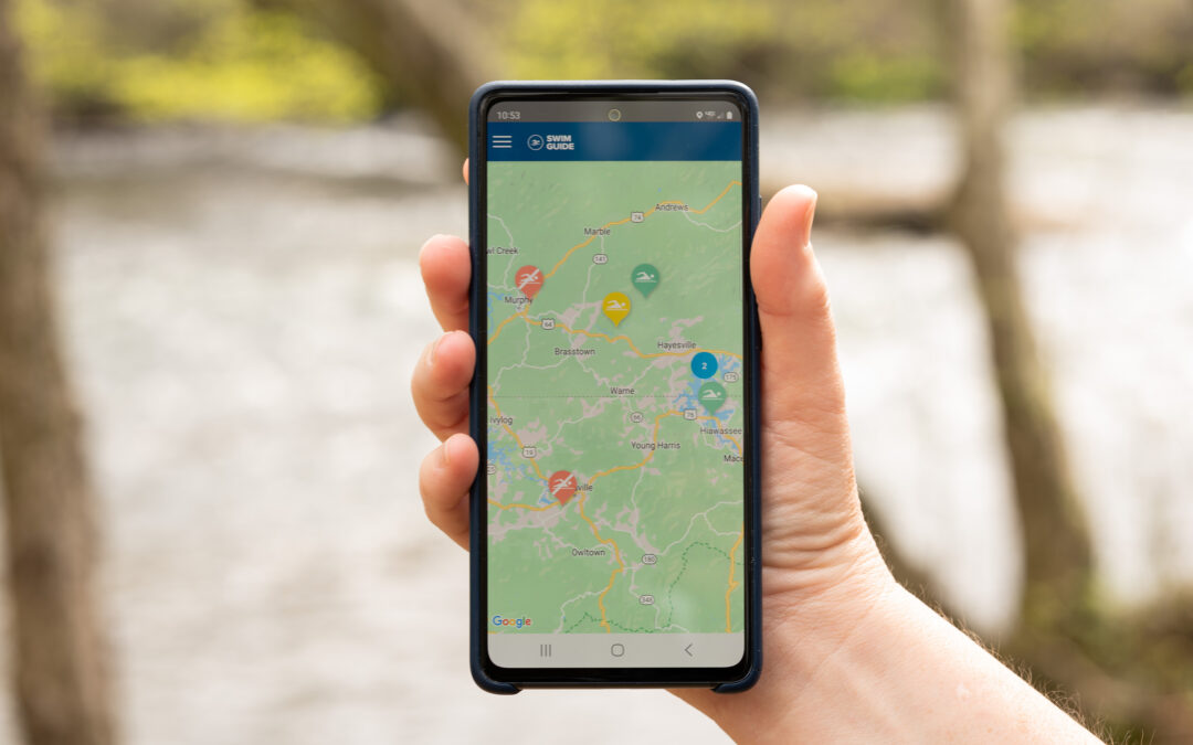
Swim Guide is an international program used by Riverkeepers and other advocates to provide up-to-date recreational E. coli data for beaches, lakes, and rivers worldwide. E. coli is a bacteria found in the fecal waste of warm-blooded animals, including humans, and indicates contamination in our waterways. E. coli levels increase with rainfall events due to surface runoff and sewer overflow events.

Samples are collected every Wednesday from Memorial Day to Labor Day. Volunteers collect surface water samples in a 100mL sample bottle and drop samples off at the lab, to be processed by MountainTrue staff. Results from samples are measured in MPN, the most probable number of colony-forming units (cfu). The EPA’s limit for recreational water quality is 235 cfu/100mL. The EPA estimates at that concentration, 8 in 1,000 people will contract an illness.

Pass/Fail results are updated every Friday on www.swimguide.org to inform the public about local water quality. We use the data generated from our Swim Guide Program to identify sites for follow-up sampling. We sample in both urban and rural areas. Determining the location and source of E. coli in our waterways is one way we can hold polluters accountable.

News headline: Upper French Broad Bedevilled by Bad Bacteria

The French Broad’s turbulent history with E. coli is well-known among watershed locals. Our two new testing sites along the upper French Broad at Lyons Mountain and Island Ford secured the top spots for worst water quality and highest bacteria count

In Henderson County, Mud Creek at Brookside Camp Road experienced slight improvement from 2020 to 2021, but remains one of the worst sites we sample with an average E. coli count of 1535 cfu/100mL. Our data suggests a mix of animal agriculture, septic failures, and sewer overflows are the primary sources of E. coli pollution in Mud Creek. 

The week of July 28 proved to be the summer’s worst. Just 23% of our French Broad River testing sites passed the EPA’s 235 cfu/100mL safe standard for primary recreational waters. 

For more information about the larger French Broad River Watershed, check out this blog post

Let’s move on to the Green River Watershed.

Good news headline: Green River Watershed Report Concludes ‘It’s Actually Pretty Easy Being Green’

We’re happy to report the past year saw the Green River Watershed boast no worst sites. With the exception of the week of August 18 during Hurricane Fred, all seven testing sites routinely passed the EPA’s safe standard throughout the summer. 

Overall, the Green River’s water quality remains excellent for recreational users and fares much better than the French Broad River’s water quality. Out of 98 total samples, only nine failed to pass the EPA’s safe standard. Our data shows the Green River was clean 90.8% of the time we sampled it this summer. 

Bad news headline: Rains of Climate Change Pose Threats to Overall Clean Green River

Users of the Green River Watershed enjoy a largely clean present. Still, the future is less certain with the potential for negative changes due to heavier summer rains. This summer saw Hurricane Fred wreak havoc across the watershed in mid-August, immediately resulting in poorer water quality. With an average value of 951.9 cfu/100mL per site, the week of August 18 proved to be the summer’s worst with six out of seven testing sites failing to pass the EPA’s safe standard. 

Stormwater runoff pollution remains a formidable threat to the Green River Watershed and the whole of the Southern Blue Ridge. Without immediate and direct action, the Green River’s water quality will suffer as higher annual amounts of stormwater runoff enter the watershed due to climate change.   

Now, let’s discuss the state of the Broad River Watershed. 

Good news headline: Broad River Somewhat Less Bacteria-laden in 2021 than 2020

Sampled weekly from Memorial Day to Labor Day, our data concludes slight water quality improvement at all nine testing sites across the Broad River Watershed in both Rutherford and Cleveland counties from 2020-2021. We’re happy to say that the river continues to be a safe, reliable recreation spot.

Cleveland County’s Moss Lake maintains the title of best testing site, passing the EPA safe standard 100% of the time over the past two years.  

Bad news headline: Development and Manure are Broad River’s Biggest Bacteria Blunders

Buffalo Creek has remained our worst testing site for two years, failing to pass the EPA’s safe standard 81% of the time. The high bacteria concentrations in Buffalo Creek are attenuated in Moss Lake, just 15 miles upstream. The nutrients associated with Buffalo Creek’s high bacteria levels continue to pose a risk for algal blooms in Moss Lake. Not all algal blooms are dangerous, but those with the potential to form in Moss Lake would pose a severe risk to water quality and surrounding biodiversity. 

Lake Lure and the Rocky Broad have mixed testing results. Coupled with existing agriculture, ongoing development surrounding the Rocky Broad is likely causing an increase of bacteria-laden runoff during rain events. 

Data from our two testing sites along the First Broad River indicate that the water is unsafe for recreation roughly 33% of the time. Poor agricultural practices like inadequate stream buffers and abundant cow and poultry manure in the river are the likely sources for the First Broad’s high E. coli levels.  

Let’s wrap up our water quality discussion with two future news headlines: 

1) Governments Must Step in to Mitigate Green River’s Worsened Water Quality

Existing stormwater infrastructure is outdated and inadequate. Local and state government action is needed to protect the Green River’s water quality from threats posed by climate change. 

2) Remedying Broad River’s Bacteria Problem with Sound Policy, Infrastructure and Agriculture Investments

Despite incrementally improved water quality at each testing site, data collected from the Broad River Watershed still produced less than ideal results. The prevalence of E. coli in the watershed illuminates a dire need for workable solutions to lackluster development policies, poor agricultural practices, and deficient stormwater infrastructure. 

Moving forward, MountainTrue will:

  • Encourage government officials to implement policies addressing land use and development impacts and make worthy investments to improve existing stormwater infrastructure.
  • Continue to monitor sites of most concern while aiming to pinpoint and eliminate sources of E. coli pollution at our newest testing sites in the near future.
  • Further develop valued relationships with community members to combat threats posed to water quality by poor animal agriculture practices. 

Want to learn more about our efforts to bring about clean water for all? Check out our ILoveRivers webpage and join MountainTrue’s dedicated community of volunteers to help us protect the places we share.

Join Us for an Annual Member Gathering in Your Area!

Join Us for an Annual Member Gathering in Your Area!

Join Us for an Annual Member Gathering in Your Area!

We are excited to be gathering in person this year to connect with our members, celebrate our MountainTrue Award winners, and see each others’ smiling faces!

Each year, MountainTrue hosts a gathering of our members to recognize and honor outstanding volunteers, vote on new board members, and reflect on a year of hard work and accomplishments. Due to the COVID resurgence, we are holding four separate outdoor events — one in each region —  in order to reduce the size of our crowd and to protect the safety of others. All attendees are required to be vaccinated. We hope you can join us. If you have questions about any of these events, please contact Susan Bean at susan@mountaintrue.org. Registration is accessible below for both the High Country and Central Region events. 

Check here to confirm that your membership is current, and if you are not a member you can join or renew when you RSVP!

Vaccination Required

Due to the high rate of COVID infections and hospitalizations across our region, we are requiring that all attendees be fully vaccinated in order to participate. Please come prepared to show proof of vaccination when you arrive. If you are not vaccinated, you will have an opportunity to vote for new and returning board members online.

October 7th – High Country Region
Valle Crucis Community Park in Banner Elk, NC
4:30 PM – 6:00 PM

October 20th – Western Region
Big Bear Pavilion in Downtown Franklin, NC
4:30 PM – 6:00 PM


October 26th – Southern Region
Guidon Brewing Company in Hendersonville, NC
4:30 PM – 6:00 PM

October 28th – Central Region
HiWire Brewing Bier Garden in Asheville, NC
4:30 – 6:00PM

Our Recommendation for the Henderson County Community Survey

Our Recommendation for the Henderson County Community Survey

Our Recommendation for the Henderson County Community Survey

Henderson Country has kicked off its Comprehensive Planning effort with a Community Survey. This is an important opportunity for you to have a voice in how our county grows and develops to meet the challenges of climate change, a growing population, and increased pressures on our built and natural environments.

This is a guide for members of MountainTrue who want to see our community grow sustainably and responsibly. The survey has 13 questions. Questions 2-7 are the most relevant to the work and issues of concern to MountainTrue, our members and supporters. Below we provide you with a list of suggestions, and a brief explanation for each of these questions.

TAKE THE SURVEY NOW
Check out the schedule of open houses. Save the date to participate in person.

9/14/21 from 2:30pm to 4:30pm – Dana Community Park
9/21/21 from 2:30pm to 4:30pm – Tuxedo Park
10/6/21 from 4pm to 6pm – Thomas Auditorium at Blue Ridge Community College
10/12/21 from 4pm to 6pm – Hendersonville Main Library
10/18/21 from 4pm to 6pm – Edneyville Community Center
10/26/21 from 4pm to 6pm – Community Center at Crab Creek
11/3/21 from 4pm to 6pm – TBA
11/2/21 from 4pm to 6pm – Fletcher Library
11/9/21 from 4pm to 6pm – Etowah Library
For up-to-date meeting details, visit: https://www.hendersoncountync.gov/planning/page/county-comprehensive-plan

Question 2. Henderson County’s population has grown 38% between 2000 and 2020. If this growth trend continues, what potential impacts of growth are you most concerned about? (Select up to three)

As this question relates to MountainTrue’s principles, we recommend choosing answers that promote healthy communities, those that have increased sidewalks, bike lanes, greenway connections, and public transportation – methods of transportation that are equitable and serve all communities. We encourage long-range plans and land-use controls for more housing choice, and climate resilience — especially those that protect ecologically sensitive areas. With this in mind, we have reordered the options in accordance with trends that provide the greatest positive impact, and we recommend choosing three from the top of the list:

  • Loss of farmland, and/or impacts to natural resources
  • Housing availability/affordability
  • Other (please specify) Climate resiliency
  • Neighborhood density
  • Utility and infrastructure capacity
  • Outdoor recreation opportunities development

Question 3. The future of Henderson County is dependent upon a variety of factors. Which of the following factors should this 25-year comprehensive plan prioritize? (Select up to five)

The recommendations we made for answering question #2 above also relate to question #3, and we would add: Resilient forests are an asset to healthy communities as is good water quality, with strong stormwater rules and enforcement to support them. Our energy future, free from fossil fuels, is also a priority. While the survey lists many factors that deserve our attention, we encourage you to focus on the factors that deliver the greatest impact on our community. With this in mind, we recommend you choose your five from the top of the list, which we have arranged:

  • Protect open spaces/forests
  • Conservation of unique natural areas
  • Increase energy efficiency and reduce waste
  • Maintaining/improving water quality
  • Increase sidewalks/bike lanes/pedestrian connectivity
  • Farmland preservation
  • Reduce vulnerabilities to wildfire, flooding, and landslides
  • Increase public transportation options
  • Greenway connections
  • Coordinate with towns & cities on development
  • River access for boating & fishing

Question 4. What is one priority you would like the County to address in the next 2-5 years? Blank space provided.

“Minimize the County’s sewer and waterline obligations, reduce urban sprawl, and preserve the County’s rural character by reinvesting in the areas we’ve already developed. Increase housing choice, invite mixed use development, and center it around town centers and main thoroughfares.”

Question 5. Which of the following development types do you feel are missing from the County? (Select up to three)

We recommend choosing the development types that support density close to towns and cities in order to take pressure off of rural undeveloped areas. It is also the fiscally responsible choice to invest in the areas we have already developed, rather than extending new infrastructure to undeveloped lands. Choose your three from the top of the list, which we have arranged:

  • Other (please specify) Suggestion: Mixed-use infill development, expanding housing choices to include duplexes, triplexes and small multi-family courtyard units
  • Parks and recreation
  • Agriculture and agri-tourism

Question 6. Which is the single most important role for Henderson County government in the land use and zoning process, if any? (Would not apply to incorporated towns, cities, or villages)

We recommend choosing: Enhance regulations of property land use MountainTrue supports stronger regulations that limit construction on steep slopes and in flood plains, and ensure that new developments don’t negatively impact communities and our natural environment.

Question 7. When making decisions related to land use, should the County Board of Commissioners weigh the impact to the property owners closest to the proposed project more so than the overall benefit to the County as a whole?

We recommend you choose “Somewhat disagree.” While it is important that nearby property owners have a say in the process and that projects generally adhere to existing zoning regulations, the priority should be on making our community sustainable and livable for everyone. As such, we favor a balanced approach that weighs the interests of property owners with the needs of the greater community.