MountainStrong Hurricane Recovery Fund

In the wake of Hurricane Helene, MountainTrue is dedicated to addressing the urgent needs of our community.

 - 
Arabic
 - 
ar
Bengali
 - 
bn
German
 - 
de
English
 - 
en
French
 - 
fr
Hindi
 - 
hi
Indonesian
 - 
id
Portuguese
 - 
pt
Russian
 - 
ru
Spanish
 - 
es
Smart Growth and Henderson County’s 2045 Comprehensive Plan

Smart Growth and Henderson County’s 2045 Comprehensive Plan

Smart Growth and Henderson County’s 2045 Comprehensive Plan

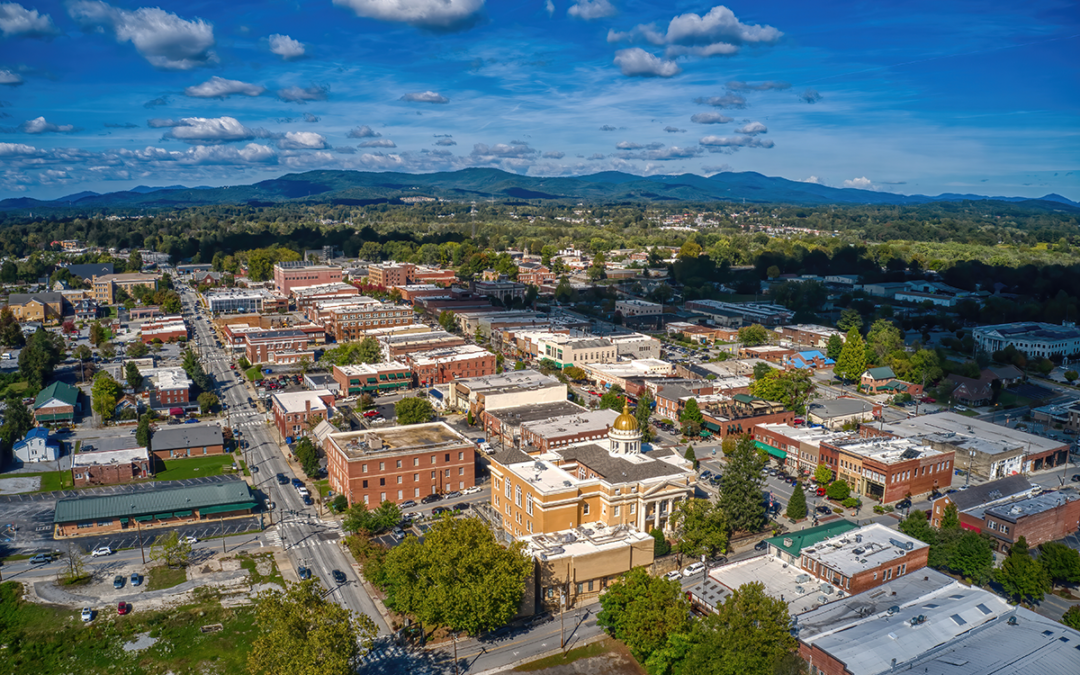
The state projects that in the next 25 years, over 39,000 people will move to Henderson County. To put that in perspective, that’s more than the current populations of Hendersonville, Flat Rock, Fletcher, Laurel Park, and Mills River combined. Furthermore, when they get here, they’ll require 17,000 new homes — that equates to nearly 700 new homes per year!

How will we accomplish that? Where will those houses go? Fortunately, we have an opportunity to answer those pressing questions, as Henderson County is now developing a 25-year plan for future development. 

This long-range plan, called a comprehensive plan, provides a significant opportunity for residents and businesses to inform the next 25 years of growth and development in Henderson County. Community input in the comprehensive planning process will ensure the county is better equipped to meet the challenges of a growing population, climate change, and increased pressures on our built environment.

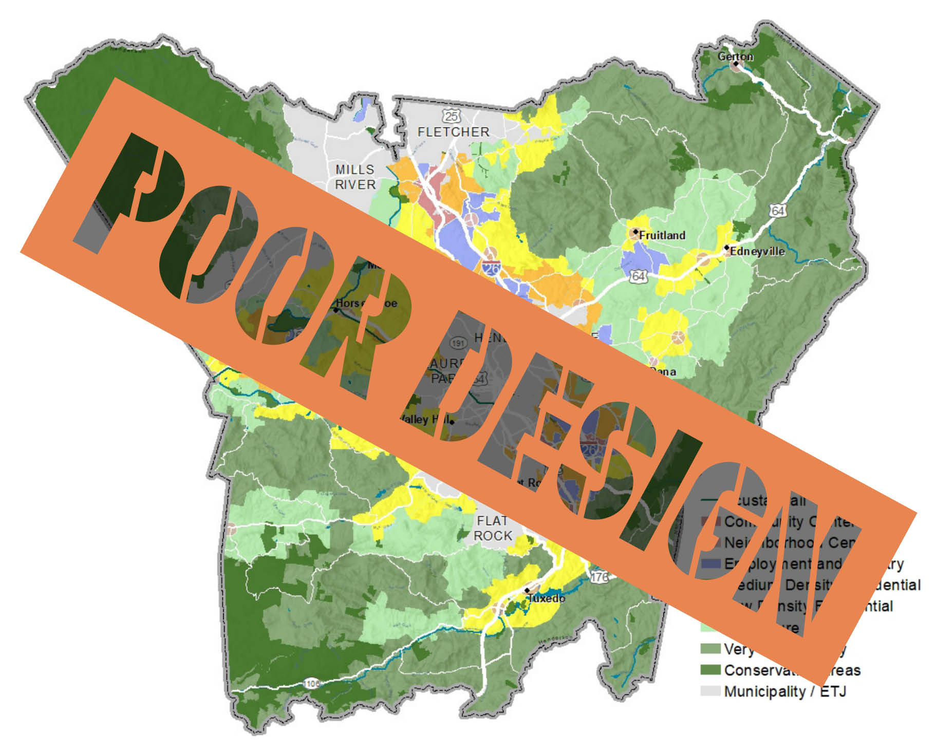
When we think of how we typically meet a huge demand for housing, we envision sprawling subdivisions and massive apartment complexes.

Smart Growth: limiting the expansion of infrastructure and building only where infrastructure such as water, sewage, and electricity already exists is one of the most effective ways to combat urban sprawl, protect green space, and ensure higher density and more functional communities.

On February 10, MountainTrue Healthy Communities Program Director Chris Joyell chatted with us about smart growth in relation to Henderson County’s 25-year Comprehensive Plan. Taking the county’s predicted population increase into consideration, Joyell outlined how we can realize a vision for growth that encourages economic development, respects our natural resources and agricultural heritage, and enhances our communities’ quality of life for generations to come! Presented in partnership with Conserving Carolina, this free webinar was the first of four Special Edition Green Drinks series webinar, entitled Good Growth Makes Good Sense. Click here to watch the webinar recording!

Those projects usually require extending new water and sewer lines into rural and undeveloped land. Instead of expanding our infrastructure into rural landscapes, we can choose to invest in our existing communities by improving aging infrastructure to accommodate the growth that cities and towns are designed to absorb.

Focusing development in established neighborhoods protects our farmland and natural areas and represents a sound financial approach to the problem. By encouraging development in existing communities, the county reduces the long-term maintenance obligation of new infrastructure. Investing in our communities supports our neighbors and is ultimately more efficient, saving the county money and strengthening its tax base.

A greater focus on providing a wide range of housing options can serve as an antidote to sprawling development patterns that perpetuate gridlock, auto emissions, and the climate crisis. These housing options don’t always have to be 200-unit multi-family apartment buildings. Instead, we can encourage modest forms of infill development that are comparable in size and scale to large homes. These “middle housing” types include duplexes and courtyard apartments and have been largely missing from housing production since the 1970s.

If you visit any pre-war neighborhood in the region, you’ll find modest brick-faced townhouses and courtyard apartments blending in seamlessly with single-family homes. These middle housing types can provide a wide range of affordable options for, say, seniors looking to downsize or young adults looking to strike out on their own; for service workers, public servants, and school teachers looking to live closer to where they work. 

Accessible, affordable housing options can help us build a community that accommodates all walks of life. To do this, we need a fair and predictable set of rules to guide development. When we leave these decisions to the discretion of a county board or a judge, the only people who benefit are the lawyers. Instead, we need to streamline the permitting and approval process to make development decisions more timely, transparent, and predictable for developers and residents alike. 

If we want to preserve Henderson County’s farmland, forests, and heritage, we need to find a better way to accommodate the anticipated influx of new residents while supporting our existing communities. Henderson County’s ongoing comprehensive planning process allows county residents to articulate what middle housing options could look like and how they could fit in/around existing neighborhoods and town centers while preserving their unique character.

Visit Henderson County’s 2045 Comprehensive Plan website to learn more and get involved.

MountainTrue Wins Historic Investments for WNC

MountainTrue Wins Historic Investments for WNC

MountainTrue Wins Historic Investments for WNC

As you may know, lawmakers at the North Carolina General Assembly finally approved a budget in November after months of wrangling among themselves as well as with Governor Cooper. The new spending plan represents the first full budget approved by the legislature and signed by the Governor since 2018.

The budget makes substantial investments in Western North Carolina, including many of the funding priorities MountainTrue has been promoting since this time last year — when lawmakers began their 2021 session.

Every year, MountainTrue makes a list of priority projects and programs for funding in the state budget. We then work with WNC legislators and our various partners — including our members at the grassroots level — to help convince lawmakers to invest in our rivers, streams, mountains, and forests. 

Here’s a quick look at MountainTrue’s budget victories in Raleigh: 

  • Funding for removal of dams across WNC — $7.2 million.
  • Recurring funding for landslide mapping in WNC — $370,000.
  • Restoration of the successful Waste Detection Elimination Program (WaDE) to help property owners identify and remedy failing septic systems on their property — $200,000 in both years of the biennial budget.
  • Recurring funding for water quality testing in the French Broad and other WNC rivers and streams — $100,000.

MountainTrue also went to bat for several important projects to improve public access to and/or protect water quality in rivers and streams throughout our region. New state funding for these projects included:

  • Watauga River Paddle Trail in Watauga County — $150,000. 
  • Permanent public access to a popular recreational area on the Green River Game Lands in Henderson and Polk counties — $150,000.
  • Removal of the Ward Mill Dam on the Watauga River in Watauga County — $100,000 
  • Outdoor recreation improvements at Island Park on the Tuckaseegee River in Swain County — $200,000. 
  • Expanded fishing, canoeing, and kayaking on the Valley River in Cherokee County — $125,000. 
  • Improved access to and stream restoration on the Bakersville Creekwalk in Mitchell County — $200,000. 

Some other budget items that MountainTrue supported include $12.2 million for Pisgah View State Park in Buncombe County and $750,000 for planning and improvements to DuPont State Forest. 

Of course, no one gets everything they want in the state budget process. Two of MountainTrue’s priorities — additional funding to help livestock producers reduce water pollution from their farming operations and communities to manage stormwater runoff — did not make it into the state’s spending plan. MountainTrue will continue to work in support of these investments in 2022.

We at MountainTrue extend our gratitude to the WNC legislators from both parties for their help with these budget victories. A big shout out to Sen. Chuck Edwards of Henderson County — from the beginning of his time in the Senate, Edwards has shown a consistent commitment to water quality issues in our region and used his position on a key Senate budget committee to address them. We are especially grateful to him for his partnership with MountainTrue.

But you, our supporters, are still MountainTrue’s most important partner. We are the only WNC environmental organization with a year-round presence in Raleigh. Your support makes our work in the capital possible! Thank you and cheers to an impactful 2022!

MountainTrue FAQ: Live Staking

MountainTrue FAQ: Live Staking

MountainTrue FAQ: Live Staking

We love live staking here at MountainTrue, as it’s one of the easiest and most effective ways to support native biodiversity and stream bank restoration! This blog hopes to answer many of the frequently asked questions we get about live staking. Most of this information is general, but some is specific to the Watauga Basin and Riverkeeper Program. 

Q: What’s live staking?

Live staking is a method of stream bank repair using native tree cuttings to revegetate the riparian buffer. The riparian buffer consists of trees, shrubs, and grasses alongside stream banks — it plays a crucial role in protecting stream health. The resiliency of riparian buffers is frequently impacted by land use. Activities like mowing to the edge of a stream, cutting down trees to see the water, or new development can negatively impact water quality. By live staking, we can positively and directly impact the overall health of our waterways! 

Q: Where do you get the stakes from?

We get our live stakes from Foggy Mountain Nursery in Lansing, NC — their team harvests the stakes from native tree species, cutting stakes two to three feet long and one-half to two inches thick. While it’s possible to cut the stakes ourselves, we choose to support a fantastic local business and ensure that we’re planting the correct species. We’ve also harvested stakes from our previous live staking sites, where planted stakes have become well established. 

Q: How do you choose where you’ll be planting?

We prioritize local public parks and river accesses because they’re easy to access and directly benefit the public. We’ve frequented Valle Crucis Community Park in Banner Elk, Cove Creek, and other public riverside locations around Watauga County. We also partnered with the City of Hendersonville to host two live staking workdays in Henderson County this February! 

Q: What species do you plant?

We only plant tree species native to our region — primarily silky willow, silky dogwood, elderberry, and ninebark stakes. We’ve also planted other species, like buttonbush, black willow, and red stem dogwood. Recommended for stream bank repair by the NC State Cooperative Extension, these native tree species prefer moist soil and thrive in riparian habitats. These species support native wildlife, especially local pollinators. They can also establish extensive root systems to successfully hold soil in place along riparian buffers, ultimately preventing erosion. 

Q: Why do you plant during the winter?

Live stakes are living cuttings of dormant trees that can propagate or sprout a new plant from the cutting of the parent plant. During winter, trees enter a state of dormancy to conserve their energy and weather the colder temperatures. Our live staking season lasts from November to March. We plant hearty hardwood stakes that use their energy to establish roots, waiting until spring to grow their branches and leaves. These resilient roots serve as a stream bank’s first line of defense against erosion, especially during high-flow events. Planting live stakes while tree species are in their natural pattern of energy conservation allows for a higher likelihood of survival along riparian buffers. 

Q: How successful are the stakes?

Live stakes have a survival rate of 30-80%. However, survival varies from species to species and depends on environmental conditions. For example, we’d likely have very low survivability if a drought occurred after planting. But, if we plant under ideal conditions using correct planting techniques and have favorable weather post-planting, our stakes can do remarkably well! We can also remove invasive plant species and water the freshly planted live stakes to give them a better chance of success. 

Stakes are most successful when planted along naturally sloped stream banks. They can still be planted on extremely incised banks, though they’re more likely to be less impactful in those locations. In our experience, silky willow and silky dogwood stakes tend to fare better than other native tree species we plant. 

Q: How long does it take for the stakes to grow?

Roots, leaves, and branches can be well established after one growing season. From there, they continue to grow in length from the tips of their roots and branches year after year. 

Q: How do live stakes benefit our waterways?

Live stakes grow root systems that hold soil in place and prevent erosion in local waterways. Sediment pollution remains a significant threat to the Watauga River Basin. This type of pollution clogs aquatic habitats and transports toxic substances through local waterways, increasing water temperatures and negatively impacting native biodiversity.

Once planted, small live stakes will grow into larger trees that stabilize and support riparian buffer health. Healthy riparian buffers benefit stream health in a multitude of ways — they also absorb nutrients, create wildlife habitat, and reduce the intensity of flooding from rain events. Unvegetated streams are often incised and can lose several feet of bank in a single rain event — this can be detrimental to nearby homes and other structures. 

Q: What’s a typical day of planting?

We prep the stakes by cutting the live ends at a 45-degree angle. The NC State Cooperative Extension states that such cutting is enough to catalyze root growth at the nodes. The folks at Foggy Mountain Nursery kindly mark the planting ends of our stakes, so we know which ends to cut (pictured right). Once prepped and ready, we take the stakes in buckets down to the stream. We plant along the bank from the water’s edge to the bank’s top — not in the actual stream bed. Stakes are planted at an angle and submerged into the soil about two-thirds of the way. From there, the rest of the work is up to the stakes!

Want to learn more about live staking? Check out our Events page to sign up for one of our upcoming volunteer workdays, or contact our resident live staking experts listed below:

MountainTrue Weighs in on Henderson County 2045 Comprehensive Plan

MountainTrue Weighs in on Henderson County 2045 Comprehensive Plan

MountainTrue Weighs in on Henderson County 2045 Comprehensive Plan

MountainTrue has sent an open letter to the Henderson Country Planning Board that lays out our priorities and goals for a comprehensive plan that will guide future growth and development in a responsible and sustainable way for Henderson County. The letter (included below) addresses public participation in the process, smart growth principles, land preservation, protection and expansion of public lands, protecting clean water, and advancing clean energy.

Over the past several months, MountainTrue has been busy meeting with groups in Henderson County to increase public participation in the 2045 Comprehensive Planning Process. Every 20 years, comprehensive planning offers residents the opportunity to weigh in with their vision for the future. We need everyone’s voice represented as this key initial public input and engagement phase winds down. Here are some links with information about how to get involved:

December 13, 2021

Henderson County Planning Board
100 North King Street
Hendersonville, NC 28792

Via email

RE: MountainTrue’s Principles for Henderson County 2045 Comprehensive Plan

Dear Henderson County Planning Board Members:

On behalf of MountainTrue, a nonprofit organization that has worked to champion resilient forests, clean waters, and healthy communities in Henderson County for over 30 years, and our local members, we appreciate the process that you are beginning of formulating a new 2045 Comprehensive Plan that will serve as the vision and guide for growth and development in the County for the next quarter century. As we embark on this important task together, we would like to convey the following principles and issues that we believe the comprehensive plan should address:

Public Participation – Overall, we believe that communities should play a central role in planning for their future growth and development. We advocate for a design process that invites diverse voices, including those that have traditionally been excluded or ignored. The process should be equitable and inclusive of all communities and people regardless of class or clout.

We encourage the County to engage in targeted outreach to people in historically underrepresented communities. Surveys were mailed to all property-owning residents early in the process and, while we understand that there are many other input opportunities and that anyone is welcome to participate in the process, no such targeted outreach has been planned for renters and residents of housing authorities — who are disproportionately low-to-moderate income households. And although a Spanish language survey is available, Stewart consultants reported at the October 22nd Planning Board meeting that few if any of these have been returned. We encourage the County to work with organizations that serve these communities to target outreach and solicit participation to ensure that there is equitable participation and representation of all County residents regardless of wealth. Advertising should also be expanded and conducted in multiple languages on various media outlets.

Smart Growth – MountainTrue supports economic vitality and growth in Western North Carolina without compromising our mountain ecosystem. We champion our cities and small towns, which function as economic, cultural, and residential centers. We encourage public and private development in areas where adequate infrastructure already exists. At the same time, we discourage the expansion of infrastructure that induces sprawl into natural areas or the rural landscape. We advocate for a wide variety of housing choices and multiple modes of transportation.

According to our analysis, the County can accommodate projected growth within existing urban areas by focusing on increasing density without any zoning changes. To accomplish this, the County should confine industrial uses to specifically defined areas so that communities are protected from potential impacts. The County can also discourage urban sprawl by resisting developers’ calls to expand water and sewer service beyond the urban service area. The County should also streamline the permitting and approval processes so that development decisions are more timely, transparent, and predictable for developers and residents alike.

The County has made great strides in recent years around multi-modal transit options and connectivity between communities. The Ecusta Trail, Oklawaha Greenway Feasibility Study, and Greenway Master Plan are all efforts that should be included in future planning.

Land Preservation – We support planning for development in a way that protects valued natural resources. Planning can identify critical landscapes, like agricultural lands, wetlands, forests and steep slopes, and identify strategies for preserving those resources from destruction or degradation by development. There are a wealth of resources available to planners including landslide hazard maps, the National Wetland Inventory, NC Natural Heritage Program areas, the National Land Cover Database, and others that should guide development restrictions and define priority preservation areas.

Our rural and agricultural heritage are important to our communities and the economy of Henderson County. Therefore, the County should invest in preservation by establishing a funding mechanism that is dedicated to protecting open space and agricultural and forested lands and is replenished annually.

Public Lands – MountainTrue advocates for the protection of our national and state forests in addition to our national, state, county and city parks and trails. We believe the management of public lands should maintain and restore their ecological integrity and promote recreational opportunities.

The County has a wealth of public land resources including the Blue Ridge Parkway, Pisgah National Forest, DuPont State Recreational Forest, Green River Game Land, privately conserved land that is publicly accessible, and many county and municipal parks and trails. The County should encourage and expand access to these resources through increased public transit options and greenway connectivity. The County should create buffers and transition zones between development and public resources, and manage these areas in a way that protects them from encroachment and reduces the threats of wildfire to surrounding communities.

Clean Water – We work to preserve and restore waterways as healthy ecosystems as well as recreational and aesthetic resources. MountainTrue supports the development and enforcement of standards and regulations to protect surface and groundwater from pollution, litter, and the negative impacts of development.

MountainTrue has been monitoring and sampling water quality in the County for decades and will be glad to share our data with planners to determine impacted waterways deserving of increased protection, development buffers, and stormwater runoff reduction measures. As climate change drives increased frequency, intensity, and quantity of rainfall in our area, it is imperative that we reduce impervious surface cover and encourage infiltration and stormwater best management practices to reduce impacts from urban and agricultural runoff on water quality. Development standards around sediment and erosion control should be updated to account for increasing rainfall. Impacts from litter, especially from single-use plastic products, should also be considered and addressed.

Clean Energy – MountainTrue supports the development of clean, sustainable, locally-produced energy. We are dedicated to helping communities transition to renewable energy. We work with local community members, policymakers, and utilities to bring our region sustainable solutions for our energy demands and to promote energy efficiency.

County facilities should incorporate renewable energy generation features, and design standards for all government buildings should promote this. New development approved by the county should similarly be encouraged to incorporate renewable energy features. Housing, especially for low-income residents, should be audited for energy usage and retrofitted to maximize energy efficiency.

Thank you for your consideration of these principles and issues as the Comprehensive Planning process moves forward, and we look forward to working with you to realize a vision for growth in Henderson County that continues an upward trajectory for economic development, preserves our rural and agricultural character, enhances our quality of life, and respects our natural resources for decades to come.

Sincerely,

Gray Jernigan
Southern Regional Director

Katie Breckheimer
Interim Southern Regional Director

CC: Henderson County Board of Commissioners
Jake Petrosky, Stewart, Inc.
Henderson County Manager and Planning Staff

SMIE: What’s Bugging Our Rivers?

SMIE: What’s Bugging Our Rivers?

SMIE: What’s Bugging Our Rivers?

A species of stonefly that is sensitive to pollution in streams. This quick, crawling predator is an indicator of overall good water quality.

MountainTrue has many water sampling programs that tell us much about the health and status of our waterways. The Stream Monitoring Information Exchange (SMIE) program is a volunteer-based water quality monitoring program that operates throughout Western North Carolina. MountainTrue works in partnership with the Environmental Quality Institute based in Black Mountain to facilitate bi-annual sampling across our Southern and High Country Regions each year. SMIE sampling efforts occur each spring and fall typically in the months of April and October.

Some of MountainTrue’s water quality monitoring programs look specifically at the chemical indicators of water samples, which give us a snapshot of the water quality at one particular moment in time. SMIE is unique in that we look for living samples to help us form a more holistic understanding of water quality over a longer period of time — a process known as biomonitoring. Biomonitoring allows us to assess the ability of certain underwater habitats to maintain the right chemical conditions needed for the survival of living aquatic species.

Close-up of an ice cube tray that we use to collect and identify species of macroinvertebrates. Pictured here are net-spinning caddisfly larvae. 

So, what do we find when we’re looking for living aquatic samples?

Insects! Or benthic macroinvertebrates, if you want to get more scientific. While benthic refers to the bottom of a stream bed, macroinvertebrates are any animal without a backbone (invertebrate) that you can see without a microscope (macro). Essentially, we’re looking for stream bottom-dwelling bugs, including species like mayflies, stoneflies, caddisflies, and many more!

Why do we care so much about bugs?

Different species of macroinvertebrates have different abilities to tolerate pollution.

Species that are highly sensitive to pollution are found in our cleanest waterways, while more pollution-tolerant species can be found in our less healthy streams. These special little bugs are excellent bioindicators — their health and presence in local waterways give us key insights into the health of our region’s aquatic ecosystems.

This year, we had many returning volunteers join us in the water, along with some new enthusiastic volunteers willing to learn on the fly. We recently wrapped up this year’s SMIE efforts after spending some colorful and scenic fall days sampling local streams. October and November saw13 hard-working volunteer teams sample the streams of Henderson, Polk, and Cleveland counties. The excitement and investment of long-standing and new volunteers who helped us throughout the 2021 sampling season was infectious — every time we don the waders, hop into the water, and rustle up rocks and leaves to scour for bugs, we get to share in discovery together.

Want to learn more about the results of these biomonitoring efforts over the years? Check out the Environmental Quality Institute’s interactive Water Quality Map to see sampling locations and review data from the past 30 years of biomonitoring efforts!

If you’re interested in becoming a SMIE volunteer, sign up for our spring season training in Hendersonville! Hosted by Americorps Water Quality Administrator and SMIE extraordinaire, Mara Chamlee, our spring SMIE training promises to be a fun day full of learning (and bug watching!) on the Green River that you won’t want to miss! 

Swim Guide Watershed Report: Upper French Broad, Green & Broad River Watersheds

Swim Guide Watershed Report: Upper French Broad, Green & Broad River Watersheds

Swim Guide Watershed Report: Upper French Broad, Green & Broad River Watersheds

While the past year has been unkind to the French Broad River, the Green River Watershed — a headwater tributary of the Broad River — had a great year. Alternatively, the larger Broad River Watershed’s 2020-2021 highlight reel is less glamorous, but we’re happy to report commendable water quality improvement across this important watershed. 

We’ll split this blog post into three sections, starting with a summary of our upper French Broad River Watershed data. Then, we’ll discuss the data we collected across the Green River and greater Broad River Watershed, summarize the good and bad news for each, and spotlight the water testing sites with the lowest and highest bacteria counts. We’ll conclude with achievable solutions for the future and a call to action so you can continue to help us protect the places we share.

Before we dive into our water quality summary, let’s review important terminology to help us better understand the data our Riverkeepers, volunteers, and Clean Waters teams worked so hard to collect, analyze, and report. Cfu, or colony forming unit, is a data metric scientists use to estimate the number of microbes present per 100 milliliters of a singular water sample. Microbes (also known as microorganisms) include bacteria, algae, and fungi. Like most things, some microbes are good for human health and some aren’t. We test for E. coli bacteria because it’s the best indicator for the presence of microbes that pose threats to human health.

According to the US Environmental Protection Agency (EPA), 235 cfu/100mL is the safe standard for primary recreational waters, where people are most likely to engage in recreational activities involving underwater immersion and potential water ingestion.

First, let’s talk about the Upper French Broad River

About Our Swim Guide Program

Swim Guide is an international program used by Riverkeepers and other advocates to provide up-to-date recreational E. coli data for beaches, lakes, and rivers worldwide. E. coli is a bacteria found in the fecal waste of warm-blooded animals, including humans, and indicates contamination in our waterways. E. coli levels increase with rainfall events due to surface runoff and sewer overflow events.

Samples are collected every Wednesday from Memorial Day to Labor Day. Volunteers collect surface water samples in a 100mL sample bottle and drop samples off at the lab, to be processed by MountainTrue staff. Results from samples are measured in MPN, the most probable number of colony-forming units (cfu). The EPA’s limit for recreational water quality is 235 cfu/100mL. The EPA estimates at that concentration, 8 in 1,000 people will contract an illness.

Pass/Fail results are updated every Friday on www.swimguide.org to inform the public about local water quality. We use the data generated from our Swim Guide Program to identify sites for follow-up sampling. We sample in both urban and rural areas. Determining the location and source of E. coli in our waterways is one way we can hold polluters accountable.

News headline: Upper French Broad Bedevilled by Bad Bacteria

The French Broad’s turbulent history with E. coli is well-known among watershed locals. Our two new testing sites along the upper French Broad at Lyons Mountain and Island Ford secured the top spots for worst water quality and highest bacteria count

In Henderson County, Mud Creek at Brookside Camp Road experienced slight improvement from 2020 to 2021, but remains one of the worst sites we sample with an average E. coli count of 1535 cfu/100mL. Our data suggests a mix of animal agriculture, septic failures, and sewer overflows are the primary sources of E. coli pollution in Mud Creek. 

The week of July 28 proved to be the summer’s worst. Just 23% of our French Broad River testing sites passed the EPA’s 235 cfu/100mL safe standard for primary recreational waters. 

For more information about the larger French Broad River Watershed, check out this blog post

Let’s move on to the Green River Watershed.

Good news headline: Green River Watershed Report Concludes ‘It’s Actually Pretty Easy Being Green’

We’re happy to report the past year saw the Green River Watershed boast no worst sites. With the exception of the week of August 18 during Hurricane Fred, all seven testing sites routinely passed the EPA’s safe standard throughout the summer. 

Overall, the Green River’s water quality remains excellent for recreational users and fares much better than the French Broad River’s water quality. Out of 98 total samples, only nine failed to pass the EPA’s safe standard. Our data shows the Green River was clean 90.8% of the time we sampled it this summer. 

Bad news headline: Rains of Climate Change Pose Threats to Overall Clean Green River

Users of the Green River Watershed enjoy a largely clean present. Still, the future is less certain with the potential for negative changes due to heavier summer rains. This summer saw Hurricane Fred wreak havoc across the watershed in mid-August, immediately resulting in poorer water quality. With an average value of 951.9 cfu/100mL per site, the week of August 18 proved to be the summer’s worst with six out of seven testing sites failing to pass the EPA’s safe standard. 

Stormwater runoff pollution remains a formidable threat to the Green River Watershed and the whole of the Southern Blue Ridge. Without immediate and direct action, the Green River’s water quality will suffer as higher annual amounts of stormwater runoff enter the watershed due to climate change.   

Now, let’s discuss the state of the Broad River Watershed. 

Good news headline: Broad River Somewhat Less Bacteria-laden in 2021 than 2020

Sampled weekly from Memorial Day to Labor Day, our data concludes slight water quality improvement at all nine testing sites across the Broad River Watershed in both Rutherford and Cleveland counties from 2020-2021. We’re happy to say that the river continues to be a safe, reliable recreation spot.

Cleveland County’s Moss Lake maintains the title of best testing site, passing the EPA safe standard 100% of the time over the past two years.  

Bad news headline: Development and Manure are Broad River’s Biggest Bacteria Blunders

Buffalo Creek has remained our worst testing site for two years, failing to pass the EPA’s safe standard 81% of the time. The high bacteria concentrations in Buffalo Creek are attenuated in Moss Lake, just 15 miles upstream. The nutrients associated with Buffalo Creek’s high bacteria levels continue to pose a risk for algal blooms in Moss Lake. Not all algal blooms are dangerous, but those with the potential to form in Moss Lake would pose a severe risk to water quality and surrounding biodiversity. 

Lake Lure and the Rocky Broad have mixed testing results. Coupled with existing agriculture, ongoing development surrounding the Rocky Broad is likely causing an increase of bacteria-laden runoff during rain events. 

Data from our two testing sites along the First Broad River indicate that the water is unsafe for recreation roughly 33% of the time. Poor agricultural practices like inadequate stream buffers and abundant cow and poultry manure in the river are the likely sources for the First Broad’s high E. coli levels.  

Let’s wrap up our water quality discussion with two future news headlines: 

1) Governments Must Step in to Mitigate Green River’s Worsened Water Quality

Existing stormwater infrastructure is outdated and inadequate. Local and state government action is needed to protect the Green River’s water quality from threats posed by climate change. 

2) Remedying Broad River’s Bacteria Problem with Sound Policy, Infrastructure and Agriculture Investments

Despite incrementally improved water quality at each testing site, data collected from the Broad River Watershed still produced less than ideal results. The prevalence of E. coli in the watershed illuminates a dire need for workable solutions to lackluster development policies, poor agricultural practices, and deficient stormwater infrastructure. 

Moving forward, MountainTrue will:

  • Encourage government officials to implement policies addressing land use and development impacts and make worthy investments to improve existing stormwater infrastructure.
  • Continue to monitor sites of most concern while aiming to pinpoint and eliminate sources of E. coli pollution at our newest testing sites in the near future.
  • Further develop valued relationships with community members to combat threats posed to water quality by poor animal agriculture practices. 

Want to learn more about our efforts to bring about clean water for all? Check out our ILoveRivers webpage and join MountainTrue’s dedicated community of volunteers to help us protect the places we share.