- 
Arabic
 - 
ar
Bengali
 - 
bn
German
 - 
de
English
 - 
en
French
 - 
fr
Hindi
 - 
hi
Indonesian
 - 
id
Portuguese
 - 
pt
Russian
 - 
ru
Spanish
 - 
es
MountainTrue Participates in Waterkeeper Alliance PFAS Study

MountainTrue Participates in Waterkeeper Alliance PFAS Study

MountainTrue Participates in Waterkeeper Alliance PFAS Study

Study shows widespread contamination of surface waters, though relatively low levels of PFAS in WNC.

MountainTrue’s Watauga, Green, and Broad Riverkeepers participated in a recently released, groundbreaking new study of cancer-causing per- and polyfluoroalkyl substances (PFAS) contamination across a select subset of U.S. surface waters. The study found that PFAS pollution is widespread. In samples collected from 114 waterways across the country, 83% contained at least one type of PFAS — substances widely linked to serious public health and environmental impacts.

Since the 1950s, PFAS have been widely used in manufacturing and are found in many consumer, commercial, and industrial products. Often referred to as “forever chemicals,” PFAS do not break down over time. Instead, these dangerous chemicals accumulate in people, wildlife, and the environment. As a result, PFAS have been found in surface water, air, soil, food, and many commercial materials.

“These dangerous chemicals are an emerging threat throughout our country. Here in Western North Carolina, we’ve documented relatively low levels of PFAS contamination,” explains Broad Riverkeeper David Caldwell, “we have more work to do to identify sources of PFAS pollution, but often increased levels are documented downstream of industry, landfills, and wastewater treatment plants.”

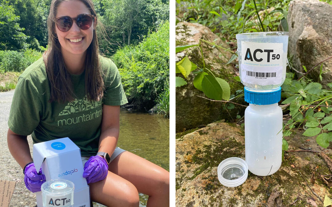
MountainTrue’s Riverkeepers collected water samples upstream and downstream of wastewater treatment plants on the Watauga River and Green River and an industrial landfill on the Broad River. The results showed generally low levels of PFAS contamination throughout the mountain region compared to samples collected in the eastern part of the state. Sampling conducted by the Broad Riverkeeper found no detectable PFAS upstream of the Cleveland County landfill and the presence of four PFAS varieties downstream (download the sampling results for the Broad River). The Watauga Riverkeeper found low levels of two varieties of PFAS upstream from the Jimmy Smith Wastewater Treatment Facility and higher levels and three additional PFAS varieties downstream (download the results for the Watauga River). The Green Riverkeeper found no detectable PFAS upstream of the Columbus Wastewater Treatment Plant and found low levels of three varieties of PFAS downstream in White Oak Creek (download the results for the Green River).

“This is a wakeup call for our region,” explains Watauga Riverkeeper Andy Hill. “But we have more work to do. MountainTrue and Waterkeepers Carolina are conducting additional sampling throughout our region and the state, and we will provide a more detailed analysis of PFAS contamination of local waterways.”

A total of 113 Waterkeepers across the country collected samples from 114 waterways across 34 states and the District of Columbia (D.C.). Independent analysis indicates widespread contamination, with 94 participating Waterkeeper groups confirming the presence of PFAS in their waterways. Waterways in 29 states and D.C. were found to be contaminated by at least one, but most frequently, many revealed the presence of up to 35 different PFAS compounds.

In some places, like creeks connected to the Potomac River in Maryland, the Lower Susquehanna River in Pennsylvania, and the Niagara River in New York, the level of contamination is thousands to hundreds of thousands of times higher than what experts say is safe for drinking water. An estimated 65% of Americans source their drinking water from surface waters similar to those sampled. While the state of North Carolina has done some testing of drinking intakes, additional data is needed. It is important to note that locally in Western North Carolina, we do not suspect a threat to drinking water supplies based on current evidence.

Scientific studies increasingly link these toxic chemicals to serious health conditions such as cancer, liver and kidney disease, reproductive issues, immunodeficiencies, and hormonal disruptions. Despite serious health risks, there are currently no universal, science-based limits on the various PFAS chemicals in the United States. For many PFAS chemicals, the EPA has not even set a health advisory limit that would give the public a baseline to determine what amount of PFAS is unhealthy in drinking water. In most cases, the EPA is not doing adequate monitoring for these chemicals, which is why these findings are so unique and important.

This data plainly demonstrates that Congress and EPA must act with urgency to control persistent PFAS contamination across the country. The current lack of oversight puts the health and safety of communities and ecosystems across the nation at risk and results in costly cleanup and treatment activities to remove PFAS contamination after it has occurred. To learn more, visit waterkeeper.org/pfas.

What do Healthy Mountain Rivers Mean to You?

What do Healthy Mountain Rivers Mean to You?

Testing Sites

River Basins

Counties

States

Protecting our mountain waters wouldn’t be possible without the help of members, volunteers, and supporters like you.

With your help, we will maintain E. coli sampling at 85 popular swimming areas this summer. Samples will be taken, processed, analyzed, and published on the easy-to-use Swim Guide website and smartphone app before starting your weekends!

Will you help us monitor and report water quality conditions at popular swimming areas this summer? Consider making a donation today.

Our goal is to raise $20,000 by May 30 to help fund this summer’s Swim Guide E. coli sampling program. Each sample costs $30, which includes staff time, supplies, lab analysis, and travel expenses. Businesses or organizations can fully sponsor a site for $500/year with recognition on the Swim Guide platform and social media.   

“I like to paddleboard, so water quality is important to me. People need a tool like the Swim Guide app to know when the water is safe. My friends and I care about sharing these results and letting community members know about this amazing tool. MountainTrue addresses pollutants they find in the river and advocates for better policies that will protect it.” 
-Tiffany Narron, Swim Guide Volunteer
“I love getting outside and helping our Riverkeepers by taking water samples, and it’s especially rewarding to see the results posted within 24 hours so my friends and I know the water conditions before the weekend.” 
-Erica Shanks, MountainTrue Board Member and Swim Guide Volunteer
“I’m a hardcore river enthusiast, spending a lot of time canoeing and paddleboarding. I need to know if the water I’m playing in is safe. I appreciate how local this is to the High Country. It’s awesome to know where it’s safe and have that knowledge be current for my family and dogs. I love the sampling side because I get to feel like I’m contributing.” 
Jordan Sellers, Swim Guide Volunteer
“The City of Hiawassee strives to have the best water quality. Being out on the lake and knowing it’s safe to boat, swim, and fish in is important. We really appreciate our relationship with MountainTrue.” 
Liz Ordiales, Mayor of Hiawassee, GA

We want you and your family to be able to visit publicly accessible swimming areas without having to worry about health risks. Swim Guide makes it easy for people to know when their water is contaminated and when it is safe to swim, giving our community the information needed to prevent waterborne illnesses. Our sampling will also help us identify problem areas where work is needed to improve water quality for the future.

Will you stand with MountainTrue? We need you to take action today so our waters can be healthy today and for generations to come. Help us reach our $20,000 goal by donating today.

From all of us on the MountainTrue Clean Water Team, thank you for making this summer swim season the safest one yet!

Join us for the 16th Annual Green Bash!

Join us for the 16th Annual Green Bash!

Join us for the 16th Annual Green Bash!

Get ready for an exciting day full of kayaking trips, waterfall rappelling, treks, cold beer, and good music when the Spring Green Bash — Saluda’s favorite river and block party — returns on May 7!

The whole Green River community is invited to the Spring Green Bash block party at Green River Adventures in downtown Saluda, NC. We’ll enjoy great beer from Oskar Blues Brewing and music by Aaron Burdett. We’ll also announce the winner of the charity raffle for a Liquidlogic Coupe XP kayak, a whitewater kayak valued at $1,000! Proceeds from the raffle benefit MountainTrue’s Green Riverkeeper –  the protector and defender of the Green River Watershed.

Join us at the Spring Green Bash at Green River Adventures on May 7, 2022, to see if you’re the lucky winner of a Liquidlogic Coupe XP kayak (you do not need to be present to win)! Ticket sales end on May 7, 2022, and tickets may also be purchased at the event. 

Where: Green River Adventures, 111 E. Main Street, Saluda, NC

When: Saturday, May 7, 5:00 to 9:00 p.m.

2021 State of the River Reports

2021 State of the River Reports

2021 State of the River Reports

The 2021 State of the River Reports are finally here! In this blog, we’ll discuss the cleanliness and water quality of the French Broad, Broad and Green, and Watauga River watersheds. 

There are four sets of data that MountainTrue uses to formulate our water quality rankings for each stream, including:

  • E. coli data taken by MountainTrue’s riverkeepers and water quality monitoring volunteers.
  • Aquatic insect (a.k.a., benthic macroinvertebrate) data — part of the Stream Monitoring Information Exchange program (SMIE) — from the Environmental Quality Institute. Learn more about SMIE here
  • Chemical data — part of the Volunteer Water Information Network (VWIN) — from the Environmental Quality Institute.
  • Chemical, aquatic insect, fish, and bacteria data from the North Carolina Department of Environmental Quality (NC DEQ).

The data from testing sites in streams across each watershed are weighed, and each stream is given a letter grade. The grading scale is as follows: 

A (90-100): These streams have excellent water quality, low pollution levels, and healthy aquatic insect and fish populations.

B (80-89): These streams have good water quality but some impacts from pollution or development. The aquatic life and fish populations are relatively healthy.

C (70-79): These streams have average water quality. There are some concerns about pollution inputs and development impacts. Generally, aquatic life and fish populations are healthy but could become negatively impacted

D (60-69): These streams have below-average water quality. Pollution is a concern, and aquatic life and fish populations are not as healthy as they should be.

F (<60): These streams have poor water quality. Pollution levels are often high, and aquatic life and fish populations are impacted.

When comparing this year’s report to 2018’s report, it’s important to note that the way we process our water samples for E.coli at MountainTrue has changed. Up until 2018, we used an Environmental Protection Agency (EPA)-approved method using Coliscan Easygel. The results from this method were sometimes subjective and thus could be less accurate. In 2019, we switched to another EPA-approved protocol, using the Idexx system. Those results are quicker, more objective, and more accurate. This 2021 report includes E.coli data from both analysis methods (2018 Swim Guide data using Coliscan Easygel and 2019-2021 Swim Guide data using the Idexx system).

 Now, let’s review the findings from each of the three reports.

The state of the French Broad River Watershed:

 Of the 62 testing sites across the French Broad River Watershed, 16% received an A grade, 20.9% received a B grade, 29% received a C grade, 25.8% received a D grade, and 6% received an F grade. 

Overall, we observe a general decline in water quality. We attribute this to two primary factors — climate change and increasing construction and development throughout the watershed. Asheville and the surrounding region have experienced more frequent heavy rains in the last several years. Climate change in the Southern Blue Ridge region is expected to present random “boom and bust” patterns in precipitation, seen as floods and droughts in our region. This causes increased stormwater runoff from urban areas and agriculture operations, along with more sewer overflows and saturated septic fields surrounding failing septic systems. It also brings extra sediment into our waterways from construction sites and weak riverbanks, which can smother aquatic habitats, increase water temperature, and transport toxins into our rivers. All of this is happening during a period of unprecedented recreational growth on the French Broad. 

We documented the most dramatic change in Transylvania County, as the quality of the Upper French Broad decreased significantly. We attribute part of this decrease in quality to our transition to new, more accurate E.coli sampling protocols. However, that doesn’t explain the whole picture since water quality in other parts of the watershed didn’t drop as steeply. Notoriously the wettest county in the state, this drop in water quality is indicative of the effects that a changing climate coupled with increasing development is having on our region. 

On a positive note, the Nolichucky Watershed saw increased water quality with high grades in benthic and fish samples. Such pristine waters cannot be taken for granted, which is why we’re advocating for the Nolichucky River between Poplar, NC, and Erwin, TN, to be permanently protected with a Wild and Scenic Rivers designation.

Four Cleanest Streams:

  • Cataloochee Creek (A)
  • Cathey’s Creek (A)
  • Bent Creek (A)
  • South Toe (A)

Four Dirtiest Streams:

  • French Broad River – Pisgah Forest (F)
  • French Broad River – Etowah (F)
  • French Broad River – Hominy Creek (F)
  • French Broad River – Westfeldt (F)

 Learn more about the state of the French Broad River Watershed by reviewing last year’s Swim Guide results.

The state of the Broad and Green River watersheds: 

Of the 18 testing sites across the Broad and Green River watersheds, 27% received an A grade, 61% received a B grade, none received a C grade, 5.5% received a D grade (1 site), and 5.5% received an F grade (1 site). 

The Green River is the largest tributary of the Broad River in North Carolina, and its headwaters are largely protected. From its source in Henderson County to Lake Summit, the Upper Green is significantly impacted by agriculture, poor stream management practices, and lack of appropriate riparian buffers. 

The Green River flows into the Broad River near the Polk and Rutherford County Line. Major tributaries in the lower Green River Watershed include Walnut Creek from the north and White Oak Creek from the south. In a tale of two tributaries, the former touts excellent water quality and benefits from a large nature preserve while the latter suffers from degraded water quality as a result of development, land clearing, agriculture, and other intensive land use. 

By the time the First Broad reaches Shelby, it fails to meet EPA bacteria standards nearly 50% of the time. First Broad tributary Buffalo Creek has a history of high bacteria levels and feeds Moss Lake — Cleveland County’s only public reservoir and the water supply for Kings Mountain. In June 2020, NC DEQ documented Moss Lake’s first-ever harmful algal bloom (HAB) — this is a big concern for nearby residents, recreationists, and all who depend on Moss Lake for their drinking water supply. 

Overall, water quality in the most popular recreational area on the main stem of the Broad River is pretty good. The river is so large that contaminants of concern in the tributaries are diluted, and bacteria levels at the Broad River Greenway in Cleveland County almost always meet EPA standards for safe recreation.

Four Cleanest Streams:

  • First Broad River – North Fork (A)
  • Moss Lake (A)
  • North Pacolet River – Near Tryon (A)
  • Big Hungry River (A)

Four Dirtiest Streams:

  • Buffalo Creek – Above Moss Lake (F)
  • Sandy Run Creek (D)
  • Lower Broad River (B)
  • Upper Broad River (B)

Learn more about the state of the Broad and Green River watersheds by reviewing last year’s Swim Guide results.

The state of the Watauga River Watershed:

Of the 27 testing sites in the Watauga River Watershed, 37% received an A grade, 33% received a B grade, 11% received a C grade, 3.7% received a D grade (1 site), and 14.8% received an F grade. 

Overall, water quality is pretty good across the Watauga River Watershed, which originates at an elevation of 5,964 feet on the northern slopes of North Carolina’s Grandfather Mountain. The 78-mile-long Watauga River Basin includes the headwaters and tributaries of the Elk and Watauga Rivers, flowing northwest from North Carolina into Tennessee’s Holston and Tennessee Rivers before joining the Mississippi River and draining into the Gulf of Mexico. 

The Watauga River Watershed includes mountain bog wetlands that sit at the head of the basin and serve as an important water purification system and habitat for native wildlife. Nearly 90% of mountain bogs in North Carolina and throughout the Southeastern United States have been destroyed. The rapid elimination of mountain bogs poses a challenge for water quality and environmental conservation in the Watauga River Basin. 

Increases in development, plastic pollution, soil erosion, sedimentation, and excess nutrients are stressors on aquatic health and habitats. When combined, these stressors can significantly damage aquatic habitats and ecosystems. Much of the land disturbance in the basin takes place on steep mountain slopes, which are naturally vulnerable to soil erosion. As land is cleared due to urbanization and agriculture, rain and melting snow carry eroded sediments, pesticides, fertilizers, and road salt into the Watauga River. 

Fortunately, North Carolina has designated 18 miles along Boone’s Fork Creek for conservation to receive extra protection. More than half of the basin’s streams are classified as trout waters and thus require additional treatment at local wastewater treatment plants. In addition, 25-foot buffers of shrubs and trees must be maintained between trout streams and graded construction sites to filter runoff and prevent erosion.

Four Cleanest Streams: 

  • Watauga River @ Adam’s Apple Dr Bridge (A)
  • Watauga River @ Wilbur Dam Rd Bridge (A)
  • Watauga River @ Smalling Rd Bridge (A)
  • Elk River @ Lees-McRae Mill Pond (A)

Four Dirtiest Streams:

  • Watauga River @ Lover’s Lane (F)
  • Watauga River @ Hunter Bridge (F)
  • Watauga River @ Blevins Boat Ramp (F)
  • Watauga River @ Calloway Rd. Bridge (F)

 Learn more about the state of the Watauga River Watershed by reviewing last year’s Swim Guide results.

Microplastic pollution is widespread throughout the waters of Western North Carolina

Microplastic pollution is widespread throughout the waters of Western North Carolina

Microplastic pollution is widespread throughout the waters of Western North Carolina

Testing by MountainTrue shows that microplastics are present throughout the Broad, French Broad, Green, Hiwassee, Little Tennessee, New River and Watauga River Basins.

Western North Carolina — Regional conservation organization MountainTrue has documented the high levels of microplastics in surface water samples collected from waterways throughout western North Carolina. Microplastics are pieces of plastic smaller than 5 millimeters that are the result of the breakdown of larger plastic litter and debris into smaller and smaller pieces. They are harmful to aquatic life and are considered a potential threat to human health. 

MountainTrue collected and analyzed water samples from the Broad, French Broad, Green, Hiwassee, Little Tennessee, New River and Watauga River Basins. We found microplastics in every sample from every region, even in otherwise pristine areas and protected watersheds. We documented an average of 19 particles of microplastic per liter of water across all tested watersheds. The highest particle counts of microplastics were found in the Little Tennessee (37 particles/liter) and Hiwassee (30 particles/liter) watersheds. Even in watersheds with lower levels of microplastic contamination, there were testing sites with concentrations in the high twenties and thirties. 

Watershed

Avg no. of microfibers per liter

Avg no of microbeads per liter

Avg. no of microfragments per liters

Avg. no. of microfilms per liter

Avg no. of all microplastics per liter

Broad River

12

1

5

6

24

French Broad River

7

0

4

5

16

Green River

20

0

5

2

27

Hiwassee River

18

0

2

10

30

Little Tennessee River

29

1

3

5

37

New River

20

0

3

6

29

Watauga River

14

0

0

3

17

All Watersheds

12

0

2

5

19

Microfibers, which come from synthetic clothing and fishing line, was the most common form of microplastic that we observed. Microfilms, which degrade from plastic bags and food wrappers, accounted for more than a quarter of microplastics recorded. 

There have been significant amounts of microplastics research in marine systems, but microplastics in freshwater systems have been less studied overall. MountainTrue’s study is one of the first to look at levels across western North Carolina in order to gain a general understanding of the amount of microplastics in our water. MountainTrue is partnering with the Waterkeeper Alliance on a state-wide study for all of North Carolina.

Microplastics can enter the environment as plastic litter degrades, in runoff from landfills, and through discharges from wastewater treatment plants. Once in the environment, they can travel for thousands of miles suspended in water or carried by the wind. 

MountainTrue is partnering with businesses in Hendersonville to help them shift their operations away from single-use plastics toward reusable bags and compostable utensils and packaging through the Working to be Plastic Free partnership. In Buncombe County and the Town of Boone, MountainTrue is advocating for local ordinances that would encourage the use of reusable shopping bags by replacing single-use plastic bags with paper bags and charging a 10 cent fee that would be waived for shoppers enrolled in the SNAP or WIC programs. To learn how you can support these efforts visit plasticfreewnc.com

“The first step to stop the contamination of our environment and our bodies is to reduce the amount of plastic that enters and escapes the waste stream,” explains Anna Alsobrook, MountainTrue’s French Broad Watershed Outreach Coordinator. “And that starts by breaking our dependence on single-use plastics like plastic grocery bags and fast food utensils and packaging.” 

Microplastics are inadvertently ingested by fish and other aquatic organisms causing microplastics to be transferred throughout the food web. Researchers have found that microplastic ingestion can negatively affect freshwater fish through physical complications of passing plastic through the gut or false satiation. Microplastics can also leach harmful chemicals like plasticizers and additives into the organs of fish. The chemicals have varying effects on fish changing feeding rates, development and survival. Much of the research is focused on centrarchids. Centrarchids are the family of sunfish, and they are a sentinel species, so they are often used to detect risks to humans by providing advance warning of danger.

People consume microplastics in contaminated food and water, and by breathing them in. Microplastics have been found in seafood, salt, tap water and even in bottled water. It is estimated that, globally, people ingest an average of five grams, or the equivalent of a credit card, worth of plastic every week. 

The effects of plastic pollution on human health is the subject of a growing body of research. A study has found microplastics small enough to be carried in the bloodstream in the placentas of pregnant mothers. Other research has shown that microplastics cause damage to human cells, including cell death and allergic reactions, at levels known to be consumed in food. 

Other research has shown that it’s not just the plastics, but also the additives used to make them can have a harmful effect on human health. Phthalates, which are a family of chemicals used in food packaging, are known endocrine disruptors that harm the reproductive and nervous systems and have been linked to higher rates of childhood asthma and other respiratory conditions. Styrene, which is used to make styrofoam cups, food containers, and disposable coolers, leaches into the food and drinks they hold and from landfills into drinking water. The World Health Organization has classified styrene as a probable human carcinogen

“These plastics can persist in our environment for hundreds if not thousands of years,” says Anna Alsobrook. “The more we learn about what plastics and the chemicals used to make them are doing to our environment and to our bodies, the clearer it becomes that we need to take action now.”

MountainTrue FAQ: Live Staking

MountainTrue FAQ: Live Staking

MountainTrue FAQ: Live Staking

We love live staking here at MountainTrue, as it’s one of the easiest and most effective ways to support native biodiversity and stream bank restoration! This blog hopes to answer many of the frequently asked questions we get about live staking. Most of this information is general, but some is specific to the Watauga Basin and Riverkeeper Program. 

Q: What’s live staking?

Live staking is a method of stream bank repair using native tree cuttings to revegetate the riparian buffer. The riparian buffer consists of trees, shrubs, and grasses alongside stream banks — it plays a crucial role in protecting stream health. The resiliency of riparian buffers is frequently impacted by land use. Activities like mowing to the edge of a stream, cutting down trees to see the water, or new development can negatively impact water quality. By live staking, we can positively and directly impact the overall health of our waterways! 

Q: Where do you get the stakes from?

We get our live stakes from Foggy Mountain Nursery in Lansing, NC — their team harvests the stakes from native tree species, cutting stakes two to three feet long and one-half to two inches thick. While it’s possible to cut the stakes ourselves, we choose to support a fantastic local business and ensure that we’re planting the correct species. We’ve also harvested stakes from our previous live staking sites, where planted stakes have become well established. 

Q: How do you choose where you’ll be planting?

We prioritize local public parks and river accesses because they’re easy to access and directly benefit the public. We’ve frequented Valle Crucis Community Park in Banner Elk, Cove Creek, and other public riverside locations around Watauga County. We also partnered with the City of Hendersonville to host two live staking workdays in Henderson County this February! 

Q: What species do you plant?

We only plant tree species native to our region — primarily silky willow, silky dogwood, elderberry, and ninebark stakes. We’ve also planted other species, like buttonbush, black willow, and red stem dogwood. Recommended for stream bank repair by the NC State Cooperative Extension, these native tree species prefer moist soil and thrive in riparian habitats. These species support native wildlife, especially local pollinators. They can also establish extensive root systems to successfully hold soil in place along riparian buffers, ultimately preventing erosion. 

Q: Why do you plant during the winter?

Live stakes are living cuttings of dormant trees that can propagate or sprout a new plant from the cutting of the parent plant. During winter, trees enter a state of dormancy to conserve their energy and weather the colder temperatures. Our live staking season lasts from November to March. We plant hearty hardwood stakes that use their energy to establish roots, waiting until spring to grow their branches and leaves. These resilient roots serve as a stream bank’s first line of defense against erosion, especially during high-flow events. Planting live stakes while tree species are in their natural pattern of energy conservation allows for a higher likelihood of survival along riparian buffers. 

Q: How successful are the stakes?

Live stakes have a survival rate of 30-80%. However, survival varies from species to species and depends on environmental conditions. For example, we’d likely have very low survivability if a drought occurred after planting. But, if we plant under ideal conditions using correct planting techniques and have favorable weather post-planting, our stakes can do remarkably well! We can also remove invasive plant species and water the freshly planted live stakes to give them a better chance of success. 

Stakes are most successful when planted along naturally sloped stream banks. They can still be planted on extremely incised banks, though they’re more likely to be less impactful in those locations. In our experience, silky willow and silky dogwood stakes tend to fare better than other native tree species we plant. 

Q: How long does it take for the stakes to grow?

Roots, leaves, and branches can be well established after one growing season. From there, they continue to grow in length from the tips of their roots and branches year after year. 

Q: How do live stakes benefit our waterways?

Live stakes grow root systems that hold soil in place and prevent erosion in local waterways. Sediment pollution remains a significant threat to the Watauga River Basin. This type of pollution clogs aquatic habitats and transports toxic substances through local waterways, increasing water temperatures and negatively impacting native biodiversity.

Once planted, small live stakes will grow into larger trees that stabilize and support riparian buffer health. Healthy riparian buffers benefit stream health in a multitude of ways — they also absorb nutrients, create wildlife habitat, and reduce the intensity of flooding from rain events. Unvegetated streams are often incised and can lose several feet of bank in a single rain event — this can be detrimental to nearby homes and other structures. 

Q: What’s a typical day of planting?

We prep the stakes by cutting the live ends at a 45-degree angle. The NC State Cooperative Extension states that such cutting is enough to catalyze root growth at the nodes. The folks at Foggy Mountain Nursery kindly mark the planting ends of our stakes, so we know which ends to cut (pictured right). Once prepped and ready, we take the stakes in buckets down to the stream. We plant along the bank from the water’s edge to the bank’s top — not in the actual stream bed. Stakes are planted at an angle and submerged into the soil about two-thirds of the way. From there, the rest of the work is up to the stakes!

Want to learn more about live staking? Check out our Events page to sign up for one of our upcoming volunteer workdays, or contact our resident live staking experts listed below: