- 
Arabic
 - 
ar
Bengali
 - 
bn
German
 - 
de
English
 - 
en
French
 - 
fr
Hindi
 - 
hi
Indonesian
 - 
id
Portuguese
 - 
pt
Russian
 - 
ru
Spanish
 - 
es
MountainTrue and Conservation Groups prepare for lawsuit over Nantahala-Pisgah Forest Plan

MountainTrue and Conservation Groups prepare for lawsuit over Nantahala-Pisgah Forest Plan

MountainTrue and Conservation Groups prepare for lawsuit over Nantahala-Pisgah Forest Plan

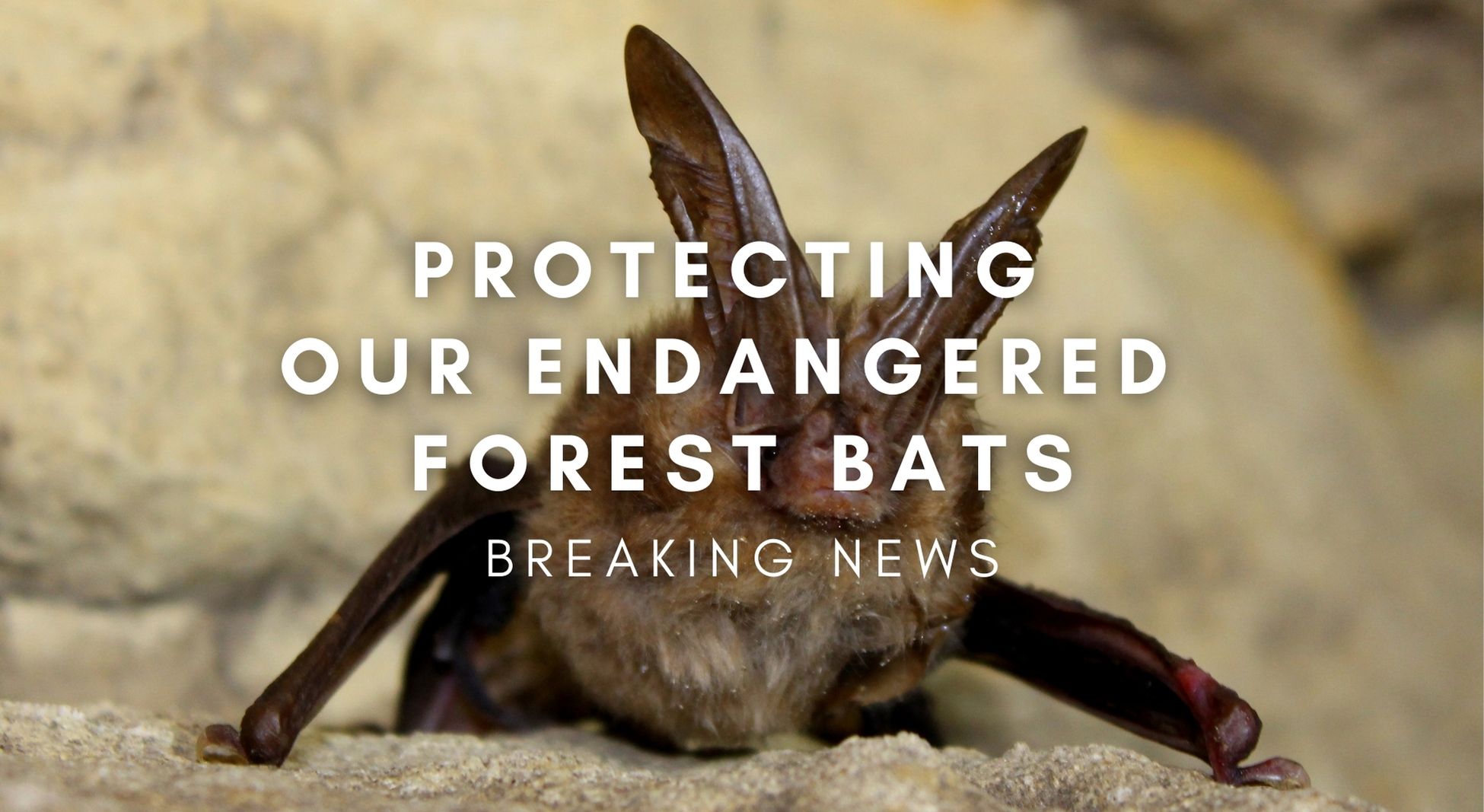
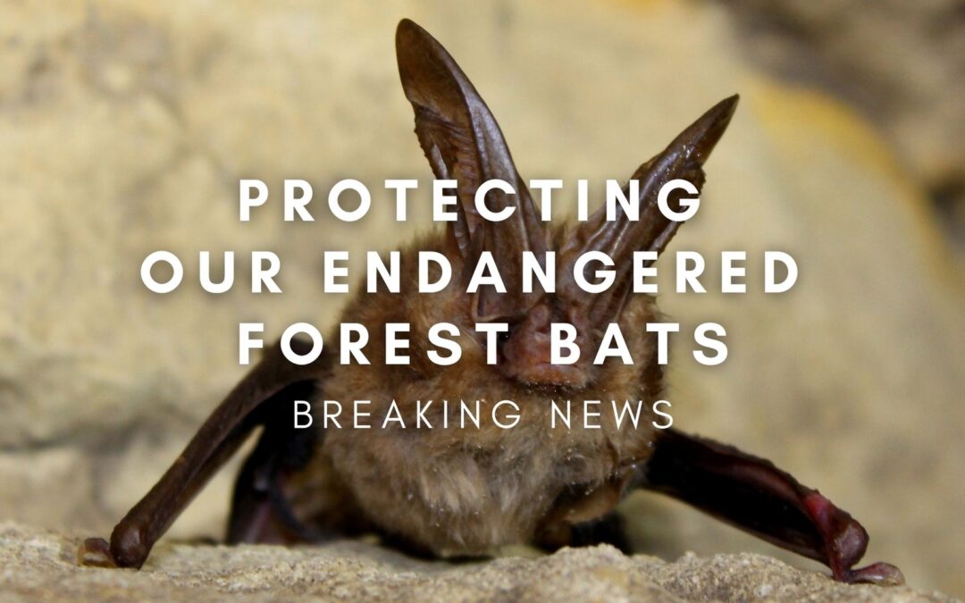
Photo  of a Virginia big-eared bat by Larisa Bishop-Boros – Own work, CC BY-SA 3.0, https://commons.wikimedia.org/w/index.php?curid=32046949

MountainTrue has joined a coalition of conservation groups in sending a letter to the U.S. Forest Service, signaling our intent to sue over glaring flaws in the Nantahala-Pisgah Forest Plan.

MountainTrue Statement: 

The US Forest Service’s management plan for the Nantahala and Pisgah National Forests is deeply flawed. The Forest Service put commercial logging first, ignored the best science available, and is needlessly putting several endangered bat species at risk of extinction. The endangered species that would be affected are the northern long-eared bat, Indiana bat, Virginia big-eared bat, and the gray bat. Two species that are being considered for the endangered species list — the little brown bat and the tricolored bat — would also be adversely affected. 

From the beginning of the drafting process, we’ve tried to work in partnership with the Forest Service and many other stakeholders to develop a responsible win-win plan for the environment, our economy, and the people of our region. MountainTrue and our experts remain ready and willing to help the Forest Service fix its plan and make it more ecologically responsible and more responsive to the needs of our communities.  

Our incredibly diverse ecosystems deserve a better plan. The people who love and use these forests deserve a better plan. And MountainTrue and our litigation partners are willing to go to court to win a plan that we can all be proud of. 

Read the 60-Day Notice of Intent to Sue for Violations of the Endangered Species Act Related to Consultation on the Nantahala-Pisgah Land Management Plan.

Our members and supporters power our Resilient Forests program. Donate today, so we can continue to protect our old-growth and mature forests, which are critical habitats for many endangered and threatened species.

Press release from the Southern Environmental Law Center, MountainTrue, Sierra Club, The Wilderness Society, Defenders of Wildlife, and Center for Biological Diversity:

For immediate release: July 26, 2023

Media Contacts:
Southern Environmental Law Center: Eric Hilt, 615-921-9470, ehilt@selctn.org
MountainTrue: Karim Olaechea, 828-400-0768, karim@mountaintrue.org
Sierra Club: David Reid, 828-713-1607, daviddbreid@charter.net
The Wilderness Society: Jen Parravani, 202-601-1931, jen_parravani@tws.org
Defenders of Wildlife: Allison Cook, 202-772-3245, acook@defenders.org
Center for Biological Diversity: Jason Totoiu, 561-568-6740, jtotoiu@biologicaldiversity.org

Conservation Groups prepare for lawsuit over Nantahala-Pisgah Forest Plan 

ASHEVILLE, N.C. —A coalition of conservation groups sent a letter to the U.S. Forest Service signaling their intent to sue unless officials fix the glaring flaws in the Nantahala-Pisgah Forest Plan that put endangered forest bats at risk. 

On Tuesday, The Southern Environmental Law Center, on behalf of MountainTrue, Sierra Club, The Wilderness Society, Defenders of Wildlife, and Center for Biological Diversity, sent a 60-day Notice of Intent to Sue, which is a prerequisite to filing a lawsuit under the Endangered Species Act. The letter explains how the Forest Service relied on inaccurate and incomplete information during the planning process, resulting in a Forest Plan that imperils endangered wildlife.

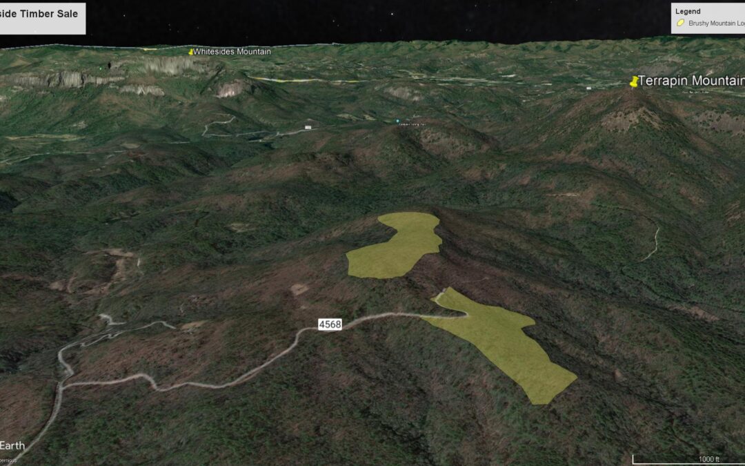
At its most basic level, the Nantahala-Pisgah Forest Plan outlines where activities like logging and roadbuilding are prioritized and where they are restricted. The Plan, published in 2023, will have a significant and lasting impact on the beloved forests and the rare animals and plants that live there.

But even though these forests are a critical refuge for hundreds of rare species, the Plan prioritizes logging in the wrong places, even when it threatens endangered wildlife. For instance, some of our most critically imperiled bats are harmed by logging and need intact mature forests to survive. However, the Forest Plan aims to quintuple the amount of heavy logging, including in parts of the forest that are vitally important for forest bats. The Notice of Intent to Sue alleges the Forest Service had information showing increased risks to endangered species but withheld that information from the Fish and Wildlife Service, which oversees endangered species protection.

At every step of the planning process, the Forest Service ignored public concerns and the best available science about the new Plan’s harms to endangered species. Instead, the agency used misleading and inaccurate information to downplay the impacts this huge increase in logging in sensitive habitats will have on sensitive wildlife. The agency now has 60 days to reconsider its decision.

Below are statements from the Southern Environmental Law Center, MountainTrue, Sierra Club, The Wilderness Society, Defenders of Wildlife, and Center for Biological Diversity:

“The Nantahala and Pisgah National Forests are home to an amazing diversity of animals and plants, including some of the most critically endangered species in the country. We cannot sit back while this irresponsible Forest Plan ignores the science, breaks the law, and puts these remarkable species at risk.” Sam Evans, leader of SELC’s National Forests and Parks Program, said. “Forest plans are revised only every 20 years or so, and our endangered bats won’t last that long unless we get this Plan right.”

“The Forest Service’s management plan for the Nantahala Pisgah National Forests is deeply flawed. The Forest Service put commercial logging first, ignored the best science available, and is needlessly putting endangered species at risk of extinction. Our incredibly diverse ecosystems deserve a better Plan. The people who love and use these forests deserve a better Plan. And MountainTrue and our litigation partners are willing to go to court to win a Plan that we can all be proud of,” said Josh Kelly, Public Lands Field Biologist for MountainTrue.

“The Pisgah and Nantahala National Forests serve as anchor points for sensitive habitat that protects a marvelous array of plant and animal species, which are increasingly under pressure. The recently released Forest Plan misses the boat for protecting key species by emphasizing activities that fragment and degrade habitat, especially for species that rely on mature and undisturbed forests. The N.C. Sierra Club will continue to work to protect the wildlife and habitats that we cannot afford to lose,” David Reid, National Forests Issue Chair for the Sierra Club, said. 

“It is unacceptable that the Nantahala-Pisgah Forest Plan puts imperiled wildlife at even greater risk of extinction. The Forest Service has blatantly ignored the best available science and shirked its legal duties to protect forest resources at nearly every step of the way in this planning process, leading to a Plan that prioritizes logging in the wrong places and trivializes intact mature and old-growth forest habitat,” said Jess Riddle, Conservation Specialist at The Wilderness Society. “At a time when wildlife species face unprecedented threat from the climate crisis, we must do everything we can to protect the biodiversity that we have. We need to use every tool in our toolbox to safeguard healthy, connected nature, including litigation, if necessary.”

“The Nantahala and Pisgah National Forests are home to several endangered bat species that have already taken a terrible hit from white nose syndrome, a deadly fungal disease that infects them while they’re hibernating,” said Jane Davenport, senior attorney at Defenders of Wildlife. “These bats rely on intact, mature forests to forage and to rear their young. Heavy logging in some of their last and best habitat on the East Coast may tip the populations over the edge. We must hold the U.S. Forest Service and Fish and Wildlife Service accountable for violating their Endangered Species Act duties to get the science right in the forest planning process.”

“It’s outrageous that this forest plan greenlights a fivefold logging increase in important bat habitat even as our bat populations plummet from disease, habitat loss and climate change,” said Jason Totoiu, a senior attorney at the Center for Biological Diversity. “This misguided Plan will destroy tens of thousands of acres and jeopardize species like the Indiana, northern long-eared, Virginia big-eared and gray bat. We will ask a court to step in to protect these highly imperiled animals.” 

###


Take Action: Manage Pisgah and Nantahala National Forests in line with our Climate Reality

Take Action: Manage Pisgah and Nantahala National Forests in line with our Climate Reality

Take Action: Manage Pisgah and Nantahala National Forests in line with our Climate Reality

Public Comments Due by July 20, 2023

Our national forests are public treasures and should be managed to maintain the health of our environment and best serve our communities’ current and future needs. The Forest Service is soliciting public feedback on how it should adapt current policies to protect, conserve, and manage mature and old-growth forests on public lands for climate resilience. 

Climate change will significantly impact our region, our uniquely bio-diverse ecosystems, and our watersheds. Yet, here in Western North Carolina, the Forest Service has maintained an outdated focus on exploiting our forests for commercial logging, and this year they finalized a new Forest Management Plan that could allow logging on 60% of the Nantahala-Pisgah National Forests’ one million acres, including thousands of acres of old-growth forest. 

Please provide public comment to the Forest Service asking that they update their policies to prioritize the preservation of old-growth and mature forests, which provide critical functions as wildlife habitats, carbon sinks, and pristine watersheds and sources of clean drinking water.

Need help drafting public comments? Try Nick’s Comment Generator. 

MountainTrue Board Member Nick Holshouser has developed a Comment Generator Tool that uses OpenAI to generate a short, meaningful, and unique comment. By selecting from a menu of topics, you can easily generate a first draft that you can review, edit, and further personalize. Then, all you have to do is copy and paste your comment into the Regulations.gov comment portal.  

Try the Comment Generator Now. 

Public comments are due by July 20, 2023. (Note that the original June due date is still listed on the public feedback page, but the comment deadline has been extended.)

MountainTrue’s Statement on the Nantahala-Pisgah Forest Plan

MountainTrue’s Statement on the Nantahala-Pisgah Forest Plan

MountainTrue’s Statement on the Nantahala-Pisgah Forest Plan

On March 20, after 10 years of public input and planning, the Forest Service will adopt its new management plan for the Nantahala-Pisgah National Forests — a disappointing document that is significantly worse than the current plan and contradicts an executive order issued by President Biden that would protect and expand our nation’s old growth forests. 

The new plan does have a few bright spots: the Eastern Band of Cherokee Indians will have more influence over forest management, new recommendations for Wilderness and Wild and Scenic River designations are welcome, and the plan implements more prescribed fire and wildfire protection activities. On other key issues — like tackling our massive road maintenance backlog, developing a plan to maintain and expand our trail networks and recreation infrastructure to meet current user demand, and drafting a monitoring plan to evaluate their own management practices — the Forest Service has failed to deliver, instead putting these critical concerns on the back burner for at least the next three years. 

However, for MountainTrue, the most egregious shortcoming is that the Forest Service has placed significant old-growth forests, rare species habitat, and roadless backcountry into zones that are open to commercial logging. The Forest Service has also relaxed rules to allow ground-based logging on steep, hard-to-reach slopes — where many of our old-growth forests remain.

To be clear, MountainTrue is not against commercial logging, and we’re not concerned about the amount of logging permitted by the new forest plan. It’s essentially the same amount allowed by the old plan. Regardless of how much logging occurs — whether it’s the modest 800 acres annually of today or the eyebrow-raising 3,200-acre annual maximum, what matters most is where logging occurs. MountainTrue has provided detailed maps of existing old-growth communities and filed formal objections, and despite our best efforts, the Forest Service chose to expand the footprint of where logging can occur to 600,000 acres, more than half of the land of the Nantahala-Pisgah National Forest. This includes 100,000 acres of natural heritage areas, roadless areas, and sensitive habitats where we will vigorously oppose any future logging projects. 

It doesn’t need to be this way. Logging is a critical part of Western North Carolina’s economy and can play an important role in establishing the kinds of wildlife habitat desired by local hunters. Half a million acres can provide more than enough timber harvests and early-successional habitat while still protecting our most treasured natural areas and recreational resources. A detailed blueprint for accomplishing this was provided to the Forest Service by the Nantahala-Pisgah Forest Partnership, a coalition that brought together recreation, conservation, civic, and business interests — including timber and paper industry representatives. 

Instead, the Forest Service devised a forest plan that seems designed to pit user-interest groups against each other by allowing logging in some of our most diverse forests and pristine backcountry areas. The agency also wants the right, as it is pushing through in the Southside Project, to cut existing old-growth forest, even though the Environmental Impact Statement for the planning process discloses that there is a minimum of a 300,000-acre deficit of old-growth on Forest Service Land alone, making it the most under-represented age class in the region compared to the average over the last few millennia. 

To paper over this egregious management strategy, the Forest Service has devised its own “designated old-growth network” which fails to include existing and well-documented old-growth areas and can change significantly from plan to plan. This scheme allows the Forest Service to place relatively young trees in the old-growth network until they are old enough to log profitably decades from now. It also flies in the face of President Biden’s executive order 14072 of April 22, 2022, which, in part, seeks to “conserve America’s mature and old-growth forests on Federal lands” and directs the Secretary of Agriculture to “define, identify, and complete an inventory of old-growth and mature forests on federal lands […]” That inventory is due this April, and, if done correctly, will include tens of thousands of acres that this Forest Plan leaves open to logging.

According to executive order 14072, it is the policy of the Biden Administration to “manage forests on Federal lands, which include many mature and old-growth forests, to promote their continued health and resilience; retain and enhance carbon storage; conserve biodiversity; mitigate the risk of wildfires; enhance climate resilience; enable subsistence and cultural uses; provide outdoor recreational opportunities; and promote sustainable local economic development.” That’s a vision of forest management that we wholeheartedly support and that this Forest Plan quite simply fails to accomplish. 

The Forest Service had the chance to unify the public behind a well-balanced Forest Plan. Instead, they sided with more narrowly aligned interests inside and outside the agency and, despite a 10-year planning process, kicked many difficult decisions down the road. But the fight for our forests is far from over. You can count on MountainTrue to continue working to protect the places we share.

For media inquiries, contact: Karim Olaechea, Deputy Director of Strategy & Communications 
Phone: 828-400-0768 | Email: karim@mountaintrue.org

MountainTrue offers to bid on reckless Southside Timber Sale to stop important old-growth forests from being cut

MountainTrue offers to bid on reckless Southside Timber Sale to stop important old-growth forests from being cut

MountainTrue offers to bid on reckless Southside Timber Sale to stop important old-growth forests from being cut

ASHEVILLE, NC — Today, the US Forest Service closed bidding on 98 acres of the Southside Timber Sale (pictured above), which aims to eventually log 300 acres of North Carolina’s Nantahala National Forest, including critical tracts of old-growth forests. To stop the logging of old-growth forest, MountainTrue is offering to pay the Forest Service to keep the 37 acres of trees in place and the Forest intact. 

This offer would protect exceptional old-growth forests from unnecessary logging and ensure the Forest Service recoups its investments in this sale. In fact, the Forest Service would make more money by accepting payment from MountainTrue, which is offering to match any offers for the value of the timber. Leaving the forest in place would free the Forest Service from the expense of administering the sale and overseeing roadbuilding and logging activities. 

While the Forest Service typically does not accept payment to keep forests intact, this extraordinary offer is an effort to stop an extraordinarily harmful sale. 

“We are willing to pay the Forest Service in order to save this old-growth forest and the critical habitat that it provides for native species,” explains Josh Kelly. “Our bid is both the most environmentally responsible and profitable option for the Forest Service.”

The 37 acres targeted by the Southside Timber Sale on Brushy Mountain are incredibly important ecosystems. Old-growth forests are made of trees that have been standing for centuries and hold tremendous amounts of carbon. Cutting these trees releases that carbon – tons of it – into the atmosphere, where it will worsen the impacts of climate change. Keeping these remarkable tracts of forest in the ground is a key step to fighting the climate crisis. 

These forests also provide habitat for what experts recently documented as one of the most important green salamander populations in the state. Cutting these forests threatens this already-imperiled species. In fact, Forest Service leaders have ignored concerns from the agency’s own scientists about the impact logging could have on this already-imperiled species.

The Forest Service acknowledges that 17 acres on Brushy Mountain are old-growth and knows about the presence of the critically imperiled Blue Ridge lineage of green salamanders at the site but still insists on cutting this forest. Logging these critical tracts of forest will threaten at-risk species, worsen the impacts of climate change, and do permanent damage to these important ecosystems. USFS leaders should instead preserve these forests for generations by allowing MountainTrue to purchase the carbon rights to the forests for sale at Brushy Mountain in Southside Timber Sale – or by scrapping this misguided project altogether.


Have questions? Email Josh at josh@mountaintrue.org.

MountainTrue Staff Spotlight: Forest Plan

MountainTrue Staff Spotlight: Forest Plan

Over the rivers and through the woods in

Pisgah and Nantahala National Forests

A brief chat with these amazing MountainTrue team members working hard to protect our region’s beloved national forests:

How long have you been involved in this process?

Bob: “I’ve been involved since the Forest Service’s planning process officially started in 2013. Prior to this, I also attended the first meetings held by The Wilderness Society (I think in 2011) when it first began to pull together a partnership of stakeholders in anticipation of the start of the planning process.”

Callie:I’ve been involved in this forest planning process almost since the beginning, first as Executive Director of the Hiwassee River Watershed Coalition and then in my current role as MountainTrue’s Western Regional Director. I helped organize the Nantahala Pisgah Forest Partnership in 2011. Our initial focus was on making the best Forest Plan ever, but what we’ve really created over the past decade is a ‘lasting voice for innovative management and public investment in the public forests of North Carolina’s mountains for the future.’

Josh:I’ve been involved with this Forest Plan revision for almost 10 years. MountainTrue was involved with the very first Forest Plan in 1987. We championed a petition to the Chief of the Forest Service that led to the 1987 Plan being remanded and the creation of the 1994 Amendment.”

Why is this an important part of your work and why is it important to you on a personal level?

Bob:It’s an important continuation of the forest protection work I did for what was then the Western North Carolina Alliance (now MountainTrue) during the decade before Josh came aboard. As a botanist/forest ecologist, I’ve always felt it’s important to work to keep our mountain ecosystems as healthy and secure as possible, given the continuing challenges from development, fragmentation, poor forest management, and climate change. On a personal level, my heart is in these mountains!”

Callie:Almost 20 years ago, I chose to make my home in Western North Carolina because of the amount of public land in these mountains. Nantahala National Forest is only eight miles from my house by car. It’s the view out my window — it’s my backyard!”

Josh:The new Forest Plan will set the management direction for over one million acres of Pisgah and Nantahala National Forests for the next 20 years. These forests are incomparable in their ecological and social value. They support thousands of species — many of them found nowhere else, they nourish the hearts and souls of millions of people, and they’re a huge part of important traditions.”

What’s one thing you want folks to know about the Revised Forest Plan?

Bob:Because the Forest Plan has not become finalized (due to the ongoing objection process), I’m not quite sure yet. But, there’s currently a strong focus on timbering that people should know about. I do think it’s encouraging that we have a diversity of partner organizations in place who have stated their commitment to helping the Forest Service implement the Plan over the next two decades. Their collaboration will be essential in shaping good management out of whatever becomes the Final Plan.”

Callie:While water quality and riparian protections are pretty strong, the Plan sets up the next 20 years to continue the tradition of making Nantahala the ‘working forest’ and Pisgah the ‘recreational forest.’ While timber harvest and recreation will of course continue to occur on both forests in a variety of locations, the emphasis for Nantahala is much more oriented toward timber harvest.”

Josh:The Revised Plan puts too much emphasis on logging cove forests. Southern Blue Ridge Cove Forests are some of the most diverse temperate forests on the planet. They grow the biggest trees in our region, support diverse understories of wildflowers and medicinal plants, protect water quality, and have historically been over-exploited. The new Forest Plan should instead put more emphasis on thinning and burning the fire-adapted forests that respond positively to timber harvest and are suffering from a lack of fire.”

What’s your favorite location in one or both of the forests?

Bob:My favorite conservation-related places are the old-growth forests in Nantahala’s Big Choga Creek area and Pisgah’s Daniel Ridge area. I’m also equally fond of the rare Southern Appalachian bogs in both national forests. My favorite recreation area is probably Pisgah’s Pilot Cove Loop (which is also a Natural Heritage Area), but it’s hard to pick out a single place!”

Callie:Fires Creek. Hands down. With its crystal clear, cold waters, unique biodiversity, trout fishing, hiking, camping, horseback riding, picnicking, swimming, and hunting, Fires Creek offers something for everyone!”

Josh:There are many great areas in Pisgah and Nantahala National Forests, but none are better to me than Santeetlah Creek in Graham County. It’s just an incredible landscape that inspires me every time I visit.”

Josh’s Forest Plan update:

We and our organizational partners had a great time at the Pisgah Party + Rally for the Forest, organized by I Heart Pisgah on August 1, 2022. Over 500 people attended and made clear that too much of Nantahala and Pisgah are being prioritized for logging. The Objection meetings hosted by the Forest Service from August 2-4 went well. The dialogue was high-quality and our team was well prepared — we made our case and the Forest Service should realize they need to make some changes to the new Forest Plan. We hope the Forest Service seriously reviews and implements the solutions included in the Nantahala-Pisgah Forest Partnership’s proposal. The Forest Service expects to respond to all objections and finalize the Forest Plan by late 2022. Click here to read our blog detailing our objections to the Draft Forest Plan.

More Forest News

MountainTrue is Objecting to the Revised Forest Plan for the Nantahala-Pisgah National Forests. These are our Reasons.

MountainTrue is Objecting to the Revised Forest Plan for the Nantahala-Pisgah National Forests. These are our Reasons.

MountainTrue is Objecting to the Revised Forest Plan for the Nantahala-Pisgah National Forests. These are our Reasons.

After over eight years of work and more than 25,000 public comments, the United States Forest Service (USFS) has released its Revised Forest Plan for the Nantahala and Pisgah National Forests. Comprised of a 360-page plan, a 738-page Final Environmental Impact Statement (FEIS), and more than 1,000 pages of appendices to the FEIS, the Forest Plan provides a strategic framework for the next 20 years of management in the Nantahala and Pisgah National Forests. We offer this critique of the Revised Forest Plan so that our members and the general public can better understand the plan and its implications and why and on what grounds MountainTrue is filing formal objections to the plan.

MountainTrue is a longtime advocate for the sustainable management and conservation of Nantahala and Pisgah National Forests. Our members led the successful campaign to stop the practice of clear-cutting in the forests, and our staff conducted the first inventory of old-growth stands in the Nantahala and Pisgah National Forests. MountainTrue’s Public Lands Team members are intimately involved in protecting these public lands: monitoring timber sales to ensure old-growth forests, water quality, and sensitive habitats are protected, restoring and protecting native habitats by treating invasive non-native plants and pests, and helping the Forest Service design and implement restoration projects.

Our views are influenced by our intimate history with these national forests, but also by our membership in the Nantahala-Pisgah Forest Partnership (Partnership) and our endorsement of the Forest Plan Alternative provided to the USFS by the Partnership in June 2020.

Protect Pisgah and Nantahala National Forests

Support our Resilient Lands program and help protect the places we share.

The Partnership consists of 27 active member and affiliate organizations representing conservation, economic development, forest products, recreation, water, and wildlife interest groups. The Partnership worked collaboratively to negotiate the outcomes presented in the Forest Plan Alternative. The Partnership hoped the heavily negotiated compromise would resolve the Draft Forest Plan’s key issues, streamline its implementation, and reduce future conflicts with the Forest Service and between user groups.

There were two key innovations in the Partnership’s Forest Plan Alternative. First, the group identified the largest broadly supported area for timber production — approximately 500,000 acres or nearly half of the Nantahala and Pisgah National Forests, where timbering could be done without impacting important recreation and conservation areas. The second innovation was the linking of objectives that are in tension with one another. For example, the Partnership Alternative required that roads and trails in a geographic area be well-maintained before the Forest Service constructed new ones, and base levels of timber harvest would have to be accomplished before any new Wilderness designation was sought. These innovative ideas would have incentivized collaboration.

The Partnership’s Forest Plan Alternative was a painstakingly negotiated road map that included maps and specific consensus recommendations that would have achieved:

  • the protection of old-growth stands, natural heritage natural areas, backcountry wilderness, and other sensitive recreation areas;
  • the protection, maintenance, and expansion of recreation areas and trail systems;
  • the creation of new young forest habitats at biologically significant levels for the benefit of wildlife and hunters alike;
  • and, at the same time, meet the Forest Service’s goals to increase timbering.

The Forest Services’ previous management plan suffers from some of the same issues as the proposed plan, namely inefficient management area allocation, and its implementation resulted in public controversy and conflict. Forest interests groups — such as timber companies, hunters, recreators, and conservationists — often perceived themselves to be in competition with one another when timber harvest was proposed in areas with multiple high values. The result was gridlock and damaged ecosystems: the Forest Service trampled on biologically sensitive areas without meeting their timbering goals, and forest interests groups blamed each other.

This was supposed to change with the 2012 Planning Rule adopted by Secretary of Agriculture Tom Vilsack, which sought to modernize forest management by addressing the “evolving scientific understanding of approaches to land management, changing social demands, and new challenges such as changing climate.”

At the core of the new planning rule was a commitment to a collaborative process that would ensure transparency and effective public participation. In its preamble, the Department of Agriculture states that the new rule “emphasizes providing meaningful opportunities for public participation early and throughout the planning process, increases the transparency of decision-making, and provides a platform for the Agency to work with the public and across boundaries with other land managers to identify and share information and inform planning.” In this spirit, the Nantahala-Pisgah Forest Partnership was established and painstakingly negotiated its consensus Plan Alternative.

Unfortunately, the Forest Service declined to adopt or even fully analyze the Partnership proposal as an alternative. Instead, the Forest Service has proposed a plan that offers vague assurances while placing important conservation areas in areas designed for timbering, expanding the road network without providing plans to maintain it, and establishing loopholes that undermine the protection of the conservation areas that are established by the plan. Many of our concerns relate to the potential for poorly conceived timber harvest to impact water quality, steep slopes, and areas critical for the preservation of biodiversity. We want to emphasize, though, that we fully support meeting the timber harvest goals agreed to by the Partnership, even going so far as to compromise in supporting rotational timber harvest in the consensus suitable timber base.

While there are some bright spots in the Forest Service’s Revised Plan — such as an increase in active fire management, recommendations for Wild and Scenic Rivers, and a recommitment to adequate streamside zones — they are far outweighed by its shortcomings:

Land Allocations Unnecessarily Prioritize Timber at the Expense of Conservation Areas

The Forest Services divides the Nantahala and Pisgah National Forests’ 1.045 million acres into 17 unique management areas with specific management needs in the Revised Forest Plan. Because many ecological communities exist at various elevations, the Forest Service’s management approach must be specialized and place-based to support each management area’s abundant biodiversity.

Ensuring the efficacy of the Forest Service’s proposed place-based management area allocations was a primary objective of the Nantahala Pisgah Forest Partnership as it negotiated its Forest Plan Alternative. Instead of adopting these recommendations, the Forest Service puts the ecological well-being of more than 100,000 acres of important conservation areas at risk. These conservation areas include North Carolina Natural Heritage Areas, existing old-growth forests, and potential Wilderness Areas.

In the chart below, you will see that the Partnership identified 501,646 acres (or roughly half of the Nantahala-Pisgah National Forests) to be included in Matrix and Interface — the two management area designations where the emphasis is placed on timber harvesting/production. This is more than sufficient for the Forest Service to meet its goal of harvesting up to 3,200 acres per year.

*The difference in acreage is not significant
**While the Forest Service did not include a specific Management Area for the proposed Craggy Mountain National Scenic Area, it does recognize the scenic value of an approximately 10,000-acre core.
***The Middle Creek Research Natural Area was included in the Black Mountains Recommended Wilderness by the Partnership
****Special Interest Areas are largely composed of North Carolina Natural Heritage Natural Areas. The Partnership recommended that most of these areas either be allocated to management areas not suited for timber production or protected through Forest Plan Standards.

The Forest Service’s Revised Plan includes an additional 108,723 acres in their Matrix and Interface allocations. All but roughly 8,000 (7,823) acres come from conservation areas that include North Carolina Natural Heritage Areas, existing old-growth forests, and potential Wilderness Areas.

As it currently stands,  at least 12,000 acres of inventoried, existing old-growth forest, more than 45,000 acres of Natural Heritage Natural Areas ranked “High” to “Exceptional” by the NC Natural Heritage Program, and over 100,000 acres of important conservation areas have been designated for “regularly scheduled timber harvest” within the Matrix and Interface allocations. Not all of the important conservation values designated to suitable management areas will be proposed for logging, but some certainly will.

This regrettable management area allocation prioritizes commercial timber harvest projects that will negatively impact these important conservation areas, making timber harvest unnecessarily complicated, controversial, and damaging.

^ Return to Top

The Old-Growth Network Shell Game

Old-growth forests are vital for native species, scientific study, aesthetic and spiritual reasons, and are crucial for sequestering and storing carbon that would otherwise contribute to climate change. Before the industrial age, most of the forest in the Southern Blue Ridge were old-growth forests with complex structures and a vast diversity of tree sizes and ages. A wave of logging for national and international markets from 1880-1940 removed most of the original forest, and today only 10% of Nantahala and Pisgah and just 3% of the region as a whole are believed to be in old-growth condition. The analysis in the Revised Forest Plan acknowledged that approximately half of the tree canopy of Nantahala and Pisgah would have been in old-growth condition prior to European colonization.

The Forest Service has touted the Revised Plan as an improvement for old-growth forests because it designates approximately 265,000 acres for old-growth management (ROD p.22). While this is a big number, it’s important to note that all but 44,000 acres of old-growth designations are already protected at a higher level, such as by the Wilderness Act, the Inventoried Roadless Rule, the Wild and Scenic Rivers Act, Research Natural Areas, and others. So, these are primarily designations of convenience — in the sense that they are already off-limits to logging rather than because of their outstanding values.

MountainTrue and our predecessor organization, the Western North Carolina Alliance, began mapping the old-growth forests of Nantahala and Pisgah National Forests in 1994. Through that work, we have documented over 90,000 acres of old-growth on Forest Service lands. We shared that inventory with the Forest Service, and unfortunately, over 12,000 acres of field-verified old-growth remains in timber production management areas, where the plan direction is to create young forest through timber harvest.

What’s more, 110,000 acres of the designated old-growth network in the plan is relatively young — less than 100 years old, according to Forest Service Records. The Forest Service claims that by designating middle-aged forests, they are ensuring the development of old-growth in the future, even though they are leaving much more worthy forests unprotected.

The network of old-growth designations begins to look like a shell game when you realize that thousands of acres of small patch old-growth designations made in the last 28 years were not included in the Revised Plan. The Forest Service seems to be setting up a precedent where they can open up more mature, lucrative forests that had previously been “designated old growth” to logging now, and only protect middle-aged forests until the next plan — when they could theoretically open up some of those more mature stands to timbering. Examples of this dynamic include very high-quality designations that were made and subsequently discarded in the Upper Santeelah and Shope Creek Projects but have now been allocated to a timber production management area.

Another major concern is that the Forest Service is providing project staff and district rangers with too much flexibility and decision-making power to cut the last remnants of existing old-growth forests under their stewardship. The Record of Decision states:

“The District Ranger, or the Forest Supervisor for multi-district projects, will retain the option of how to manage old trees, old stands, or old growth forest patches in the project itself, depending on the management area direction, site-specific conditions, and ecological needs in the area” (ROD pp. 44-45, emphasis added)

In recent years, we have provided input on numerous projects where the Forest Service proposed to cut existing old-growth forests and only relented under vigorous public pressure (see the Globe Project, Big Choga Project, Haystack Project, Harmon Den Project, Mossy Oak Project, Buck Project, and more).

Old growth takes centuries to develop, and the fact that the Forest Service discarded thousands of acres of designations from the last plan, so casually and without analysis or effort to include them in the new plan, needs to be corrected. And protecting existing old-growth forests should not be up to the discretion of Forest Service staff at the project level. It is crucial that the Forest Service not just manage for future old growth but also protect the old-growth forests we have now. To be meaningful, old-growth designations need to be nearly permanent.

^ Return to Top

The “such as, but not limited to” Timber Loophole

The USFS has historically focused on cutting and growing trees, emphasizing active forest management that prioritizes timber harvest revenues over economic activity and public benefits derived from outdoor recreation, wildlife, and clean water. This emphasis is reflected in the binary designation of Management Areas as either “suitable” or “unsuitable” for timber production:

TIM-DC-06 Lands identified as suitable for timber production have a regularly scheduled timber harvest program that contributes to forestwide desired conditions. Rotation ages needed to meet restoration and habitat objectives for young forest and future middle-aged mast producing forests are also compatible with the production of sawtimber and pulpwood products.

TIM-DC-07 Land identified as not suitable for timber production, but where timber harvesting could occur for other multiple-use purposes, has an irregular, unscheduled timber harvest program. Harvest meets management direction and desired conditions for the area while providing services and benefits to the public.  

(Forest Plan Page 91)

Now, let’s consider the Forest Plan’s definition of what is allowed in management areas classified as “not suitable for timber production.” The sections we have bolded create a loophole big enough to drive a logging truck through.

TIM-S-02 While timber harvest can occur on lands both suitable and not suitable for timber production, unless otherwise specified in management area direction, it can only occur on lands not suitable for timber production when it is determined that timber harvesting activities are needed for salvage or to protect multiple use values other than timber production, such as, but not limited to:

(1) addressing issues of public health or safety; 
(2) reducing hazardous fuels and managing wildfire; 
(3) restoring or maintaining a terrestrial or aquatic ecological system or wildlife habitat over time; 
(4) restoring or maintaining habitat for federally threatened and endangered animals or plants and SCC; 
(5) harvesting dead or dying trees due to fire, natural disturbances, insects, and disease; (6) restoring or maintaining recreation, scenery, or transportation management; 
(7) accommodating special use permits and outstanding rights; or
(8) for research, demonstration, or education purposes.

(Forest Plan page 91, Emphasis added)

The use of “such as, but not limited to” negates the purpose of the list that follows by allowing timbering for any reason that a ranger or project manager may contemplate in the future. As close observers of Nantahala and Pisgah National Forest know, every single timber sale in the past 40 years has purported to “restore or maintain terrestrial wildlife habitat.”

There is a common thread throughout the Forest Plan of delegating most decision-making to individual rangers at the project level with overly broad language. As it stands now, the binary distinction between what management areas are suitable and unsuitable for timber harvest is rendered moot by a set of criteria that neglects to exclude much of anything. Essentially, this makes no part of the Nantahala and Pisgah National Forests off-limits to logging. For there to be a distinction between the suitable and unsuitable management areas, the Forest Service must strengthen this language.

^ Return to Top

Nantahala National Forest is Treated as a Second-class Forest by the Forest Service

Nantahala and Pisgah National Forest have equivalent acreages, physical features, biological values, and both are beloved by the public. Why then is the Forest Service proposing to manage the two forests so differently based on their management area allocations?

The USFS plan places approximately half (50.3%) of Pisgah National Forest in the Interface and Matrix designations, where active timber production is a primary or secondary goal. Nearly two-thirds of Nantahala National Forest, on the other hand, is open to rotational logging.

Of the two forests, Nantahala National Forest is certainly the more remote, and more of its acreage qualifies for the backcountry management allocation. Why then, is so much more land dedicated to timber production in Nantahala National Forest versus Pisgah National Forest? The USFS is proposing to only place 8.9% of the Nantahala National Forest in Backcountry designation (where logging is not supposed to happen) compared to an already modest 16.5% in Pisgah National Forest.

There is no analysis in the Forest Plan to support this discrepancy. We are concerned that this is the result of arbitrary decision making on the part of the Forest Service and, once again, a desire to delegate the decisions that should have been made by the Forest Plan, such as whether or not to cut old-growth forest, to District Rangers at the project level. If the Forest Service had adopted a more balanced plan, similar to the Partnership alternative, the land allocation would be more equitable for Nantahala National Forest.

^ Return to Top

Highly Rated Natural Heritage Natural Areas Remain Vulnerable to Timbering

Every state in the United States has a Department of Natural Heritage whose mission is to catalog and preserve the natural diversity within the state’s boundaries. North Carolina has had a better-than-average Natural Heritage Program, though at times, protecting natural resources has been politically controversial, despite being overwhelmingly popular.

North Carolina’s Natural Heritage Program has inventoried Natural Areas in 97 of the state’s 100 counties. Many of North Carolina’s very best Natural Areas are situated within the boundaries of Nantahala and Pisgah National Forests. Unfortunately, the Forest Service has historically been ambivalent, at best, about these important areas. More recently, the Forest Service has acknowledged that some of these areas deserve special attention.

Natural Heritage Areas have a five-tiered ranking that categorizes natural values as General, Moderate, High, Very High, and Exceptional. In one of the bright spots of the Revised Plan, the Forest Service chose to place most of the acreage of Natural Heritage Areas rated as Exceptional in Special Interest Area Management. Unfortunately, over 45,000 acres of Natural Heritage Areas rated as High, Very High, and Exceptional were placed in timber production management areas, ensuring that some of these areas will continue to be proposed for timber sales. To reduce the potential for project-level conflict, the Forest Service should place these remaining highly rated natural areas in protected management areas.

^ Return to Top

Water Quality at Risk from Logging without Steep Slope Protections or Adequate Road Maintenance

The Forest Plan is a mixed bag when it comes to protecting water quality. On the positive side, the new plan maintains the 50’ buffers on intermittent streams and 100’ buffers on perennial streams introduced in 1994. In these areas, trees must be retained and heavy equipment is excluded to prevent erosion and sediment pollution from stormwater runoff.

On the other hand, the Forest Service is proposing to remove the prohibition on ground-based logging for steep slopes, providing only vague assurances that new technology would prevent harm. In the previous plan, logging on slopes over 40% required aerial logging systems that lifted trees off the ground and negated the need to build logging roads on steep slopes. The revised plan proposes to remove this requirement. There may be new technologies that would be as protective as aerial logging methods, but the plan should continue to prohibit the creation of harvest roads on steep slopes and have stronger standards as to how logging methods on steep slopes are chosen.

Finally, sedimentation from forest roads is the primary threat to water quality and aquatic wildlife, and the Revised Plan should have made meaningful progress towards decreasing sedimentation from roads. Instead, the Forest Service is projecting 6 miles of road construction annually to meet Tier 1 timber harvest goals and an additional 4 miles to meet Tier 2 goals, while declining to produce a plan for meaningfully maintaining the 2,200 miles of roads already under Forest Service management. It would be more logical and more protective of water quality to require road maintenance goals from Tier 1 to be met before moving to Tier 2 levels of road building.

^ Return to Top

Forest Service Drew Management Areas Around Controversial Projects

If the forest plans are the map given to Forest Service personnel to manage the land and water, then the projects proposed by Forest Service staff are the vehicles to get to the destination or the “desired conditions” identified in the Forest Plan. For the past 40 years, the Forest Service has struggled to propose vegetation management projects within the Nantahala and Pisgah National Forests that have been broadly acceptable to timber, recreation, and conservation interest groups alike.

Such controversial projects can damage important conservation areas, as occurred in the Pisgah Ridge Natural Heritage Area in the Courthouse Creek Project. In Courthouse Creek, logging on steep slopes caused severe erosion that led to a landslide during Tropical Storm Fred and turned Courthouse Creek the color of chocolate milk during the average rainy season of 2017. Such projects also tend to be less efficient and require a large amount of planning and analysis time. Only one-third of the approved timber harvesting at Courthouse Creek was ever accomplished.

Erosion and logging at Courthouse Creek. Photos by Nicholas Holshouser.

There is a spate of recent projects that were approved under the old forest plan but will be implemented under the new plan. Some like the Twelve Mile Project had consensus support and approved over 1,800 acres of timber harvest and wildlife habitat while protecting old growth and Natural Heritage Natural Areas. Others, like Buck and Southside, were very controversial because they proposed logging old growth, areas inventoried as potentially suitable for Wilderness Designation, and Natural Heritage Natural Areas, while also building miles of roads across steep slopes. Some projects, like Crossover and Lickstone, are still in development but have a high potential for controversy because of these same issues.

Reviewing the Forest Plan, it appears that the Forest Service has drawn management area boundaries in all of those projects that would support the controversial steep slope logging and excessive road building (8 miles) of Buck, the old-growth logging of Southside, and potential logging of old-growth and backcountry areas in Crossover. We believe that the Forest Service should not be building the new plan around poorly designed old projects, but instead, create a new plan that is consistent in its application and leads to more broadly supported and efficient projects.

^ Return to Top

Curious Omissions Among the Designations

Wilderness Designations

There are several categories of designation requiring an act of Congress that the Forest Plan addresses. The first is Wilderness recommendation. The designation of new Wilderness areas under the Wilderness Act of 1964 requires an act of Congress and the Signature of the President. The first step in that journey is the recommendation of suitable areas by the Forest Service during the forest planning process.

The Revised Plan allocates just over 49,000 acres in 14 areas to Recommended Wilderness. Compared to the current Forest Plan, that is an increase of 33,000 acres. While over 100,000 acres were both suitable and had collaborative support, the Revised Plan offers more for those that appreciate Wilderness than any time since the RARE II process of the late 1970s.

Despite being an improvement over the old plan, there are some curious omissions in the Revised Plan’s designations and some strange logic in those omissions. For example, the Black Mountains were disqualified because you can see sights and sounds of human development from the area, but Mackey Mountain was included despite I-40 being in the foreground view and very audible. A portion of the Chunky Gal is recommended for addition to Southern Nantahala Wilderness, but about 1,000 acres of the Inventoried Roadless Area was not recommended — again due to claims that sound from US Hwy 64 disqualified the area. The truth is that all of these areas are suitable for Wilderness recommendation, and the Forest Service should acknowledge that, regardless of whether they decide to recommend them for designation.

Wild & Scenic Rivers

The second major type of designation is the identification of streams eligible for protection under the Wild and Scenic Rivers Act. The primary benefit of Wild and Scenic designation is to keep streams free-flowing and free of impoundments. There are three categories of Wild & Scenic Eligibility: recreational, scenic, and wild. Recreational is the least protective category, and Wild is the most protective. All three categories prevent eligible river segments from being impacted by dams once they are Congressionally designated.

The old plan recognizes 10 streams as eligible for Wild and Scenic designation, and the Revised Plan adds another 8 streams to that total. We were disappointed that the Forest Service did not find the North Fork of the French Broad, Panthertown Creek, and Greenland Creek eligible, and we believe the Forest Service should correct that error when the plan is finalized.

National Scenic Areas

The final designation opportunity in the Revised Plan is National Scenic Area (NSA) designation for the Craggy Mountains. This is perhaps the designation most likely to succeed in the next year because the people and government of Buncombe County support the protection of the area. Senators Burr and Tillis have indicated that they will not support federal designation without the endorsement of local governments. That box has been checked for the Craggy National Scenic Area.

The Forest Service has also designated over 10,000 acres of Big Ivy as a Forest Scenic Area. There is some ambiguity about the final boundaries of the Craggy NSA, as Buncombe County has endorsed a 15,000-acre area composed of all Forest Service Lands in the Craggy Mountains, while Forest Service has excluded Coxcombe Mountain, Snowball Mountain, Ox Creek, and Shope Creek from their recognition and placed them into areas where timber production is an emphasis. MountainTrue believes this should be corrected when the plan is finalized, and all these areas should be allocated to more protective management such as Ecological Interest Areas.

^ Return to Top

Sensitive Wildlife Could Be Impacted by Faulty Assumptions

The Revised Forest Plan has laudable goals for wildlife and wildlife habitat. The Plan emphasizes the creation of young forest and open woods for the wildlife that benefit from those conditions, and also includes strategies and standards for protecting more disturbance-sensitive species like green salamanders, bats, northern flying squirrels, and dozens of rare habitats that support an abundance of rare species.

The new plan aims to create more of this young forest through timber harvesting, but the top levels of allowable harvest, while being three to four times higher than current levels, are no higher than what is allowed in the old plan. As discussed above, we believe that the timber harvest goals will be counterproductive until the Forest Service has consistent direction regarding Natural Heritage Natural Areas, old-growth forests, and potential Wilderness Areas that are currently allocated to timber production. As far as strategies for increasing timber harvest, we fail to see how the Revised Plan is an improvement over the status quo.

Perhaps the biggest flaw in the plan content on wildlife is that the Final Environmental Impact Statement fails to show any benefits or costs to the management strategies and objectives in the Forest Plan. As a rhetorical question, why manage the forest for wildlife at all if there will be no benefits? We suspect that there will be costs and benefits for the management the Forest Service is proposing and that the Environmental Analysis is either too flawed or lacks the sensitivity needed to detect the changes that will occur. We also suspect that increased levels of young forest habitat would benefit associated species and cause declines in disturbance-sensitive species, but the Final Environmental Impact Statement shows neither trend. In general, we have serious concerns that the Forest Service is relying on flawed assumptions and inaccurate analysis for many of the decisions (and in some cases, the absence of a decision) in the Revised Forest Plan.

On the other side of the coin are dozens of rare species, many of them unique to this region, that the Forest Service analyzes with a coarse filter and without plan content to protect them. In particular, disturbance-sensitive species reliant on closed-canopy forest, old trees, and down wood are presumed by the Forest Service to be well protected by the 40% of the Forest that will remain lightly managed in this Forest Plan, again, partly due to faulty modeling, and partly due to not making assumptions from the models (for example, that old-growth forests will not be cut), management standards, or guidelines in the plan. So the Forest Service is assuming that old-growth forest-associated wildlife will not be impacted because the models assume no old growth will be cut. All the while, the Forest Service is asserting the right to cut old-growth forest in the plan.

The Forest Service should address these issues by improving their environmental analysis, and making the assumptions in their analysis translate into management strategies.

^ Return to Top

Recreation: Improvements to Trail Access but Too Restrictive to Other Activities

The Forest Service’s Revised Plan is an improvement over its own Draft Plan in terms of trail access. Two of the potential draft alternatives severely limited the potential to expand the existing trail network. Limiting opportunities for new trails would have been draconian considering the increasing demand for outdoor recreation, the already high use of Nantahala and Pisgah National Forests, and the social and economic benefits of outdoor recreation to our region.

The Revised Plan allows existing user-created trails and new construction to be added to the official trail system. However, the addition of any trails requires collaborative planning processes that consider supply and demand issues and have committed resources for long-term maintenance.

Overly restrictive limitations on other recreation resources — like rock climbing — lack the specificity needed to protect those resources and provide equitable public access. The Forest Service did not adopt Partnership’s suggestions regarding limitations on rock climbing as a recreation resource, nor is there a process for rock climbers or other recreationists to engage in collaborative management like there is for trail users.

The Forest Service should treat all user groups as potential partners and extend opportunities for collaborative management in the text of the plan to all interest groups.

^ Return to Top

Support Healthy, Resilient Forests

MountainTrue’s Public Lands Team tracks and analyzes every timber project in the Nantahala and Pisgah National Forests to protect old-growth forests, sensitive habitats, and rare species. We help protect the places we share to ensure they stay healthy and beautiful for future generations. Support this work by making a donation to MountainTrue.