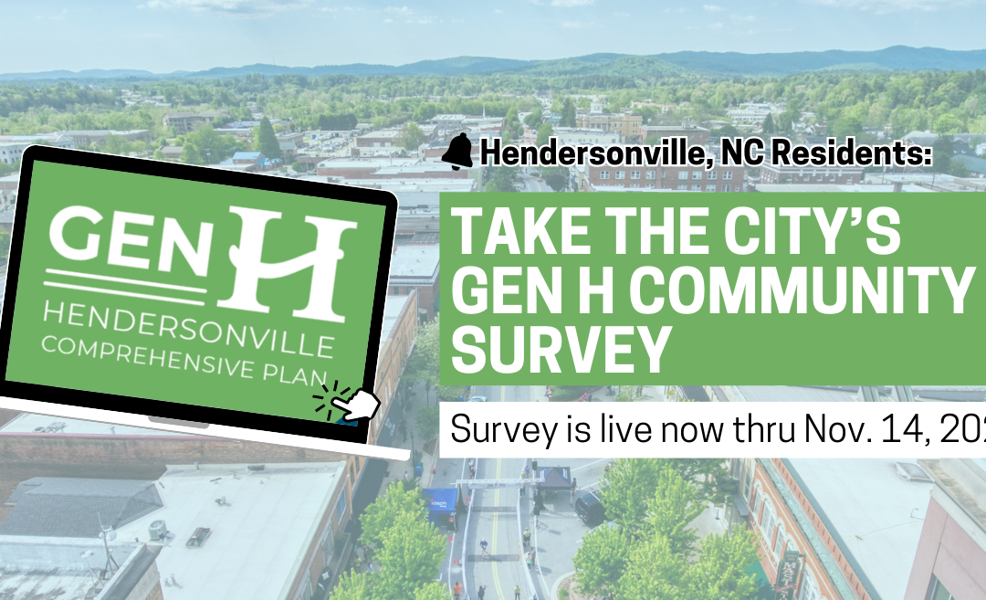
MountainStrong Hurricane Recovery Fund

In the wake of Hurricane Helene, MountainTrue is dedicated to addressing the urgent needs of our community.

 - 
Arabic
 - 
ar
Bengali
 - 
bn
German
 - 
de
English
 - 
en
French
 - 
fr
Hindi
 - 
hi
Indonesian
 - 
id
Portuguese
 - 
pt
Russian
 - 
ru
Spanish
 - 
es
2022 Volunteer of the Year and Esther Cunningham Award Winners

2022 Volunteer of the Year and Esther Cunningham Award Winners

2022 Volunteer of the Year and Esther Cunningham Award Winners

Every year, MountainTrue recognizes five individuals from across the Southern Blue Ridge as our regional Volunteer of the Year and Esther Cunningham award winners. We look forward to celebrating these exceptional MountainTrue volunteers at our 40th Anniversary Celebration on October 12, 2022:

High Country Volunteer of the Year: Hayden Cheek

Hayden (pictured above) works at a local fly shop in Boone, NC. He’s an excellent angler and guide, and he often goes above and beyond to take care of his local waterways. His practice of giving back and leaving our rivers and woods better than he finds them permeates his friendships, work relationships, and his career. He’s a consistent water quality volunteer with our High Country water quality team and his impact is being passed on to those fortunate enough to spend time with him on the trail or in the river. Thanks so much for all you do, Hayden!

Central Region Volunteer of the Year: Jim Clark

Jim Clark has been helping us clean up the French Broad River for years. He’s been a Swim Guide volunteer for nearly ten years and has been a part of our microplastics sampling team from the very beginning. The data he’s gathered at Pearson Bridge has helped to get the new Real-Time E. coli Estimator (created in partnership with NCDEQ) up and running. He’s gone out of his way to keep trash out of the river, including lugging dozens of heavy, muddy tires out of its reach. Thanks for all your hard work to make the river a better place, Jim!

Western Region Volunteer of the Year: Stacey Cassedy

This year, Stacey has volunteered with both of our Adopt-A-Stream water quality monitoring programs (water chemistry and E. coli) and our Swim Guide program. Stacey’s unwavering dedication to our weekly Swim Guide sampling program helped many folks from across the Western Region know where it was safe to swim this summer! When her sampling site failed for the first time in August, she returned to resample and continued to check and photograph the beach for several additional days to monitor the source of the pollution: goose droppings! Stacey has offered to help with festival tabling events and is interested in doing anything needed to help with MountainTrue’s mission, particularly in the water quality program area. She’s a true super volunteer!

Southern Region Volunteer of the Year: Don Cooper

When Don learned about high bacteria levels in his community’s local waterways, he sprung to action and rallied the support of his fellow Rotarians. With his leadership, dozens of volunteers collected hundreds of water samples from streams in and around Hendersonville over the last several years. The data generated from his efforts helped us isolate the sources of bacteria pollution and direct our advocacy resources in the right direction to make meaningful change for water quality and public health. Thank you so much for your leadership, Don!

The 2022 Esther Cunningham Award Winner: Grady Nance

This award is given each year in honor of one of our organization’s founders, Esther Cunningham. Esther bravely stood in the face of opposition, rallied her community to stand with her, and tirelessly fought to protect and defend the forests of Western North Carolina. 

Grady and his wife, Kathleen, have been MountainTrue members since 2015. In that time, Grady has repeatedly stepped up to support MountainTrue and our region in a number of ways.  Grady spent his career in the electric utility industry and has been a crucial resource to our energy-focused work, especially as we were working both in opposition to and in partnership with Duke Energy. Grady also served on the Henderson County Environmental Advisory Committee for several years, pushing the county to do more in terms of energy efficiency and renewable energy. Finally, and perhaps most importantly, Grady has served on MountainTrue’s board as our treasurer since 2019. He has acted more like a CFO than just a board member and has been enormously helpful as our budget and the complexity of our budgeting have grown. Grady also says yes to every request we make of him. He has been a thoughtful, conscientious, and diligent board member and treasurer, and we will miss him terribly when he rolls off the board at the end of this year. Because of his commitment and service to MountainTrue and his dedication to the environment, we are pleased to award him with the 2022 Esther Cunningham Award.

Oppose the weakening of land-use regulations and save the Henderson County Comprehensive Plan.

Oppose the weakening of land-use regulations and save the Henderson County Comprehensive Plan.

Oppose the weakening of land-use regulations and save the Henderson County Comprehensive Plan.

Take action to oppose the weakening of land-use regulations and to save the Henderson County Comprehensive Plan.

The Henderson County Commission is backsliding on important land-use regulations, and that spells big trouble for the 2045 Comprehensive Plan and for our region’s ability to manage future growth and prevent sprawl.

Here’s what you can do:

  1. Join us at the September 6 County Commissioners’ meeting, and let’s remind our elected leaders of their responsibility to their constituents. Stand up for responsible development rules, good planning, and a better comprehensive plan.
    Henderson County Commission Meeting
    September 6, 2022, at 5:30 P.M. 
    1 Historic Courthouse Square, Hendersonville
  2. Email the Henderson County Commissioners and let them know that you oppose rolling back floodplain regulations and that you support a smart, comprehensive plan.

Poor Land-Use Decisions Undermine the County’s Future

In its July 20 meeting, Henderson County Commissioners went against the recommendations of their own planning board and voted to adopt extremely lax rules on residential storage units that would allow property owners to construct an unlimited number of storage units within five feet of neighboring properties.

More concerning is that Commissioner Michael Edney and Commission Chair Bill Lapsley have proposed a dangerous rollback to floodplain regulations. As reported by the Hendersonville Lightning, Edney has proposed allowing more industrial development in floodplains — an idea rejected in an 8-0 vote by its own appointed Planning Board. And Commission Chair Lapsley has suggested allowing for more residential and commercial development in floodplains as well. Building in floodplains increases the chances of flooding and puts homes, businesses, and people’s lives at risk. As climate change now causes 100-year floods much more frequently, Henderson County should be taking the opposite approach by increasing limits on floodplain construction.

MountainTrue has serious concerns about Commissioners’ willingness to circumvent and ignore the recommendations of the County’s Planning Board — an expert body appointed by the Commission to give input on these very issues. We are also concerned about Commissioner David Hill’s stated opposition to any countywide zoning (as quoted in the Hendersonville Lightning), especially as the County is preparing to release its draft Comprehensive Plan.

Done well, Henderson County’s 2045 Comprehensive plan will help our communities meet the challenges of climate change, a growing population, and increased development pressures on the natural environment. Done badly, it will have the opposite effect — leading to more sprawl, less preservation of farmland, and more of our forests being cut down to accommodate poorly-planned development.

County Residents Support Support Land-use Protections

As part of the Comprehensive Planning process, the county fielded a survey to gauge the priorities of Henderson County residents. They received more than 7,000 responses and found out that the public is overwhelmingly in favor of land-use protections, preservation and conservation.

Henderson County residents’ top 3 priorities for the 2045 Henderson County Comprehensive Plan:

  • protection of open spaces and forests (55.30%),
  • farmland preservation (45.16%), and
  • conservation (35.04%) of unique natural areas

But, these recent actions, coupled with the release of a poorly-designed draft Future Land Use Map, raise questions about whether Henderson County’s Commissioners care about the public’s priorities.

Learn More About the Henderson County Comprehensive Plan

Henderson County’s new Comprehensive Plan will serve as the blueprint for growth and development over the next twenty years. Learn about how this plan will help determine how our communities grow and develop to meet the challenges of climate change, a growing population, and increased pressures on our built environment.

Watch: How Henderson County can accommodate growth without sprawl.

Chris Joyell, MountainTrue’s Healthy Communities Director, discusses how Henderson County can welcome far more population growth than the state anticipates without causing sprawl. Watch.

ACTION ALERT: Protect Our Forests and Farms from Sprawl

ACTION ALERT: Protect Our Forests and Farms from Sprawl

ACTION ALERT: Protect Our Forests and Farms from Sprawl

We need you to email the Henderson County Board of Commissioners to ask them to take action to prevent sprawl and protect our forests, farmland, and rural communities.

Henderson County is drafting its new Comprehensive Plan — the blueprint that will guide growth and development here for the next twenty years. As part of that process, they have surveyed members of our community, and that survey shows broad support for conservation.

Henderson County residents identified:

  • protection of open spaces and forests (55.30%),
  • farmland preservation (45.16%), and
  • conservation (35.04%) of unique natural areas

as their top 3 priorities for the 2045 Henderson County Comprehensive Plan.

Unfortunately, MountainTrue has serious concerns that the comprehensive plan being created by the county’s consultants is out of step with the desires and needs of Henderson County residents. The County has circulated a draft Future Land Use Map that prioritizes sprawl — development that spreads too far into the countryside, unnecessarily destroying forests, farmland, and rural communities — at great expense to taxpayers and against the desires of county residents.

So we need you to act today. Email your Henderson County Commissioners, and ask that they adopt a smart, responsible and sustainable comprehensive plan.

Watch: How Henderson County can accommodate growth without sprawl.

Chris Joyell, MountainTrue’s Healthy Communities Director, discusses how Henderson County can welcome far more population growth than the state anticipates without causing sprawl. Watch.

Learn More About the Henderson County Comprehensive Plan

Henderson County’s new Comprehensive Plan will serve as the blueprint for growth and development over the next twenty years. Learn about how this plan will help determine how our communities grow and develop to meet the challenges of climate change, a growing population, and increased pressures on our built environment.

Hendo Comp Plan URGENT ACTION: STOP THE SPRAWL

URGENT ACTION: STOP THE SPRAWL

The Henderson County Planning Department is circulating a draft Future Land Use Map that contradicts our community’s priorities as reflected in the County’s own survey results. The draft map prioritizes sprawl — development that spreads too far into the countryside, unnecessarily destroying forests, farmland, and rural communities — at great expense to taxpayers and against the desires of county residents.

Take action: Email Henderson County Commissioners and ask them to fix its Future Land Use Map and adopt a responsible, sustainable Comprehensive Plan.

The Case Against Sprawl

Perhaps the greatest threat to clean air, clean water, and natural landscapes in Western North Carolina is sprawling, poorly-planned development. 

Sprawl is a financial loser, too.  It wastes taxpayer dollars on unnecessary roads, sewers, and other infrastructure, even as it threatens the farms and orchards that make our county attractive to visitors and investors.

What is Sprawl?

Sprawl is development that spreads too far into the countryside, unnecessarily destroying forests, farmland, and rural communities. The key word here is “unnecessarily.”

Between 1976 and 2006, Henderson County’s developed land area grew eight times faster than its population, according to a UNC Charlotte study.  In other words, as the county’s population slowly grew 92%, its developed land area exploded by 730%.  At the same time, other counties in Western North Carolina experienced something similar.

What is at Stake?

Unfortunately, the same sprawl-inducing forces are still at work today.  Growth in Henderson County is governed by antiquated rules that allow low rural land prices to drive development out into the countryside.  And … roughly 40,000 new residents are expected here between now and 2045.  About 17,000 new homes will be built.  If we don’t take action, current rules will allow new development to explode all over the county map, endangering…

  • Clean Air:  Sprawl forces residents to drive more miles, increasing air pollution and exacerbating climate change
  • Clean Water:  Sprawl threatens the purity of creeks and rivers.  Asphalt, roofs, and lawns dump polluted storm water directly into waterways, rather than letting it be filtered through the soil.  More asphalt, roofs, and lawns means more pollution.
  • Wildlife:  Sprawl displaces wildlife.  The Southern Appalachians are a global biodiversity hotspot.  To protect the amazing variety and abundance of local species, we must protect more land — not just forests, but also the habitat provided by open fields and pastures.
  • Rural Heritage:  Sprawl undermines rural heritage.  Henderson County lost one-third of its apple orchards between 2002 and 2017, according to the county’s comprehensive planning consultant.  If this trend continues, the consultant added, no apples will be grown here by 2040.  For decades, Henderson County has been “apple country.”  Why destroy our heritage, and our branding, unnecessarily?
  • Fiscal Prudence:  Sprawl burdens taxpayers.  When developed land grows faster than the population, each taxpayer becomes responsible —unnecessarily — for fixing more potholes, maintaining more sewers, repairing more electrical wires, buying more gasoline for fire and police protection, etc.

Get Your Gardening Gloves on Our New Native Planting Guide

Get Your Gardening Gloves on Our New Native Planting Guide

Get Your Gardening Gloves on Our New Native Planting Guide

MountainTrue has published a brand new guide to help you replace harmful nonnative invasive plant species with native alternatives that benefit wild birds, hummingbirds, butterflies, and other wildlife. This beautifully designed and durable guide conveniently folds up to fit in your wallet — perfect for your next visit to the garden center or nursery. 

How can you get one? Guides are available for free at invasive plant workdays and events.

  1. Sign up to volunteer for one of our workdays or join us for a hike
  2. Meet us at a tabling event.
  3. Buy one for $5 and get it mailed to your door by filling out the form below.

Want free copies for your neighbors, gardening club, or organization? Contact amy@mountaintrue.org to arrange for one of our staff to present to your group and bring free copies for all.

Want to purchase multiple copies for personal use? Contact members@mountaintrue.org.

2021 State of the River Reports

2021 State of the River Reports

2021 State of the River Reports

The 2021 State of the River Reports are finally here! In this blog, we’ll discuss the cleanliness and water quality of the French Broad, Broad and Green, and Watauga River watersheds. 

There are four sets of data that MountainTrue uses to formulate our water quality rankings for each stream, including:

  • E. coli data taken by MountainTrue’s riverkeepers and water quality monitoring volunteers.
  • Aquatic insect (a.k.a., benthic macroinvertebrate) data — part of the Stream Monitoring Information Exchange program (SMIE) — from the Environmental Quality Institute. Learn more about SMIE here
  • Chemical data — part of the Volunteer Water Information Network (VWIN) — from the Environmental Quality Institute.
  • Chemical, aquatic insect, fish, and bacteria data from the North Carolina Department of Environmental Quality (NC DEQ).

The data from testing sites in streams across each watershed are weighed, and each stream is given a letter grade. The grading scale is as follows: 

A (90-100): These streams have excellent water quality, low pollution levels, and healthy aquatic insect and fish populations.

B (80-89): These streams have good water quality but some impacts from pollution or development. The aquatic life and fish populations are relatively healthy.

C (70-79): These streams have average water quality. There are some concerns about pollution inputs and development impacts. Generally, aquatic life and fish populations are healthy but could become negatively impacted

D (60-69): These streams have below-average water quality. Pollution is a concern, and aquatic life and fish populations are not as healthy as they should be.

F (<60): These streams have poor water quality. Pollution levels are often high, and aquatic life and fish populations are impacted.

When comparing this year’s report to 2018’s report, it’s important to note that the way we process our water samples for E.coli at MountainTrue has changed. Up until 2018, we used an Environmental Protection Agency (EPA)-approved method using Coliscan Easygel. The results from this method were sometimes subjective and thus could be less accurate. In 2019, we switched to another EPA-approved protocol, using the Idexx system. Those results are quicker, more objective, and more accurate. This 2021 report includes E.coli data from both analysis methods (2018 Swim Guide data using Coliscan Easygel and 2019-2021 Swim Guide data using the Idexx system).

 Now, let’s review the findings from each of the three reports.

The state of the French Broad River Watershed:

 Of the 62 testing sites across the French Broad River Watershed, 16% received an A grade, 20.9% received a B grade, 29% received a C grade, 25.8% received a D grade, and 6% received an F grade. 

Overall, we observe a general decline in water quality. We attribute this to two primary factors — climate change and increasing construction and development throughout the watershed. Asheville and the surrounding region have experienced more frequent heavy rains in the last several years. Climate change in the Southern Blue Ridge region is expected to present random “boom and bust” patterns in precipitation, seen as floods and droughts in our region. This causes increased stormwater runoff from urban areas and agriculture operations, along with more sewer overflows and saturated septic fields surrounding failing septic systems. It also brings extra sediment into our waterways from construction sites and weak riverbanks, which can smother aquatic habitats, increase water temperature, and transport toxins into our rivers. All of this is happening during a period of unprecedented recreational growth on the French Broad. 

We documented the most dramatic change in Transylvania County, as the quality of the Upper French Broad decreased significantly. We attribute part of this decrease in quality to our transition to new, more accurate E.coli sampling protocols. However, that doesn’t explain the whole picture since water quality in other parts of the watershed didn’t drop as steeply. Notoriously the wettest county in the state, this drop in water quality is indicative of the effects that a changing climate coupled with increasing development is having on our region. 

On a positive note, the Nolichucky Watershed saw increased water quality with high grades in benthic and fish samples. Such pristine waters cannot be taken for granted, which is why we’re advocating for the Nolichucky River between Poplar, NC, and Erwin, TN, to be permanently protected with a Wild and Scenic Rivers designation.

Four Cleanest Streams:

  • Cataloochee Creek (A)
  • Cathey’s Creek (A)
  • Bent Creek (A)
  • South Toe (A)

Four Dirtiest Streams:

  • French Broad River – Pisgah Forest (F)
  • French Broad River – Etowah (F)
  • French Broad River – Hominy Creek (F)
  • French Broad River – Westfeldt (F)

 Learn more about the state of the French Broad River Watershed by reviewing last year’s Swim Guide results.

The state of the Broad and Green River watersheds: 

Of the 18 testing sites across the Broad and Green River watersheds, 27% received an A grade, 61% received a B grade, none received a C grade, 5.5% received a D grade (1 site), and 5.5% received an F grade (1 site). 

The Green River is the largest tributary of the Broad River in North Carolina, and its headwaters are largely protected. From its source in Henderson County to Lake Summit, the Upper Green is significantly impacted by agriculture, poor stream management practices, and lack of appropriate riparian buffers. 

The Green River flows into the Broad River near the Polk and Rutherford County Line. Major tributaries in the lower Green River Watershed include Walnut Creek from the north and White Oak Creek from the south. In a tale of two tributaries, the former touts excellent water quality and benefits from a large nature preserve while the latter suffers from degraded water quality as a result of development, land clearing, agriculture, and other intensive land use. 

By the time the First Broad reaches Shelby, it fails to meet EPA bacteria standards nearly 50% of the time. First Broad tributary Buffalo Creek has a history of high bacteria levels and feeds Moss Lake — Cleveland County’s only public reservoir and the water supply for Kings Mountain. In June 2020, NC DEQ documented Moss Lake’s first-ever harmful algal bloom (HAB) — this is a big concern for nearby residents, recreationists, and all who depend on Moss Lake for their drinking water supply. 

Overall, water quality in the most popular recreational area on the main stem of the Broad River is pretty good. The river is so large that contaminants of concern in the tributaries are diluted, and bacteria levels at the Broad River Greenway in Cleveland County almost always meet EPA standards for safe recreation.

Four Cleanest Streams:

  • First Broad River – North Fork (A)
  • Moss Lake (A)
  • North Pacolet River – Near Tryon (A)
  • Big Hungry River (A)

Four Dirtiest Streams:

  • Buffalo Creek – Above Moss Lake (F)
  • Sandy Run Creek (D)
  • Lower Broad River (B)
  • Upper Broad River (B)

Learn more about the state of the Broad and Green River watersheds by reviewing last year’s Swim Guide results.

The state of the Watauga River Watershed:

Of the 27 testing sites in the Watauga River Watershed, 37% received an A grade, 33% received a B grade, 11% received a C grade, 3.7% received a D grade (1 site), and 14.8% received an F grade. 

Overall, water quality is pretty good across the Watauga River Watershed, which originates at an elevation of 5,964 feet on the northern slopes of North Carolina’s Grandfather Mountain. The 78-mile-long Watauga River Basin includes the headwaters and tributaries of the Elk and Watauga Rivers, flowing northwest from North Carolina into Tennessee’s Holston and Tennessee Rivers before joining the Mississippi River and draining into the Gulf of Mexico. 

The Watauga River Watershed includes mountain bog wetlands that sit at the head of the basin and serve as an important water purification system and habitat for native wildlife. Nearly 90% of mountain bogs in North Carolina and throughout the Southeastern United States have been destroyed. The rapid elimination of mountain bogs poses a challenge for water quality and environmental conservation in the Watauga River Basin. 

Increases in development, plastic pollution, soil erosion, sedimentation, and excess nutrients are stressors on aquatic health and habitats. When combined, these stressors can significantly damage aquatic habitats and ecosystems. Much of the land disturbance in the basin takes place on steep mountain slopes, which are naturally vulnerable to soil erosion. As land is cleared due to urbanization and agriculture, rain and melting snow carry eroded sediments, pesticides, fertilizers, and road salt into the Watauga River. 

Fortunately, North Carolina has designated 18 miles along Boone’s Fork Creek for conservation to receive extra protection. More than half of the basin’s streams are classified as trout waters and thus require additional treatment at local wastewater treatment plants. In addition, 25-foot buffers of shrubs and trees must be maintained between trout streams and graded construction sites to filter runoff and prevent erosion.

Four Cleanest Streams: 

  • Watauga River @ Adam’s Apple Dr Bridge (A)
  • Watauga River @ Wilbur Dam Rd Bridge (A)
  • Watauga River @ Smalling Rd Bridge (A)
  • Elk River @ Lees-McRae Mill Pond (A)

Four Dirtiest Streams:

  • Watauga River @ Lover’s Lane (F)
  • Watauga River @ Hunter Bridge (F)
  • Watauga River @ Blevins Boat Ramp (F)
  • Watauga River @ Calloway Rd. Bridge (F)

 Learn more about the state of the Watauga River Watershed by reviewing last year’s Swim Guide results.